Peringamala
Peringammala is the first largest panchayat in Thiruvananthapuram district in the state of Kerala, India.[2][3] There are two places named Peringammala, the other one is between balaramapuram and venganoor which is on the southern side of the Thiruvananthapuram district.There is two villages peringammala and thennoor. Beautiful tourist place in there including ponmudi, mankayam, brimore, etc. Festival palod mela also there.
Per
peringammala grama panjayath | |
|---|---|
village | |
 Per Location in Kerala, India  Per Per (India) | |
| Coordinates: 8.4156°N 77.0192°E | |
| Country | |
| State | Kerala |
| District | Thiruvananthapuram |
| Talukas | Nedumangad |
| Government | |
| • Body | Gram panchayat |
| Population (2001) | |
| • Total | 21,477 |
| Languages | |
| • Official | Malayalam, English |
| Time zone | UTC+5:30 (IST) |
| PIN | 695563[1] |
| Vehicle registration | KL-21- |
History
The verdant village of Peringammala is located in the valley of the Ponmudi hills. It owes its name to the Tamil/Malayalam word, Periyamala meaning The Big Mountain. In the olden days this area was reputed for various forest produce like honey.
Geography
Peringammala panchayath (an administrative unit) consists of two villages namely Peringammala and Thennoor. Peringammala is the largest panchayth in Thiruvananthapuram district and is the second largest in the state of Kerala. Peringammala shares its east boundary with Tamil Nadu.
Demographics
As of 2001 India census, Peringamala had a population of 21477 with 10361 males and 11116 females.[2] The majority are tribal people and agriculture is the main occupation.
As per official kaneshukumari it is very less than 50000. Even the nearest panchayths holds far more than this as like Nanniyode panchayth and Vithura panchayth.
1. Name of Grama Panchayath : Peringammala
2. Village : Peringammala, Thennoor
3. Block Panchayath : Vamanapuram
4. Thalook : Nedumangadu
5. Legislative Mandalam : Vamanapuram
6. Parliament Mandalam : Attingal
7. District : Thiruvananthapuram
8. Breadth : 217.94km2
9. Boundaries
10. East : Ambasamudram(Tamil Nadu)
11. South : Vamanapuram River
12. West : T.S. Road
13. North : Ammayamblam Pacha
(Kulathupuzha Reserve Forest)
14. Population : 39792
15. Female : 20688
16. Male : 19104
17. Tribal people population
18. Scheduled cast Sect : 6147
19. Male : 3041
20. Female : 3105
21. Scheduled Tribe Sect : 3289
22. Male : 1588
23. Female : 1701
24. Block Panchayath Divisions : 2, (Idinjar, Palode)
25. District Panchayath Division : 1, (Palode)
References
- "India Post :Pincode Search". Archived from the original on 20 May 2012. Retrieved 16 December 2008.
- "Census of India : Villages with population 5000 & above". Registrar General & Census Commissioner, India. Retrieved 10 December 2008.
- "Yahoo Maps India". Retrieved 18 December 2008.
District HQ: Thiruvananthapuram | |||||||
| History | 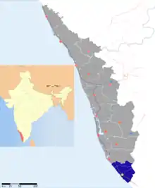 | ||||||
| Geography | |||||||
| Cities and Taluks |
| ||||||
| Transport | |||||||
| Education |
| ||||||
| Buildings | |||||||
| Culture | |||||||
| Lok Sabha constituencies | |||||||
| Sports | |||||||
| Museums | |||||||