Phai Lom, Phitsanulok
Phai Lom (Thai: ไผ่ล้อม) is a subdistrict (tambon) in the Bang Krathum District of Phitsanulok Province, Thailand.
Phai Lom
ไผ่ล้อม (English: Surrounded by Bamboo) | |
|---|---|
Tambon | |
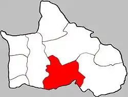 Location of Phai Lom in the district | |
| Coordinates: 16°34′00″N 100°21′00″E | |
| Country | Thailand |
| Province | Phitsanulok |
| District | Bang Krathum |
| Population (2005) | |
| • Total | 4,756 |
| Time zone | UTC+7 (ICT) |
| Postal code | 65110 |
| Geocode | 650506 |
| Chief roadway | Route 1114 |
| Chief watercourse | Wang Thong River |
Geography
Phai Lom borders Nakhon Pa Mak to the north, Noen Kum to the east, Phichit Province to the south, and Bang Krathum to the west. Phai Lom lies in the Nan Basin, which is part of the Chao Phraya Watershed. The Wang Thong River flows through Phai Lom.
Administration
The subdistrict is divided into 11 smaller divisions called (muban), which roughly correspond to the villages in Phai Lom. There are six villages, several of which occupy multiple muban. Phai Lom is administered by a Tambon administrative organization (TAO). The muban in Phai Lom are enumerated as follows: [1]
| No. | English | Thai |
| 1 | Ban Poh Daen | บ้านโพธิ์แดน |
| 2-5 | Ban Tha Na | บ้านท่านา |
| 6 | Ban Nong Bon | บ้านหนองบอน |
| 7-9 | Ban Tha Makam | บ้านท่ามะขาม |
| 10 | Ban Beung Chang | บ้านบึงช้าง |
| 11 | Ban Yangthon | บ้านยางโทน |
Temples
Phai Lom is home to the following five temples:[2]
- Wat Apai Supraron Pum (Thai: วัดอภัยสุพรรณภูมิ) in Ban Beung Chang
- Wat Tha Na (Ban Tha Na Village Temple) in Ban Tha Na
- Wat Tha Makam (Ban Tha Makam Village Temple) in Ban Tha Makam
- Wat Beung Chang (Ban Beung Chang Village Temple) in Ban Beung Chang
- Wat Phai Lom in Ban Beung Chang
References
- Phai Lom at Pitlocal.org (Thai)
- Phai Lom on WebWat.com Archived 2007-09-04 at the Wayback Machine
This article is issued from Wikipedia. The text is licensed under Creative Commons - Attribution - Sharealike. Additional terms may apply for the media files.