Phanom Thuan District
Phanom Thuan (Thai: พนมทวน, pronounced [pʰā.nōm tʰūa̯n]) is a district (amphoe) in the eastern part of Kanchanaburi Province, central Thailand.
Phanom Thuan
พนมทวน | |
|---|---|
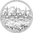
 Wat Ban Thuan, tambon Phanom Thuan | |
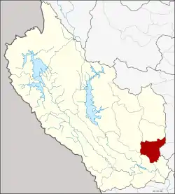 District location in Kanchanaburi Province | |
| Coordinates: 14°7′49″N 99°41′56″E | |
| Country | Thailand |
| Province | Kanchanaburi |
| Seat | Phanom Thuan |
| Area | |
| • Total | 535.78 km2 (206.87 sq mi) |
| Population (2008) | |
| • Total | 51,979 |
| • Density | 97.0/km2 (251/sq mi) |
| Time zone | UTC+7 (ICT) |
| Postal code | 71140[1] |
| Geocode | 7109 |
History
The area of Phanom Thuan was occupied in prehistoric times. At the archaeological site of Ban Don Ta Phet many artifacts were found in a 4th century cemetery, which indicated trade relations with India, Vietnam, and the Philippines.
At the Don Chedi archaeological site an excavation by the Fine Arts Department in 1982 recovered many human skeletons as well as elephant bones and swords. Thus this site might even have been the location of the famous battle of King Naresuan against the Burmese crown-prince, most commonly assigned to the Don Chedi District nearby.
Phanom Thuan District was one of the first three districts of Kanchanaburi Province. It was at first named Nuea ('northern') district as it covered the northern part of the province. When in 1831 King Rama III relocated the center of Kanchanaburi and readjusted its extent, Nuea District was renamed to Ban Thuan, covering the mountainous areas and the northward flowing river. In 1939 the district name was changed to Phanom Thuan.[2]
Geography
Neighboring districts are (from the south clockwise) Tha Maka, Tha Muang, Bo Phloi, Huai Krachao of Kanchanaburi Province, U Thong and Song Phi Nong of Suphanburi Province.
Administration
The district is divided into eight sub-districts (tambons), which are further subdivided into 103 villages (mubans). There are four sub-district municipalities (thesaban tambon) within the district. Phanom Thuan covers the central part of the sub-district Phanom Tuan, Talat Khet the part central of Rang Wai. The municipality Rang Wai covers the remaining parts of the sub-district, and Nong Sarai the whole of the same-named tambon. There are a further six tambon administrative organizations (TAO).
| No. | Name | Thai | Villages | Pop. |
|---|---|---|---|---|
| 1. | Phanom Thuan | พนมทวน | 9 | 7,667 |
| 2. | Nong Rong | หนองโรง | 17 | 6,475 |
| 3. | Thung Samo | ทุ่งสมอ | 4 | 3,089 |
| 4. | Don Chedi | ดอนเจดีย์ | 8 | 4,839 |
| 5. | Phang Tru | พังตรุ | 20 | 9,315 |
| 6. | Rang Wai | รางหวาย | 23 | 11,249 |
| 11. | Nong Sarai | หนองสาหร่าย | 9 | 3,473 |
| 12. | Don Ta Phet | ดอนตาเพชร | 13 | 5,872 |
Missing numbers now form Huai Krachao District.
References
- Rang Wai has postcode 71170 (Huai Khachao)
- พระราชกฤษฎีกาเปลี่ยนนามอำเภอ กิ่งอำเภอ และตำบลบางแห่ง พุทธศักราช ๒๔๘๒ (PDF). Royal Gazette (in Thai). 56 (0 ก): 354–364. April 17, 1939.