Philadelphia, New York
Philadelphia is a town in Jefferson County, New York, United States. The population was 1,947 at the 2010 census,[3] down from 2,140 at the 2000 census.
Philadelphia, New York | |
|---|---|
 Philadelphia  Philadelphia | |
| Coordinates: | |
| Country | United States |
| State | New York |
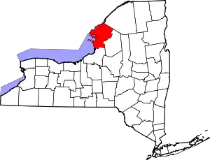
| County | Jefferson |
| Government | |
| • Mayor | Cheryl K. Horton (R)
|
| Area | |
| • Total | 37.69 sq mi (97.61 km2) |
| • Land | 37.67 sq mi (97.56 km2) |
| • Water | 0.02 sq mi (0.05 km2) |
| Population (2010) | |
| • Total | 1,947 |
| • Estimate (2016)[2] | 1,880 |
| • Density | 49.91/sq mi (19.27/km2) |
| Time zone | EST |
| • Summer (DST) | EDT |
| ZIP code | 13673 |
| Area code(s) | 315 |
| FIPS code | 36-045-57562 |
| Website | townofphiladelphiany |
The town contains a village also called Philadelphia. Both are in the northeast part of Jefferson County.
History
The area was first settled around 1804. A Grist Mill was built in 1804 on the Indian River adjacent to the north side of the large waterfall in the village. The town was formed in 1821 from part of the town of Le Ray. In 1872, the community of Philadelphia set itself off from the town by incorporating as a village.
In 1959, the Indian River Central High School opened, serving students from the towns of Philadelphia, Theresa, Antwerp, Leray, and Pamelia.
The Sterlingville Archeological District was listed on the National Register of Historic Places in 1995.[4]
Geography and climate
According to the United States Census Bureau, the town has a total area of 37.6 square miles (97.4 km2), of which 0.02 square miles (0.05 km2), or 0.06%, are water.[3]
U.S. Route 11 is a northeast-southwest highway that crosses the center of the town. It intersects New York State Route 26 at Philadelphia village.
Philadelphia holds the all-time December record low temperature for New York state at −47 °C (−53 °F).
| Climate data for Philadelphia, New York (1971–2000) | |||||||||||||
|---|---|---|---|---|---|---|---|---|---|---|---|---|---|
| Month | Jan | Feb | Mar | Apr | May | Jun | Jul | Aug | Sep | Oct | Nov | Dec | Year |
| Record high °F (°C) | 54 (12) |
59 (15) |
72 (22) |
80 (27) |
86 (30) |
92 (33) |
96 (36) |
94 (34) |
94 (34) |
83 (28) |
76 (24) |
64 (18) |
96 (36) |
| Average high °F (°C) | 28 (−2) |
30 (−1) |
39 (4) |
50 (10) |
64 (18) |
71 (22) |
76 (24) |
75 (24) |
69 (21) |
56 (13) |
43 (6) |
32 (0) |
53 (12) |
| Average low °F (°C) | 6 (−14) |
7 (−14) |
18 (−8) |
31 (−1) |
42 (6) |
50 (10) |
54 (12) |
54 (12) |
48 (9) |
39 (4) |
27 (−3) |
15 (−9) |
33 (1) |
| Record low °F (°C) | −44 (−42) |
−42 (−41) |
−40 (−40) |
−10 (−23) |
16 (−9) |
26 (−3) |
30 (−1) |
31 (−1) |
23 (−5) |
10 (−12) |
−14 (−26) |
−47 (−44) |
−47 (−44) |
| Average precipitation inches (mm) | 4.15 (105) |
2.96 (75) |
3.70 (94) |
3.99 (101) |
4.34 (110) |
4.24 (108) |
4.57 (116) |
4.62 (117) |
5.07 (129) |
4.33 (110) |
4.84 (123) |
4.48 (114) |
51.39 (1,305) |
| Average snowfall inches (cm) | 57.8 (147) |
36.4 (92) |
30.4 (77) |
13.4 (34) |
1.6 (4.1) |
0 (0) |
0 (0) |
0 (0) |
0 (0) |
2.3 (5.8) |
27.9 (71) |
66.3 (168) |
236.1 (600) |
| Average precipitation days | 19.1 | 14.5 | 15.6 | 13.6 | 14.1 | 13.6 | 12.2 | 12.8 | 13.0 | 14.1 | 17.2 | 18.7 | 178.5 |
| Average snowy days | 17.1 | 13.1 | 11.8 | 5.1 | 1.1 | 0 | 0 | 0 | 0 | 1.9 | 9.4 | 18.3 | 77.8 |
| Source: TWC[5] | |||||||||||||
Demographics
| Historical population | |||
|---|---|---|---|
| Census | Pop. | %± | |
| 1830 | 1,167 | — | |
| 1840 | 1,888 | 61.8% | |
| 1850 | 1,915 | 1.4% | |
| 1860 | 1,790 | −6.5% | |
| 1870 | 1,679 | −6.2% | |
| 1880 | 1,750 | 4.2% | |
| 1890 | 1,662 | −5.0% | |
| 1900 | 1,750 | 5.3% | |
| 1910 | 1,640 | −6.3% | |
| 1920 | 1,549 | −5.5% | |
| 1930 | 1,562 | 0.8% | |
| 1940 | 1,372 | −12.2% | |
| 1950 | 1,222 | −10.9% | |
| 1960 | 1,297 | 6.1% | |
| 1970 | 1,355 | 4.5% | |
| 1980 | 1,417 | 4.6% | |
| 1990 | 2,136 | 50.7% | |
| 2000 | 2,140 | 0.2% | |
| 2010 | 1,947 | −9.0% | |
| 2016 (est.) | 1,880 | [2] | −3.4% |
| U.S. Decennial Census[6] | |||
As of the census[7] of 2000, there were 2,140 people, 759 households, and 582 families residing in the town. The population density was 56.9 people per square mile (22.0/km2). There were 823 housing units at an average density of 21.9 per square mile (8.5/km2). The racial makeup of the town was 88.93% White, 4.91% Black or African American, 0.61% Native American, 1.17% Asian, 0.09% Pacific Islander, 2.06% from other races, and 2.24% from two or more races. Hispanic or Latino of any race were 4.16% of the population.
There were 759 households, out of which 45.5% had children under the age of 18 living with them, 60.6% were married couples living together, 11.3% had a female householder with no husband present, and 23.2% were non-families. 19.5% of all households were made up of individuals, and 10.1% had someone living alone who was 65 years of age or older. The average household size was 2.82 and the average family size was 3.20.
In the town, the population was spread out, with 33.7% under the age of 18, 10.1% from 18 to 24, 32.0% from 25 to 44, 15.7% from 45 to 64, and 8.5% who were 65 years of age or older. The median age was 29 years. For every 100 females, there were 96.9 males. For every 100 females age 18 and over, there were 93.6 males.
The median income for a household in the town was $31,250, and the median income for a family was $35,909. Males had a median income of $29,605 versus $21,121 for females. The per capita income for the town was $13,555. About 12.2% of families and 13.8% of the population were below the poverty line, including 17.2% of those under age 18 and 15.5% of those age 65 or over.
Notable people
- Cassius Marcellus Coolidge (1844-1934), known today for his famous paintings of Dogs Playing Poker, was born in Philadelphia and lived there or in nearby Antwerp for much of his adult life.[8]
Philadelphia cream cheese
When cream cheese first appeared in the United States around 1870, it was produced in small batches by many farmers in New York. Because of its origin, it eventually became legend that Philadelphia brand cream cheese was named for Philadelphia, New York. In actuality, Philadelphia Cream Cheese was named for Philadelphia, Pennsylvania, because at the time the city was associated with high-quality dairy products.[9][10]
Communities within Philadelphia
- Fort Drum – The military reservation occupies the southeastern third of Philadelphia.
- Philadelphia (originally "Quaker Settlement") – A village near the center of the town on US-11.
- Pine Plains – A location in the south part of the town, near Sterlingville.
- Rogers – A location in the south corner of the town, south of Strickland Corners on County Road 30.
- Shurtleff Corners – A location on the northwest town line, northwest of Philadelphia village on NY-26.
- Sterlingville – A former hamlet in the south corner of the town.
- Strickland Corners – A location in the south corner of the town on County Road 30, northwest of Sterlingville.
- Whitney Corners – A location on County Road 20, west of Philadelphia village.
External links
References
- "2016 U.S. Gazetteer Files". United States Census Bureau. Retrieved July 5, 2017.
- "Population and Housing Unit Estimates". Retrieved June 9, 2017.
- "Geographic Identifiers: 2010 Census Summary File 1 (G001): Philadelphia town, Jefferson County, New York". American Factfinder. U.S. Census Bureau. Archived from the original on February 13, 2020. Retrieved August 31, 2018.
- "National Register Information System". National Register of Historic Places. National Park Service. July 9, 2010.
- "NCDC: U.S. Climate Normals". US Climate Data. Retrieved August 11, 2011.
- "Census of Population and Housing". Census.gov. Retrieved June 4, 2015.
- "U.S. Census website". United States Census Bureau. Retrieved January 31, 2008.
- Joanna Richards, "Museum in Works for Pennsylvania", Watertown Daily Times, February 15, 2010, http://www.watertowndailytimes.com/article/20100215/NEWS03/302159975 Archived April 2, 2015, at the Wayback Machine
- Marx, Jeffrey A (2015). "The Days Had Come of Curds and Cream". Food, Culture & Society. 15 (2): 177–195. doi:10.2752/175174412X13233545145426. S2CID 161646823.
- https://www.nytimes.com/2011/04/04/business/media/04adco.html