Pirimai
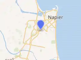
Pirimai is a suburb of the city of Napier, in the Hawke's Bay region of New Zealand's eastern North Island.[2]
Pirimai | |
|---|---|
Suburb | |
| |
| Country | New Zealand |
| Local authority | Napier |
| Electoral ward |
|
| Population (2018)[1] | |
| • Total | 3,852 |
| Onekawa | ||
| Tamatea |
|
|
| Greenmeadows | Meeanee |
It includes Pirimai Park and playground.[3]
Demographics
| Year | Pop. | ±% p.a. |
|---|---|---|
| 2006 | 3,681 | — |
| 2013 | 3,597 | −0.33% |
| 2018 | 3,852 | +1.38% |
| Source: [1] | ||
Pirimai, comprising the statistical areas of Pirimai West and Pirimai East, had a population of 3,852 at the 2018 New Zealand census, an increase of 255 people (7.1%) since the 2013 census, and an increase of 171 people (4.6%) since the 2006 census. There were 1,434 households. There were 1,914 males and 1,938 females, giving a sex ratio of 0.99 males per female, with 879 people (22.8%) aged under 15 years, 789 (20.5%) aged 15 to 29, 1,635 (42.4%) aged 30 to 64, and 555 (14.4%) aged 65 or older.
Ethnicities were 81.3% European/Pākehā, 25.9% Māori, 3.7% Pacific peoples, 4.9% Asian, and 1.6% other ethnicities (totals add to more than 100% since people could identify with multiple ethnicities).
The proportion of people born overseas was 13.1%, compared with 27.1% nationally.
Although some people objected to giving their religion, 58.5% had no religion, 27.9% were Christian, 0.8% were Hindu, 0.2% were Muslim, 0.6% were Buddhist and 4.5% had other religions.
Of those at least 15 years old, 399 (13.4%) people had a bachelor or higher degree, and 648 (21.8%) people had no formal qualifications. The employment status of those at least 15 was that 1,623 (54.6%) people were employed full-time, 408 (13.7%) were part-time, and 105 (3.5%) were unemployed.[1]
| Name | Population | Households | Median age | Median income |
|---|---|---|---|---|
| Pirimai West | 1,611 | 648 | 37 years | $29,100[4] |
| Pirimai East | 2,241 | 786 | 32.7 years | $31,600[5] |
| New Zealand | 37.4 years | $31,800 |
References
- "Statistical area 1 dataset for 2018 Census". Statistics New Zealand. March 2020. Pirimai West (214200) and Pirimai East (214700).
- Hariss, Gavin. "Pirimai, Hawke's Bay". topomap.co.nz. NZ Topo Map.
- "Pirimai Park Playground". napier.govt.nz. Napier City Council.
- 2018 Census place summary: Pirimai West
- 2018 Census place summary: Pirimai East