Pittsfield Charter Township, Michigan
Pittsfield Township, officially the Charter Township of Pittsfield, is a charter township south of Ann Arbor in Washtenaw County in the U.S. state of Michigan. The population was 34,663 at the 2010 census.[3]
Pittsfield Township, Michigan | |
|---|---|
| Charter Township of Pittsfield | |
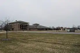 Pittsfield Township Municipal Buildings | |
Seal | |
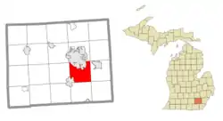 Location within Washtenaw County | |
 Pittsfield Township Location within the state of Michigan | |
| Coordinates: 42°13′21″N 83°42′52″W | |
| Country | United States |
| State | Michigan |
| County | Washtenaw |
| Established | 1834 |
| Government | |
| • Supervisor | Mandy Grewal |
| • Clerk | Michelle Anzaldi |
| Area | |
| • Total | 27.3 sq mi (70.8 km2) |
| • Land | 27.3 sq mi (70.6 km2) |
| • Water | 0.08 sq mi (0.2 km2) |
| Elevation | 827 ft (252 m) |
| Population (2010) | |
| • Total | 34,663 |
| • Density | 1,300/sq mi (490/km2) |
| Time zone | UTC-5 (Eastern (EST)) |
| • Summer (DST) | UTC-4 (EDT) |
| ZIP code(s) | |
| Area code(s) | 734 |
| FIPS code | 26-64560[1] |
| GNIS feature ID | 1626909[2] |
| Website | Official website |
Geography
According to the United States Census Bureau, the township has a total area of 27.3 square miles (70.8 km2), of which 27.3 square miles (70.6 km2) is land and 0.077 square miles (0.2 km2), or 0.25%, is water.[4]
History
When Ann Arbor Township was organized in 1827 it included what is now Pittsfield Township in its boundaries. The township was organized as the Township of Pitt in 1834. The name had been suggested by Ezra Carpenter. The current name was adopted in 1839.[5] It became a charter township in 1972.
In 2006 the Ann Arbor District Library opened its Pittsfield branch.[6]
Communities
- Bryant Pattengill West - these names collectively or as two separate names refer to the area west of State Street and north of Ellsworth. This is today largely residential and business development almost indistinguishable from Ann Arbor proper, located along the south side of I-94 with two major exits. Ann Arbor city limits have been extended west and south of I-94 in some of this area.
- Carpenter - this is the general area around the intersection of Thomas Road, and Morgan Road. It is still mainly farmland.
- Mitchell - located where US 23 intersects Ellsworth Road, this community has largely lost its identity due to the coming of the freeway and the spread of Ann Arbor.
Former communities
- Mallets Creek Settlement — 1825-1853 — this pioneering community was located surrounding the intersection of Packard and Milan (now Platt) Roads, and was the original seat of the township of Pitt and its post office.[7] In 1853 the settlement was divided between separate schools so lost its intimate social cohesiveness, although the southwest corner of Packard and Platt Roads was the location for a station on the Ypsi-Ann Interurban from 1891 until its closure in 1929. The surrounding locale grew in population to become the Platt Community, whose social life centered on the Platt School District in the Township. The community incorporated as the City of East Ann Arbor in 1947, and voted to be annexed by the City of Ann Arbor in 1956. The Platt School District joined the Ann Arbor School District.
Nearby communities
Demographics
As of the 2010 census, Pittsfield had a population of 34,663. The ethnic and racial makeup of the population was 62.9% non-Hispanic white, 13.6% black of African American, 13.6% Asian, 0.4% Native American, 0.3% non-Hispanic of some other race, 4.0% reporting two or more races. 6.5% were Hispanic or Latino, of any race.[8]
At the 2000 census there were 30,167 people, 11,817 households, and 6,960 families in the township. The population density was 1,095.4 per square mile (422.9/km2). There were 12,337 housing units at an average density of 448.0 per square mile (173.0/km2). The racial makeup of the township was 70.37% White, 14.29% African American, 0.44% Native American, 9.96% Asian, 0.05% Pacific Islander, 1.68% from other races, and 3.21% from two or more races. Hispanic or Latino of any race were 3.97%.[1]
Of the 11,817 households, 31.5% had children under the age of 18 living with them, 48.5% were married couples living together, 7.3% had a female householder with no husband present, and 41.1% were non-families. 29.8% of households were one person, and 4.1% were one person aged 65 or older. The average household size was 2.42 and the average family size was 3.11.
In the township the population was spread out, with 24.0% under the age of 18, 11.8% from 18 to 24, 39.6% from 25 to 44, 18.9% from 45 to 64, and 5.7% 65 or older. The median age was 32 years. For every 100 females, there were 107.8 males. For every 100 females age 18 and over, there were 108.1 males.
The median household income in the township was $61,262, and the median family income was $82,600. Males had a median income of $54,167 versus $35,684 for females. The per capita income for the township was $29,645. About 5.6% of families and 9.1% of the population were below the poverty line, including 9.5% of those under age 18 and 8.8% of those age 65 or over.
Education
Pittsfield Township is served by three school districts. The Saline Area Schools serve most of the township, while the Milan Area Schools serve the southeast corner of the township and the Ann Arbor Public Schools serve the north-central and eastern portions of the township.[9][10]
Gallery
 Fire Station No.2, Ellsworth Rd.
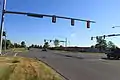 Carpenter Rd., at Ellsworth Rd., facing north
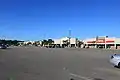 Carpenter Plaza, Carpenter and Packard Rds.
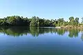 Haven Lake, Lillie Park, Platt & Ellsworth Rds.
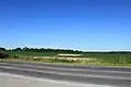 Corn field from Platt Rd.
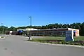 Eastern Washtenaw Multicultural Academy, Platt Rd.
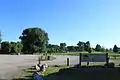 Montibeller Park, Ellsworth Rd.
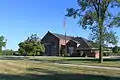
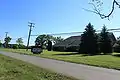 New Progressive Missionary Baptist Church, Platt Rd.
References
- "U.S. Census website". United States Census Bureau. Retrieved 2008-01-31.
- U.S. Geological Survey Geographic Names Information System: Pittsfield Charter Township, Michigan
- "Profile of General Population and Housing Characteristics: 2010 Demographic Profile Data (DP-1): Pittsfield charter township, Washtenaw County, Michigan". United States Census Bureau. Retrieved July 9, 2012.
- "Geographic Identifiers: 2010 Demographic Profile Data (G001): Pittsfield charter township, Washtenaw County, Michigan". United States Census Bureau. Retrieved July 9, 2012.
- "Pittsfield Charter Township, MI - Official Website". Archived from the original on 28 October 2009.
- "Pittsfield Branch - Ann Arbor District Library". Ann Arbor District Library. Archived from the original on 19 November 2005.
- "Pittsfield Township Historical Society :: Inside the Eastside: History of East Ann Arbor, Michigan (MI)".
- 2010 census general profile of population and housing characteristics for Pittsfield Township
- "Saline Area Schools." State of Michigan. Retrieved on May 18, 2010.
- "Precinct Map." York Charter Township. Retrieved on January 5, 2010.
External links
| Wikimedia Commons has media related to Pittsfield Township, Michigan. |
Municipalities and communities of Washtenaw County, Michigan, United States | ||
|---|---|---|
| Cities |  Map of Michigan highlighting Washtenaw County | |
| Villages | ||
| Charter townships | ||
| Civil townships | ||
| CDPs | ||
| Other unincorporated communities | ||
| Defunct | ||
| Ghost towns | ||
| Footnotes | ‡This populated place also has portions in an adjacent county or counties | |
| ||