Ponui Island
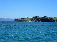
Ponui Island (also known as Chamberlin's Island) is a privately owned island located in the Hauraki Gulf, to the east of the city of Auckland, New Zealand.[1] It is located to the southeast of Waiheke Island, at the eastern end of the Tamaki Strait, which separates the island from the Hunua Ranges on the mainland to the south.

 Ponui Island Location in New Zealand | |
| Geography | |
|---|---|
| Coordinates | 36°52′S 175°11′E |
| Area | 18 km2 (6.9 sq mi) |
| Highest elevation | 173 m (568 ft) |
| Highest point | Ponui |
| Administration | |
The New Zealand Ministry for Culture and Heritage gives a translation of "long night" for Pōnui.[2]
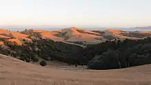
The island has an area of 18 km² and has been farmed by the Chamberlin family since 1853.[3][4] The island now consists of three farms, two owned by the Chamberlin family and one by John Spencer.[3] The only permanent inhabitants (nine in the 2001 census) are associated with the farms which are predominantly used for sheep.

The island is a popular site for youth camps for organisations such as Scouts. Crusader camps (now under the banner of Scripture Union) have been held on the island since 1932.[5]
The island is the home of New Zealand's only feral donkey breed, the Ponui donkey. It also has a large population of kiwi.[3][6]
Shipwrecks
Ponui Island is home to the Shipwreck of the Pupuke.
References
- "Ponui Island (Chamberlins Island), Auckland - NZ Topo Map". Land Information New Zealand. Retrieved 17 October 2017.
- "1000 Māori place names". New Zealand Ministry for Culture and Heritage. 6 August 2019.
- Lee, Mike (25 April 2011). Rediscovered! Ponui Island’s ‘lost tribe’ of kiwi.
- TANK 25, 1979: AUCKLAND UNIVERSITY FIELD CLUB SCIENTIFIC TRIP TO PONUI ISLAND, AUGUST 1978
- Scripture Union: The Ponui Story
- ResearchSpace at The University of Auckland: The ecology of ship rats (Rattus rattus) on Ponui Island: implications for North Island brown kiwi (Apteryx mantelli)
