Porcupine River
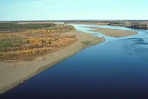
The Porcupine River (Ch’ôonjik[3] in Gwich’in) is a 916 km (569 mi) tributary of the Yukon River in Canada and the United States. It begins in the Ogilvie Mountains north of Dawson City, Yukon, Canada.[4] From there it flows north through the community of Old Crow, veers southwest into the U.S. state of Alaska, and enters the larger river at Fort Yukon.[4] It derives its name from the Gwich'in word for the river, Ch'oonjik, or "Porcupine Quill River".
| Porcupine River | |
|---|---|
 Porcupine River | |
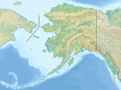 Location of the mouth of the Porcupine River in Alaska | |
| Native name | Ch’ôonjik |
| Location | |
| Countries |
|
| Territories/States | |
| Physical characteristics | |
| Source | Nahoni Range |
| • location | Ogilvie Mountains, Yukon, Canada |
| • coordinates | 65°28′N 139°32′W[1] |
| Mouth | Yukon River |
• location | Fort Yukon, Alaska, United States |
• coordinates | 66°35′42″N 145°18′32″W[1] |
• elevation | 126 m (413 ft)[1] |
| Length | 916 km (569 mi) |
| Basin size | 118,000 km2 (46,000 sq mi)[2] |
| Discharge | |
| • average | 414 m3/s (14,600 cu ft/s)[2] |
The Porcupine caribou herd, in the Arctic National Wildlife Refuge (ANWR) Alaska, gets its name from the river.
The oldest (but disputed) possible evidence of human habitation in North America was found in a cave along one of its tributaries, the Bluefish River. Many apparently human-modified animal bones have been discovered in the Bluefish Caves. They have been dated to 25,000 to 40,000 years old by radiocarbon dating—several thousand years earlier than generally accepted human habitation of North America.[5]
Boating
The Porcupine River offers the possibility of "an excellent novice river trip for those experienced in remote wilderness travel,"[4] according to author Karen Jettmar. Boaters can travel by canoe, kayak, or raft, though rafters may have difficulty with upriver winds. A 800 km (500 mi) float trip beginning at Summit Lake in the Yukon Territory, descending the Bell River to its confluence with the Porcupine, and continuing to Fort Yukon is all rated Class I (easy) on the international scale of river difficulty. However, in high water the difficulty may rise to Class II in Upper and Lower Rampart canyons, downstream of the international border, where the current is swift.[4]
See also
References
| Wikimedia Commons has media related to Porcupine River. |
- "Porcupine River". Geographic Names Information System. United States Geological Survey. January 1, 2000. Retrieved November 3, 2013.
- Benke and Cushing, p. 802
- Holton, Gary (July 16, 2013). "Alaska Native Language Archive: Alaska Place Names". University of Alaska Fairbanks. Retrieved November 3, 2013.
- Jettmar, Karen (2008) [1993]. The Alaska River Guide: Canoeing, Kayaking, and Rafting in the Last Frontier (3rd ed.). Birmingham, Alabama: Menasha Ridge Press. pp. 132–34. ISBN 978-0-89732-957-6.
- Morlan, R.E. (1986), Pleistocene archaeology in Old Crow Basin: a critical reappraisal. In Bryan, A.L.,ed. New Evidence for the Pleistocene Peopling of the Americas. Orono, Maine,Center for the study of Early Man, pp.27-48.
Works cited
External links
- Treasures of the snow Manuscript at Dartmouth College Library
| Authority control |
|
|---|