Prattsville (CDP), New York
Prattsville is a hamlet and census-designated place (CDP) in the town of Prattsville, Greene County, New York, United States. The population of the CDP was 355 at the 2010 census,[1] out of a total population of 700 in the town.
Prattsville, New York | |
|---|---|
 Prattsville  Prattsville | |
| Coordinates: 42°18′53″N 74°25′58″W | |
| Country | United States |
| State | New York |
| County | Greene |
| Town | Prattsville |
| Area | |
| • Total | 4.1 sq mi (10.5 km2) |
| • Land | 4.1 sq mi (10.5 km2) |
| • Water | 0.0 sq mi (0.0 km2) |
| Elevation | 1,165 ft (355 m) |
| Population (2010) | |
| • Total | 355 |
| • Density | 88/sq mi (33.9/km2) |
| Time zone | UTC-5 (Eastern (EST)) |
| • Summer (DST) | UTC-4 (EDT) |
| ZIP code | 12468 |
| Area code(s) | 518 |
| FIPS code | 36-59740 |
| GNIS feature ID | 961103 |
Geography
Prattsville is located in western Greene County and occupies the center and northwest parts of the town of Prattsville. The CDP is bordered to the southwest by Schoharie Creek and to the southeast by its tributary, Batavia Kill. The northwest edge of the CDP follows the Delaware County line, and the far northern extent of the CDP borders Schoharie County.
New York State Route 23 is Prattsville's Main Street, leading northwest 39 miles (63 km) to Oneonta on the Susquehanna River and southeast 36 miles (58 km) to Catskill on the Hudson River.
According to the United States Census Bureau, the Prattsville CDP has a total area of 4.1 square miles (10.5 km2), all of it land.[1]
References
- "Geographic Identifiers: 2010 Demographic Profile Data (G001): Prattsville CDP, New York". American Factfinder. U.S. Census Bureau. Retrieved December 29, 2016.
Municipalities and communities of Greene County, New York, United States | ||
|---|---|---|
| Towns | 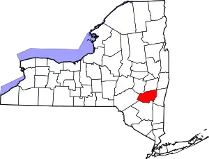 | |
| Villages | ||
| CDPs | ||
| Other hamlets | ||
| ||