Presidencia Roque Sáenz Peña
Presidencia Roque Sáenz Peña (normally known as Sáenz Peña) is a city in the province of Chaco, Argentina. It is the second largest in the province. It is located 170 kilometres (110 mi) west-northwest of the provincial capital Resistencia, on the main rail and road route across northern Argentina to Salta. The city has a population of 76,377 for the urban area (localidad) and 88,164 for the whole municipality (2001 census [INDEC]).
Presidencia Roque Sáenz Peña | |
|---|---|
 Coat of arms | |
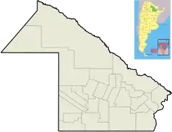 Presidencia Roque Sáenz Peña Location of Presidencia Roque Sáenz Peña in Argentina | |
| Coordinates: 26°47′S 60°27′W | |
| Country | |
| Province | |
| Department | Comandante Fernández |
| Government | |
| • Mayor | Gerardo Cipolini (UCR) |
| Population (2010 census) | |
| • Total | 89,882 |
| Time zone | UTC-3 (ART) |
| CPA base | H3700 |
| Dialing code | +54 3732 |
| Climate | Cfa |
Sáenz Peña was founded in 1912 and has developed as a commercial and industrial centre serving the surrounding agricultural region of the Gran Chaco plains.
Climate
| Climate data for Presidencia Roque Sáenz Peña, Chaco | |||||||||||||
|---|---|---|---|---|---|---|---|---|---|---|---|---|---|
| Month | Jan | Feb | Mar | Apr | May | Jun | Jul | Aug | Sep | Oct | Nov | Dec | Year |
| Record high °C (°F) | 43.8 (110.8) |
42.5 (108.5) |
41.9 (107.4) |
38.8 (101.8) |
39.0 (102.2) |
35.2 (95.4) |
36.7 (98.1) |
40.4 (104.7) |
43.0 (109.4) |
46.2 (115.2) |
44.5 (112.1) |
44.2 (111.6) |
46.2 (115.2) |
| Average high °C (°F) | 34.0 (93.2) |
32.4 (90.3) |
31.1 (88.0) |
27.2 (81.0) |
24.4 (75.9) |
21.9 (71.4) |
22.5 (72.5) |
24.8 (76.6) |
26.8 (80.2) |
29.4 (84.9) |
31.1 (88.0) |
33.0 (91.4) |
28.2 (82.8) |
| Daily mean °C (°F) | 27.1 (80.8) |
26.1 (79.0) |
24.6 (76.3) |
20.8 (69.4) |
17.9 (64.2) |
15.6 (60.1) |
15.3 (59.5) |
17.0 (62.6) |
19.2 (66.6) |
22.3 (72.1) |
24.2 (75.6) |
26.2 (79.2) |
21.4 (70.5) |
| Average low °C (°F) | 20.2 (68.4) |
19.4 (66.9) |
18.4 (65.1) |
14.9 (58.8) |
12.2 (54.0) |
10.0 (50.0) |
8.8 (47.8) |
9.8 (49.6) |
11.8 (53.2) |
15.1 (59.2) |
17.0 (62.6) |
19.2 (66.6) |
14.7 (58.5) |
| Record low °C (°F) | 8.4 (47.1) |
6.8 (44.2) |
3.9 (39.0) |
0.7 (33.3) |
−5.5 (22.1) |
−7.3 (18.9) |
−6.8 (19.8) |
−8.7 (16.3) |
−6.5 (20.3) |
0.2 (32.4) |
2.6 (36.7) |
5.0 (41.0) |
−8.7 (16.3) |
| Average precipitation mm (inches) | 136.7 (5.38) |
120.0 (4.72) |
130.7 (5.15) |
113.6 (4.47) |
47.4 (1.87) |
25.4 (1.00) |
18.6 (0.73) |
21.7 (0.85) |
37.4 (1.47) |
90.9 (3.58) |
118.9 (4.68) |
125.3 (4.93) |
986.6 (38.84) |
| Average precipitation days | 7 | 7 | 7 | 7 | 6 | 5 | 3 | 3 | 4 | 7 | 7 | 7 | 70 |
| Average relative humidity (%) | 70 | 72 | 76 | 78 | 78 | 78 | 73 | 67 | 64 | 67 | 69 | 69 | 72 |
| Mean monthly sunshine hours | 285.2 | 243.0 | 229.4 | 189.0 | 189.1 | 150.0 | 186.0 | 204.6 | 207.0 | 241.8 | 264.0 | 285.2 | 2,674.3 |
| Percent possible sunshine | 67 | 66 | 60 | 55 | 56 | 46 | 57 | 58 | 58 | 61 | 65 | 67 | 60 |
| Source: Instituto Nacional de Tecnología Agropecuaria (temperature 1930–2013, precipitation 1924–2013, humidity 1965–2013 and sun 1968–2013)[1] | |||||||||||||
 Residential section
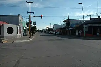 Commercial district
References
- "Estadisticas Meteorologicas: Periodo 1930–2013" (PDF). Informacion Agrometeorologica Anual–2014 (in Spanish). Instituto Nacional de Tecnología Agropecuaria. Retrieved July 6, 2015.
- Municipal information: Municipal Affairs Federal Institute (IFAM), Municipal Affairs Secretariat, Ministry of Interior, Argentina. (in Spanish)
This article is issued from Wikipedia. The text is licensed under Creative Commons - Attribution - Sharealike. Additional terms may apply for the media files.