Puerto Aysén
Puerto Aysén is a city of Chile located in the Aysén del General Carlos Ibáñez del Campo Region, 4 kilometres (2 mi) above the head of Aisén Fjord in the country's extreme south. Puerto Aisén, which is the capital city of both the Aysén Province and the commune of Aisén is located 65 kilometres (40 mi) from the Regional Capital of Coyhaique, and 15 kilometres (9 mi) from the port of Puerto Chacabuco, main entry point to Puerto Aisén by sea. The main tourist attraction is Lagoon San Rafael.
Puerto Aysén | |
|---|---|
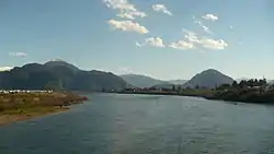 Puerto Aysén in 2008 | |
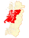 Location of the commune of Aisén in Aysén del General Carlos Ibáñez del Campo Region 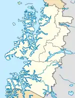 Puerto Aysén Location in Chile 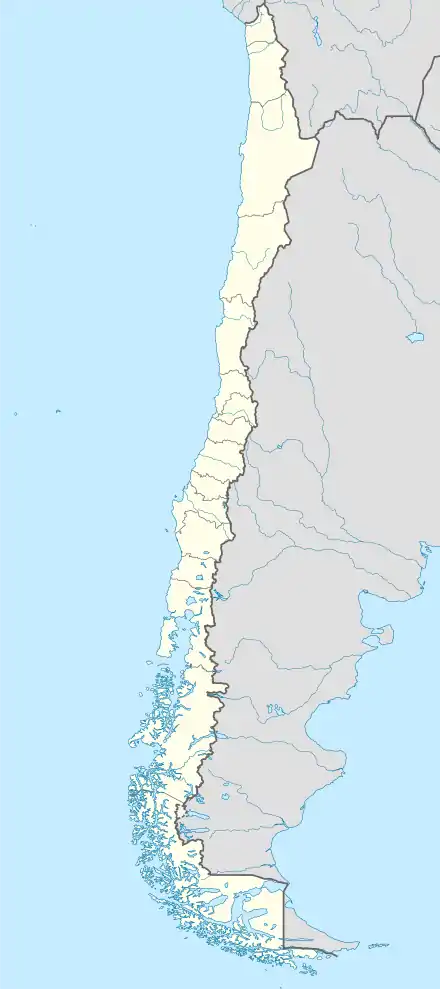 Puerto Aysén Puerto Aysén (Chile) | |
| Coordinates: 45°24′S 72°41′W | |
| Region | Aisén |
| Province | Aisén |
| Municipalidad | Aisén |
| Comuna | Aisén |
| Government | |
| • Type | Municipalidad |
| • Alcade | Óscar Catalán Sánchez |
| Population | |
| • Total | 27,644 |
| Time zone | UTC−04:00 (CLT) |
| • Summer (DST) | UTC−03:00 (CLST) |
| Area code(s) | Country + town = 56 + 67 |
| Climate | Cfb |
Originally settled around 1914, it was officially recognized as a city on January 28, 1928. It numbers around 17,000 inhabitants.
Economy
Fisheries and tourism are the main economic activities. The port of Chacabuco serves passenger ferries but also cargo traffic: fuel and other necessities are imported while live cattle and other agricultural produce are exported. The city is surrounded by several power plants, both hydro- and thermal powered.
Climate
Puerto Aysén has an oceanic climate (Köppen climate classification: Cfb) with high rainfall throughout the year (and one of Chile's wettest places). Typical of oceanic climates, precipitation peaks in late fall and early winter. The highest temperature recorded is 35.3 °C (95.5 °F) in February 2019 [1] while the lowest is −12.0 °C (10.4 °F) in June 1999.[2]
| Climate data for Puerto Aisén (1970–2000, extremes 1955–present) | |||||||||||||
|---|---|---|---|---|---|---|---|---|---|---|---|---|---|
| Month | Jan | Feb | Mar | Apr | May | Jun | Jul | Aug | Sep | Oct | Nov | Dec | Year |
| Record high °C (°F) | 34.9 (94.8) |
35.3 (95.5) |
31.5 (88.7) |
23.6 (74.5) |
17.8 (64.0) |
15.3 (59.5) |
15.2 (59.4) |
17.0 (62.6) |
23.7 (74.7) |
26.0 (78.8) |
29.0 (84.2) |
31.0 (87.8) |
35.3 (95.5) |
| Average high °C (°F) | 17.2 (63.0) |
17.2 (63.0) |
15.7 (60.3) |
12.4 (54.3) |
9.3 (48.7) |
7.0 (44.6) |
6.6 (43.9) |
8.3 (46.9) |
10.6 (51.1) |
13.0 (55.4) |
14.8 (58.6) |
16.3 (61.3) |
12.2 (54.0) |
| Daily mean °C (°F) | 14.6 (58.3) |
14.5 (58.1) |
13.0 (55.4) |
10.1 (50.2) |
7.2 (45.0) |
5.0 (41.0) |
4.5 (40.1) |
6.0 (42.8) |
8.2 (46.8) |
10.5 (50.9) |
12.4 (54.3) |
13.9 (57.0) |
9.8 (49.6) |
| Average low °C (°F) | 11.1 (52.0) |
10.5 (50.9) |
9.1 (48.4) |
7.1 (44.8) |
4.8 (40.6) |
2.8 (37.0) |
2.2 (36.0) |
3.2 (37.8) |
4.7 (40.5) |
6.8 (44.2) |
9.0 (48.2) |
10.4 (50.7) |
6.7 (44.1) |
| Record low °C (°F) | 1.0 (33.8) |
0.6 (33.1) |
−2.9 (26.8) |
−3.4 (25.9) |
−10.0 (14.0) |
−12.0 (10.4) |
−8.9 (16.0) |
−5.4 (22.3) |
−7.4 (18.7) |
−3.2 (26.2) |
−4.0 (24.8) |
1.0 (33.8) |
−12.0 (10.4) |
| Average precipitation mm (inches) | 159.1 (6.26) |
124.6 (4.91) |
149.2 (5.87) |
200.2 (7.88) |
258.5 (10.18) |
240.4 (9.46) |
237.7 (9.36) |
213.4 (8.40) |
181.3 (7.14) |
149.1 (5.87) |
146.3 (5.76) |
178.7 (7.04) |
2,238.5 (88.13) |
| Average precipitation days | 18 | 14 | 16 | 19 | 21 | 20 | 21 | 21 | 19 | 18 | 18 | 18 | 223 |
| Average relative humidity (%) | 73 | 75 | 77 | 83 | 88 | 88 | 87 | 84 | 80 | 75 | 73 | 73 | 80 |
| Source: Dirección Meteorológica de Chile[2][3] | |||||||||||||
References
- Campos, Diego (February 8, 2019). "Un activo verano en el Cono Sur". Meteochile Blog. Dirección Meteorológica de Chile. Retrieved February 19, 2019.
- "Temperatura Mensual Histórica de Puerto Aysén Ad. (450001)". Sistema de Administración de Datos Climatológicos (in Spanish). Dirección Meteorológica de Chile. Archived from the original on June 3, 2016. Retrieved April 25, 2016.
- "Estadistica Climatologica Tomo III" (PDF) (in Spanish). Dirección General de Aeronáutica Civil. March 2001. pp. 161–175. Archived from the original (PDF) on 20 October 2017. Retrieved April 25, 2016.
