Pukeatua
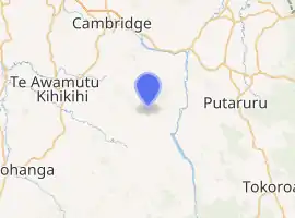
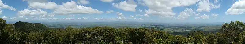
Pukeatua is a rural farming community in Waipa District and Waikato region of New Zealand's North Island. It is situated at the south-western foot of the Pukeatua hill, of the Maungatautari mountain range.[1]
Pukeatua | |
|---|---|
Village | |
| |
| Coordinates: 38.064366°S 175.557837°E | |
| Country | New Zealand |
| Region | Waikato Region |
| District | Waipa District |
| Population (2018 census) | |
| • Territorial | 159 |
| Time zone | UTC+12 (NZST) |
| • Summer (DST) | UTC+13 (NZDT) |
The area is west of Tirau, Putaruru and State Highway 1, and east of Te Awamutu and State Highway 3.[2]
Pukeatua translates as hill of god (puke = hill, atua= god).[1]
Demographics
| Year | Pop. | ±% p.a. |
|---|---|---|
| 2006 | 822 | — |
| 2013 | 819 | −0.05% |
| 2018 | 834 | +0.36% |
| Source: [3] | ||
The statistical area of Rotongata, which at 212 square kilometres is much larger than this community, had a population of 834 at the 2018 New Zealand census, an increase of 15 people (1.8%) since the 2013 census, and an increase of 12 people (1.5%) since the 2006 census. There were 294 households. There were 423 males and 411 females, giving a sex ratio of 1.03 males per female. The median age was 34.2 years (compared with 37.4 years nationally), with 222 people (26.6%) aged under 15 years, 141 (16.9%) aged 15 to 29, 408 (48.9%) aged 30 to 64, and 60 (7.2%) aged 65 or older.
Ethnicities were 77.7% European/Pākehā, 19.4% Māori, 1.8% Pacific peoples, 9.0% Asian, and 2.5% other ethnicities (totals add to more than 100% since people could identify with multiple ethnicities).
The proportion of people born overseas was 16.9%, compared with 27.1% nationally.
Although some people objected to giving their religion, 52.5% had no religion, 34.2% were Christian, 0.4% were Hindu, 1.1% were Buddhist and 4.7% had other religions.
Of those at least 15 years old, 132 (21.6%) people had a bachelor or higher degree, and 102 (16.7%) people had no formal qualifications. The median income was $38,100, compared with $31,800 nationally. The employment status of those at least 15 was that 384 (62.7%) people were employed full-time, 105 (17.2%) were part-time, and 12 (2.0%) were unemployed.[3]
Pukeatua is in meshblocks 0991000 and 0991500, which had a population of 158 people in the 2018 census.[4]
Education
Pukeatua School is a Decile 8 primary school,[5] providing full education for Years 1 to 8.[6] The school has a roll of 81 as of March 2020.[7] The school was founded in 1911.[8][9]
The village also has a small war memorial church and a playcentre.[10][11]
References
- "Pukeatua". nzhistory.govt.nz. Ministry for Culture and Heritage.
- Hariss, Gavin. "Pukeatua, Waikato". topomap.co.nz. NZ Topo Map.
- "Statistical area 1 dataset for 2018 Census". Statistics New Zealand. March 2020. Rotongata (185000). 2018 Census place summary: Rotongata
- "Meshblock Electoral Populations 2020 for proposed boundaries data". Statistics New Zealand. April 2020. Meshblocks 0991000 and 0991500.
- "Pukeatua School". pukeatuaschool.co.nz. Pukeatua School.
- Pura-Watson, Lynda. "Pukeatua School - 08/06/2017". ero.govt.nz. Education Review Office.
- Education Counts: Pukeatua School
- Reader, Christine (4 June 2010). "Pukeatua School centennial" (PDF). Te Awamutu Courier.
- "Pukeatua School Centennial : 1911-2011 (archive record)". National Library. Retrieved 9 November 2020.
- "Pukeatua war memorial church". nzhistory.govt.nz. Ministry for Culture and Heritage.
- "Pukeatua Playcentre". playcentre.co.nz. Playcentre New Zealand.