Q'asiri (Larecaja)
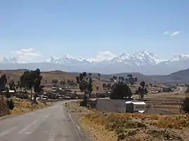
Q'asiri (Aymara for bawler,[3] Hispanicized spellings Casiri, Kasiri) is a mountain in the Cordillera Real in the Andes of Bolivia, about 5,828 m (19,121 ft) high. It is located in the La Paz Department, Larecaja Province, Sorata Municipality. It is situated south-east of the mountain Janq'u Uma, north-west of the mountains Qalsata and Ch'iyar Juqhu and north-east of San Francisco Lake.[4][5][6]
| Q'asiri | |
|---|---|
 | |
| Highest point | |
| Elevation | 5,828 m (19,121 ft) [1] |
| Coordinates | 15°53′46″S 68°28′45″W |
| Geography | |
 Q'asiri Bolivia | |
| Location | Bolivia La Paz Department, Larecaja Province, Sorata Municipality |
| Parent range | Andes, Cordillera Real |
| Climbing | |
| First ascent | 1-1928: S.W. ridge-1990[2] |
The rivers Jisk'a Q'asiri ("little Q'asiri", Jiska Khasiri) and Jach'a Q'asiri ("big Q'asiri", Jacha Khasiri) originate on the west side of the mountain. They flow to San Francisco Lake.[5]
See also
External links
- Sorata Municipality: population data and map showing Lake San Francisco. Q'asiri is situated north east of it.
References
- summitpost.org
- Jill Neate, Mountaineering in the Andes, 1994
- Juan Carlos Mamani Morales, Cuentos de Parinacota, 2009, p. 48: Casiri: del aymara q'asiri, gritador/a
- summitpost.org Map of Illampu range showing
- Bolivian IGM map 1:50,000 Comunidad Amaguaya 5946-III
- "Sorata". INE, Bolivia. Archived from the original on October 6, 2014. Retrieved September 29, 2014. (unnamed, north-east of Laguna San Francisco)
This article is issued from Wikipedia. The text is licensed under Creative Commons - Attribution - Sharealike. Additional terms may apply for the media files.