Quelimane
Quelimane (Portuguese pronunciation: [keliˈmani]) is a seaport in Mozambique. It is the administrative capital of the Zambezia Province and the province's largest city, and stands 25 km (16 mi) from the mouth of the Rio dos Bons Sinais (or "River of the Good Signs"). The river was named when Vasco da Gama, on his way to India, reached it and saw "good signs" that he was on the right path. The town was the end point of David Livingstone's west-to-east crossing of south-central Africa in 1856. Portuguese is the official language of Mozambique, and many residents of the areas surrounding Quelimane speak Portuguese. The most common local language is Chuabo. Quelimane, along with much of Zambezia Province, is extremely prone to floods during Mozambique's rainy season. The most recent bout of severe flooding took place in January 2007.
Quelimane | |
|---|---|
.jpg.webp) Quelimane | |
 Quelimane | |
| Coordinates: 17°52′35″S 36°53′14″E | |
| Country | |
| Provinces | Zambezia Province |
| City Status | 1942 |
| Area | |
| • Total | 117 km2 (45 sq mi) |
| Elevation | 1 m (3 ft) |
| Population (2017 census) | |
| • Total | 349,842 |
| • Density | 3,000/km2 (7,700/sq mi) |
| Climate | Aw |
History
Pre-colonial era
The town originated as a Swahili trade centre, and then grew as a slave market. Quelimane was founded by Muslim traders (see Kilwa Sultanate) and was one of the oldest towns in the region.
Etymology
The origins of the name 'Quelimane' are obscure. One tradition alleges that Vasco da Gama, in 1498, inquired about the name of the place from some inhabitants laboring in the fields outside the settlement. Thinking he was asking what they were doing, they simply replied kuliamani ('we are cultivating').
An alternative explanation is that when the Portuguese reached the settlement, they were welcomed by a notable Arab, or half Arab, who acted as interpreter between them and the natives. The name which the Portuguese applied to this individual, and his settlement, was 'Quelimane' (pronounced Kelimãn), because in the corrupt Arabic spoken on the East African coast 'Kalimãn' is the word for 'Interpreter'. In Swahili it is 'Mkalimani'.[1]
In 1761, the city became a town.[2] Until 1853 trade was forbidden to any other than Portuguese.[3] Sisal plantations were organized by Swiss planters in the beginning of the 20th century, namely Joseph Émile Stucky de Quay. The town started to grow and attracted several communities from different backgrounds, including Muslims and Indians, and new infrastructure was built by the Portuguese authorities. Its busy port had tea, grown and processed in the district of Zambézia (particularly important in the region around Gurúè, former Vila Junqueiro), as its major export. Coconut was also produced and transformed in the city.[4] By 1970, Quelimane had 71,786 inhabitants.
Independence
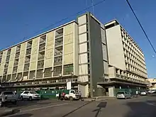
Mozambique became independent from Portugal in 1975, after the April 1974 Carnation Revolution at Lisbon. Although its location on the Rio dos Bons Sinais is less important today than in the past, Quelimane remains a major town with a large hospital, two cathedrals, a mosque, and a public university for teachers. Due to its heat, humidity, and distance from the beach, Quelimane is not among Mozambique's major tourist destinations. However, its status as a provincial capital and the fourth-largest city in Mozambique and the increasing ease of access by plane (Linhas Aéreas de Moçambique runs flights) and road contribute to a small but relatively steady stream of visitors. In addition, Quelimane is home to branches of many international NGOs, and frequent visits from foreign aid consultants, workers, and government officials also contribute to the economy. The city received a further boost when Quelimane hosted the Ninth Annual Frelimo Party Convention in November 2006. After decades of municipal decline, the current mayor, Manuel de Araujo, is reportedly overseeing a renewed civic effort at economic and infrastructural restoration .
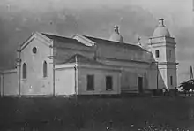
Places of worship
Among the places of worship, they are predominantly Christian churches and temples: Roman Catholic Diocese of Quelimane (Catholic Church), (Reformed Church in Mozambique (World Communion of Reformed Churches), Igreja Presbiteriana de Moçambique (World Communion of Reformed Churches), Convenção Baptista de Moçambique (Baptist World Alliance), Universal Church of the Kingdom of God, Assemblies of God, Zion Christian Church.[5] There are also Muslim mosques.
Demographics
| Year (census) | Population[6] |
|---|---|
| 1997 | 150,116 |
| 2007 | 193,343 |
| 2017 | 349,842 |
Climate
Quelimane has a tropical savanna climate (Köppen climate classification Aw).
| Climate data for Quelimane | |||||||||||||
|---|---|---|---|---|---|---|---|---|---|---|---|---|---|
| Month | Jan | Feb | Mar | Apr | May | Jun | Jul | Aug | Sep | Oct | Nov | Dec | Year |
| Record high °C (°F) | 40.3 (104.5) |
38.5 (101.3) |
38.4 (101.1) |
37.2 (99.0) |
36.4 (97.5) |
33.8 (92.8) |
34.1 (93.4) |
37.0 (98.6) |
39.0 (102.2) |
42.9 (109.2) |
42.8 (109.0) |
41.4 (106.5) |
42.9 (109.2) |
| Average high °C (°F) | 32.4 (90.3) |
32.1 (89.8) |
31.4 (88.5) |
30.2 (86.4) |
28.6 (83.5) |
26.8 (80.2) |
26.2 (79.2) |
27.6 (81.7) |
29.5 (85.1) |
31.2 (88.2) |
32.1 (89.8) |
32.3 (90.1) |
30.0 (86.0) |
| Daily mean °C (°F) | 27.4 (81.3) |
27.3 (81.1) |
26.9 (80.4) |
25.6 (78.1) |
23.2 (73.8) |
21.1 (70.0) |
20.6 (69.1) |
21.8 (71.2) |
23.6 (74.5) |
25.3 (77.5) |
26.5 (79.7) |
27.1 (80.8) |
24.7 (76.5) |
| Average low °C (°F) | 23.4 (74.1) |
23.4 (74.1) |
23.2 (73.8) |
21.5 (70.7) |
18.5 (65.3) |
16.0 (60.8) |
15.6 (60.1) |
16.1 (61.0) |
18.1 (64.6) |
20.2 (68.4) |
21.7 (71.1) |
22.8 (73.0) |
20.0 (68.0) |
| Record low °C (°F) | 18.9 (66.0) |
17.9 (64.2) |
17.2 (63.0) |
15.9 (60.6) |
11.9 (53.4) |
9.9 (49.8) |
10.3 (50.5) |
10.3 (50.5) |
11.1 (52.0) |
12.8 (55.0) |
14.1 (57.4) |
15.9 (60.6) |
9.9 (49.8) |
| Average precipitation mm (inches) | 241.4 (9.50) |
238.8 (9.40) |
237.5 (9.35) |
153.3 (6.04) |
82.3 (3.24) |
56.0 (2.20) |
62.4 (2.46) |
29.0 (1.14) |
18.5 (0.73) |
34.1 (1.34) |
88.2 (3.47) |
219.5 (8.64) |
1,461 (57.52) |
| Average precipitation days (≥ 1.0 mm) | 11.4 | 12.9 | 13.1 | 9.9 | 7.6 | 7.9 | 8.1 | 4.3 | 2.1 | 2.8 | 5.2 | 10.6 | 95.9 |
| Average relative humidity (%) | 78 | 78 | 79 | 79 | 79 | 81 | 79 | 77 | 74 | 68 | 72 | 74 | 77 |
| Mean monthly sunshine hours | 220.1 | 194.9 | 226.3 | 228.0 | 238.7 | 216.0 | 229.4 | 263.5 | 261.0 | 257.3 | 279.0 | 238.7 | 2,852.9 |
| Mean daily sunshine hours | 7.1 | 6.9 | 7.3 | 7.6 | 7.7 | 7.2 | 7.4 | 8.5 | 8.7 | 8.3 | 9.3 | 7.7 | 7.8 |
| Source: Deutscher Wetterdienst[7] | |||||||||||||
References
- British Central Africa, Sir Harry H. Johnston, K.C.B., New York, Edward Arnold, 70 Fifth Avenue, 1897, Page 55-56
- Britannica,Quelimane, britannica.com, USA, accessed on July 7, 2019
- Chisholm, Hugh, ed. (1911). . Encyclopædia Britannica. 22 (11th ed.). Cambridge University Press. p. 750.
- QUELIMANE, a film of the cosmopolitan port of Quelimane and tea centre of Vila Junqueiro, Portuguese Mozambique, before 1975.
- J. Gordon Melton, Martin Baumann, ‘‘Religions of the World: A Comprehensive Encyclopedia of Beliefs and Practices’’, ABC-CLIO, USA, 2010, p. 1985
- "Mozambique: largest cities and towns and statistics of their population". World Gazetteer. Archived from the original on December 31, 2008. Retrieved 2008-06-18.
- "Klimatafel von Quelimane / Mosambik" (PDF). Baseline climate means (1961-1990) from stations all over the world (in German). Deutscher Wetterdienst. Retrieved April 19, 2017.
- Le Port est jumelé à quatre villes portuaires Archived September 8, 2015, at the Wayback Machine (in French)
External links
 Quelimane travel guide from Wikivoyage
- . The Nuttall Encyclopædia. 1907.
- "Mozambique Holiday Destinations". Go2Africa.com. 30 November 2017. Retrieved 22 May 2020.
- quelimane.no.sapo.pt
- "Página Inicial". Zambézia On Line (in Portuguese). 24 October 2005. Archived from the original on 24 October 2005. Retrieved 22 May 2020.
Provincial capitals of Mozambique | ||
|---|---|---|
| Authority control |
|---|