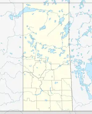
RCAF Station Weyburn
| RCAF Station Weyburn | |||||||||||||||||
|---|---|---|---|---|---|---|---|---|---|---|---|---|---|---|---|---|---|
| Weyburn, Saskatchewan Near Weyburn, Saskatchewan in Canada | |||||||||||||||||
 RCAF Station Weyburn | |||||||||||||||||
| Coordinates | 49°42′N 103°48′W | ||||||||||||||||
| Site information | |||||||||||||||||
| Operator | Formerly Royal Canadian Air Force | ||||||||||||||||
| Airfield information | |||||||||||||||||
| Identifiers | IATA: none, ICAO: none | ||||||||||||||||
| Elevation | 1,919 ft (585 m) AMSL | ||||||||||||||||
| |||||||||||||||||
| Airfields | |||||||||||||||||
RCAF Station Weyburn
The aerodrome was constructed in 1941 by the Royal Canadian Air Force (RCAF) as part of the British Commonwealth Air Training Plan. The Station was home to No. 41 Service Flying Training School and during its operation graduated 1,055 pilots and recorded more than 180,000 hours of flight time before being abandoned on 30 June 1944.[1][2][3]
Aerodrome information
In approximately 1942 the aerodrome was listed as RCAF Aerodrome - Weyburn, Saskatchewan at 49°42′N 103°48′W with a variation of 17 degrees east and elevation of 1,919 ft (585 m). Six runways were listed as follows: [4]
| Runway Name | Length | Width | Surface |
|---|---|---|---|
| 12/30 | 2,900 ft (880 m) | 100 ft (30 m) | Hard Surface |
| 12/30 | 3,300 ft (1,000 m) | 100 ft (30 m) | Hard Surface |
| 6/24 | 3,000 ft (910 m) | 100 ft (30 m) | Hard Surface |
| 6/24 | 3,400 ft (1,000 m) | 100 ft (30 m) | Hard Surface |
| 17/35 | 2,900 ft (880 m) | 100 ft (30 m) | Hard Surface |
| 17/35 | 3,300 ft (1,000 m) | 100 ft (30 m) | Hard Surface |
Relief landing field – Halbrite
A Relief Landing field for RCAF Station Weyburn was located approximately 19 mi (31 km) south-east. The site was located south of the village of Halbrite, Saskatchewan. In approximately 1942 the aerodrome was listed as RCAF Aerodrome - Halbrite, Saskatchewan at 49°28′N 103°34′W with a variation of 16 degrees east and an elevation of 1,900 ft (580 m). The Relief field was laid out in a triangle with three runways, detailed in the following table:[5]
| Runway Name | Length | Width | Surface |
|---|---|---|---|
| 5/23 | 2,700 ft (820 m) | 150 ft (46 m) | Hard Surface |
| 17/35 | 2,700 ft (820 m) | 150 ft (46 m) | Hard Surface |
| 11/29 | 2,700 ft (820 m) | 150 ft (46 m) | Hard Surface |
A review of Google Maps satellite imagery on 8 June 2018 shows no details indicating an airfield at the listed coordinates.
Relief landing field – Ralph
A Relief Landing field for RCAF Station Weyburn was located approximately 12 mi (19 km) south-east. The site was located approximately 2 mi (3.2 km) south of the unincorporated community of Ralph, Saskatchewan. In approximately 1942 the aerodrome was listed as RCAF Aerodrome - Ralph, Saskatchewan at 49°33′N 103°41′W with a variation of 16 degrees east and an elevation of 1,880 ft (570 m). The Relief field was detailed as "Turf - All way field - Servicable" and was drawn as a triangular layout with no dimensional information.[6] A review of Google Maps satellite imagery on 8 June 2018 shows no details indicating an airfield at the listed coordinates.
References
- "Services > Airport". City of Weyburn. Retrieved 2011-07-16.
- Greenhous, Brereton; Norman Hillmer (Fall 1981). "The Impact of the British Commonwealth Air Training Plan on Western Canada: Some Saskatchewan Case Studies". Journal of Canadian Studies. 16 (3): 133-144Project Muse.
- "41 Service Flying Training School, Weyburn, Saskatchewan, 1942-1944 (AIR 29/586)". The National Archives. Retrieved 8 December 2020.
- Staff writer (c. 1942). Pilots Handbook of Aerodromes and Seaplane Bases Vol. 2. Royal Canadian Air Force. p. 68.
- Staff writer (c. 1942). Pilots Handbook of Aerodromes and Seaplane Bases Vol. 2. Royal Canadian Air Force. p. 43.
- Staff writer (c. 1942). Pilots Handbook of Aerodromes and Seaplane Bases Vol. 2. Royal Canadian Air Force. p. 58.
