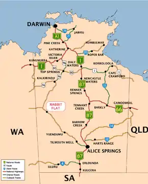
Rabbit Flat, Northern Territory
Rabbit Flat was a roadhouse in the Northern Territory of Australia located in the locality of Tanami about 160 kilometres (100 mi) from the Western Australia border.[1] It lies between the Tanami Mine (45 km NW) and The Granites Mine (53 km SE) on the Tanami Road.
Roadhouse
The former Rabbit Flat Roadhouse claimed to be the most isolated roadhouse in Australia, with no other roadhouse within 100 kilometres (62 mi).[2] It was established on 14 June 1969 by Bruce Farrands and his wife Jackie, a French national.[3] An arrangement had been agreed between the Farrands and Ansett-Pioneer Coaches to provide overnight tent accommodation for a tourist route between Alice Springs and Darwin via Wave Hill, now known as Kalkarindji.
The location was chosen because of the availability of water at the Rabbit Flat well, on the stock route from Alice Springs to Halls Creek. By December 1969 Rabbit Flat had been selected as a weather reporting station by the Bureau of Meteorology. The roadhouse became a stop for fuel, food and souvenirs over time. An orchard of fruit trees grew nearby and jams and preservatives were produced on site.
On the morning of 6 August 1975 media interest was aroused when twin boys were born to the Farrands at the Rabbit Flat Roadhouse.[3] Neither the surprised parents nor medical staff in Alice Springs were aware that more than one baby was expected. Mother Jackie and the babies were flown to Alice Springs hospital by the Royal Flying Doctor Service of Australia for observation, as the boys were six weeks premature. The pilot of the RFDS aircraft is reported to have quipped on arrival in Alice Springs, that "the population of Rabbit Flat doubled last night".[4] A documentary film about Rabbit Flat was produced by the Australian Broadcasting Corporation for its television series A Big Country.
Closure of the Roadhouse
After more than 41 years of service, the Farrands decided to close the roadhouse to all services except weather reporting and the sale of souvenirs and preserved goods. The change occurred on 31 December 2010.
Weather station
The roadhouse manager maintained the weather station at Rabbit Flat, the closest climatic station being at Balgo, a small Aboriginal community 212 kilometres (132 mi) to the West; the airstrip is 0.8 kilometres (0.50 mi) away. The climate from the weather station is in the table:
| Climate data for Rabbit Flat (1969 to 1 December 1998) | |||||||||||||
|---|---|---|---|---|---|---|---|---|---|---|---|---|---|
| Month | Jan | Feb | Mar | Apr | May | Jun | Jul | Aug | Sep | Oct | Nov | Dec | Year |
| Record high °C (°F) | 46.4 (115.5) |
45.9 (114.6) |
43.2 (109.8) |
41.3 (106.3) |
38.2 (100.8) |
34.6 (94.3) |
35.2 (95.4) |
38.6 (101.5) |
41.1 (106.0) |
44.2 (111.6) |
46.1 (115.0) |
47.9 (118.2) |
47.9 (118.2) |
| Average high °C (°F) | 38.5 (101.3) |
37.3 (99.1) |
36.2 (97.2) |
33.0 (91.4) |
28.9 (84.0) |
26.0 (78.8) |
25.9 (78.6) |
29.1 (84.4) |
33.2 (91.8) |
36.9 (98.4) |
38.6 (101.5) |
39.2 (102.6) |
33.5 (92.3) |
| Average low °C (°F) | 23.6 (74.5) |
23.1 (73.6) |
20.7 (69.3) |
16.4 (61.5) |
12.2 (54.0) |
8.3 (46.9) |
6.6 (43.9) |
9.4 (48.9) |
13.5 (56.3) |
18.1 (64.6) |
21.5 (70.7) |
23.3 (73.9) |
16.3 (61.3) |
| Record low °C (°F) | 14.2 (57.6) |
14.8 (58.6) |
11.5 (52.7) |
6.4 (43.5) |
−1.0 (30.2) |
−1.9 (28.6) |
−3.5 (25.7) |
−1.8 (28.8) |
2.9 (37.2) |
4.0 (39.2) |
10.1 (50.2) |
13.4 (56.1) |
−3.5 (25.7) |
| Average rainfall mm (inches) | 100.0 (3.94) |
110.4 (4.35) |
43.0 (1.69) |
21.3 (0.84) |
14.0 (0.55) |
11.2 (0.44) |
9.2 (0.36) |
3.4 (0.13) |
9.9 (0.39) |
17.1 (0.67) |
32.4 (1.28) |
58.0 (2.28) |
429.9 (16.92) |
| Average rainy days (≥ 0.2mm) | 9.9 | 8.7 | 4.9 | 2.1 | 2.3 | 1.3 | 0.7 | 0.9 | 1.6 | 3.4 | 6.1 | 7.0 | 48.9 |
| Source: Bureau of Meteorology[5] | |||||||||||||
References
- "Rabbit Flat". NT Place Names Register. Northern Territory Government. Retrieved 12 March 2019.
- Hema, Maps (2006). Australia’s Great Desert Tracks NC Sheet (Map). Eight Mile Plains Queensland: Hema Maps. ISBN 978-1-86500-163-0.
- "Romance along 'tragedy track'". The Australian Women's Weekly. 46 (23). Australia. 8 November 1978. p. 41. Retrieved 13 March 2019 – via National Library of Australia.
- Marsh, B (2009). Outback Towns and Pubs. Australia: Harper Collins. p. 224. ISBN 978-0-7333-2452-9.
- "Rabbit Flat". Climate statistics for Australian locations. Bureau of Meteorology. February 2013. Retrieved 4 March 2013.
Map reference
- Westprint Heritage Maps.(2002) Tanami Track: Alice Springs, The Granites, Rabbit Flat, Billiluna, Halls Creek / compiled by John Deckert; cartographic design and production by Flat Earth Mapping. 3rd ed. Scale 1:1,000,000 (E 127°20' -- E 134°00'/S 17°25' --S 24°00') Nhill, Vic. : Westprint Heritage Maps. ISBN 978-1-875608-11-9 also known as Westprint Heritage Maps for modern explorers.