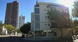
Rafaela
Rafaela (Spanish pronunciation: [rafaˈela]) is a city in the province of Santa Fe, Argentina, about 96 km from the provincial capital. It is the head town of the Castellanos Department. It has a population of 99,150 per the 2010 census [INDEC].
Rafaela | |
|---|---|
 | |
 Coat of arms | |
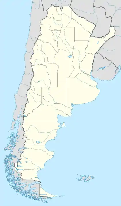 Rafaela Location of Rafaela in Argentina | |
| Coordinates: 31°16′S 61°29′W | |
| Country | |
| Province | |
| Department | Castellanos |
| Founded by | Guillermo Lehmann (colonist) |
| Government | |
| • Mayor | Luis Castellano (Justicialist) |
| Area | |
| • Total | 156 km2 (60 sq mi) |
| Elevation | 90 m (300 ft) |
| Population (2010 census) | |
| • Total | 99,150 |
| • Density | 640/km2 (1,600/sq mi) |
| Demonym(s) | rafaelino |
| Time zone | UTC−03:00 (ART) |
| CPA base | S2300 |
| Dialing code | +54 3492 |
| Website | Official website |
The city was established in 1881 by Guillermo Lehmann, and officially became a city in 1913. The city has grown 22.2% between 1991 and 2001, and 18.6% in the last census period (2001-2011) according to the official data of the Population Census (INDEC). The city is almost the exact antipode of Wuhu in China.
The city hosts Rafaela Aerodrome airport and the Autódromo Ciudad de Rafaela race track.
Zoning of the city
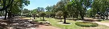
The city is located in the western-center area of Santa Fe Province and has an area of 156 km2 (60 sq mi). The design of most of the urban area of the city has a shape of a checkerboard with the main plaza (Plaza 25 de mayo) in the middle of the city and four main boulevards coming from there. The street grid of the city is composed by square blocks in most part of the neighborhoods, mainly in the historical and older part of the city.
The city has 37 neighborhoods and the downtown area (called Microcentro in Spanish) as the map of the city shows.[1]
Role of citizen participation in planning
In 2008 the municipality of Rafaela created the Department of Administration and Participation (Secretaria de Gestión y Participación, SGP) and after that the government started implementing a process of Participatory budgeting,[2] based on the successful case of Porto Alegre. The main goal of this process is to consolidate and strengthen the importance of citizen participation in the public agenda. The government of the city has implemented the method for three consecutive years. The first one in 2009 was completed; the one for 2010 is now in the stage of implementing the public works that resulted from the participation process; and the third project is in process (SGP, Municipalidad de Rafaela, 2011).[3]
Climate
| Climate data for Rafaela (1961–1990, extremes 1970–present) | |||||||||||||
|---|---|---|---|---|---|---|---|---|---|---|---|---|---|
| Month | Jan | Feb | Mar | Apr | May | Jun | Jul | Aug | Sep | Oct | Nov | Dec | Year |
| Record high °C (°F) | 42.0 (107.6) |
40.5 (104.9) |
39.5 (103.1) |
36.9 (98.4) |
34.6 (94.3) |
30.8 (87.4) |
32.4 (90.3) |
37.2 (99.0) |
39.0 (102.2) |
41.7 (107.1) |
39.1 (102.4) |
42.0 (107.6) |
42.0 (107.6) |
| Average high °C (°F) | 32.1 (89.8) |
30.9 (87.6) |
28.1 (82.6) |
24.7 (76.5) |
21.7 (71.1) |
17.9 (64.2) |
18.1 (64.6) |
20.0 (68.0) |
22.2 (72.0) |
25.3 (77.5) |
28.2 (82.8) |
30.7 (87.3) |
25.0 (77.0) |
| Daily mean °C (°F) | 24.7 (76.5) |
23.7 (74.7) |
21.4 (70.5) |
17.9 (64.2) |
15.2 (59.4) |
11.4 (52.5) |
11.4 (52.5) |
12.7 (54.9) |
14.8 (58.6) |
18.2 (64.8) |
21.0 (69.8) |
23.6 (74.5) |
18.0 (64.4) |
| Average low °C (°F) | 18.0 (64.4) |
17.4 (63.3) |
16.0 (60.8) |
12.7 (54.9) |
9.7 (49.5) |
6.4 (43.5) |
6.1 (43.0) |
6.8 (44.2) |
8.5 (47.3) |
11.8 (53.2) |
14.6 (58.3) |
16.8 (62.2) |
12.1 (53.8) |
| Record low °C (°F) | 7.0 (44.6) |
5.5 (41.9) |
3.0 (37.4) |
−1.1 (30.0) |
−5.9 (21.4) |
−6.4 (20.5) |
−8.3 (17.1) |
−5.4 (22.3) |
−4.0 (24.8) |
−0.7 (30.7) |
0.0 (32.0) |
5.4 (41.7) |
−8.3 (17.1) |
| Average precipitation mm (inches) | 121.1 (4.77) |
130.1 (5.12) |
150.5 (5.93) |
82.0 (3.23) |
42.0 (1.65) |
24.0 (0.94) |
23.6 (0.93) |
24.6 (0.97) |
57.1 (2.25) |
82.8 (3.26) |
102.8 (4.05) |
118.8 (4.68) |
959.4 (37.77) |
| Average precipitation days (≥ 0.1 mm) | 8 | 7 | 9 | 7 | 5 | 4 | 5 | 5 | 6 | 8 | 8 | 8 | 80 |
| Average relative humidity (%) | 70 | 74 | 79 | 80 | 81 | 81 | 80 | 77 | 74 | 74 | 73 | 71 | 76 |
| Mean monthly sunshine hours | 288.3 | 240.1 | 229.4 | 210.0 | 186.0 | 159.0 | 173.6 | 204.6 | 216.0 | 244.9 | 276.0 | 291.4 | 2,719.3 |
| Percent possible sunshine | 66.8 | 64.8 | 60.5 | 62.3 | 57.0 | 51.9 | 54.1 | 60.1 | 61.0 | 61.8 | 67.2 | 66.4 | 61.2 |
| Source 1: NOAA,[4] Oficina de Riesgo Agropecuario (record highs and lows)[5] | |||||||||||||
| Source 2: Servicio Meteorológico Nacional (precipitation days),[6] Instituto Nacional de Tecnología Agropecuaria (sun, 1961–1990)[7] | |||||||||||||
Notable natives
- Hermes Binner, twice mayor of Rosario and former governor of Santa Fe province.
- Javier Frana, professional tennis player
- Ricardo Lorenzetti, president elect of the Argentine Supreme Court of Justice
- Sebastián Porto, former professional motorcycle racer
- María Emilia Salerni, professional tennis player
- Martín Basso, professional TC racer
- Lucas Aveldaño, professional soccer player
- Silvia Bertolaccini, former LPGA professional golf player and current ESPN announcer for Latin America
- Denis Stracqualursi, professional soccer player currently at Everton F.C.
- Grillo Demo, contemporary artist
- Axel Werner, professional footballer who plays for Spanish club Málaga CF on loan from Atlético Madrid as a goalkeeper.
References
- Map 1: Neighborhoods of the city (In Spanish) Archived January 7, 2012, at the Wayback Machine
- Program of Citizen Participation (In Spanish)
- SGP - Secretaría de Gestión y Participación, Municipalidad de Rafaela (2011) “Presupuesto Ciudadano de Gestión Participativa. Oportunidad para los vecinos, desafío para la gestión municipal y crecimiento equitativo de la ciudad”. Prepared by Municipalidad de Rafaela, Argentina.
- "Rafaela INTA Climate Normals 1961–1990". National Oceanic and Atmospheric Administration. Retrieved March 15, 2015.
- "Rafaela, Santa Fe". Estadísticas meteorológicas decadiales (in Spanish). Oficina de Riesgo Agropecuario. Retrieved July 13, 2015.
- "Valores Medios de Temperatura y Precipitación-Santa Fe: Rafaela" (in Spanish). Servicio Meteorológico Nacional. Retrieved March 30, 2015.
- "Valores promedio (1961–1990) de Estación INTA–Rafaela (EMC)" (in Spanish). Instituto Nacional de Tecnología Agropecuaria. Retrieved June 15, 2016.
- "Hermanamiento". rafaela.gob.ar (in Spanish). Rafaela. Retrieved 2020-05-26.
External links
- Municipal information: Municipal Affairs Federal Institute (IFAM), Municipal Affairs Secretariat, Ministry of Interior, Argentina. (in Spanish)
- Rafaela.com
- City Portal
- Asociación Médica del Departamento Castellanos
