Raleigh County, New South Wales

Raleigh County is one of the 141 Cadastral divisions of New South Wales. It includes Nambucca Heads, and lies south of the Bellinger River.

Raleigh
New South Wales
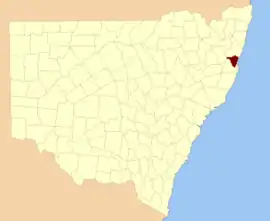
Location in New South Wales
Lands administrative divisions around Raleigh:
Fitzroy Fitzroy Pacific Ocean
Clarke Raleigh Pacific Ocean
Dudley Dudley Pacific Ocean

The origin of the name "Raleigh County" is unknown.[1]

Parishes within this county

A full list of parishes found within this county; their current LGA and mapping coordinates to the approximate centre of each location is as follows:

ParishLGACoordinates
AllgomeraNambucca Shire Council30°45′54″S 152°50′04″E
BelmoreBellingen Shire Council30°28′54″S 152°46′04″E
BonvilleCity of Coffs Harbour30°22′54″S 153°00′04″E
BowraNambucca Shire Council30°40′54″S 152°52′04″E
Buckra BendinniNambucca Shire Council30°36′54″S 152°46′04″E
CongarinniNambucca Shire Council30°43′54″S 152°54′04″E
DenisonNambucca Shire Council30°46′54″S 152°44′04″E
DingleBellingen Shire Council30°24′54″S 152°35′04″E
DudleyBellingen Shire Council30°29′54″S 152°41′04″E
GladstoneBellingen Shire Council30°29′54″S 152°50′04″E
HerbornNambucca Shire Council30°38′54″S 152°38′04″E
IngalbaNambucca Shire Council30°49′54″S 152°43′04″E
KetelghayNambucca Shire Council30°39′31″S 152°44′56″E
MedlowNambucca Shire Council30°45′54″S 152°39′04″E
MerrylegaiNambucca Shire Council30°33′54″S 152°41′04″E
MissabottiNambucca Shire Council30°34′54″S 152°50′04″E
NambuccaNambucca Shire Council30°38′54″S 152°56′04″E
Never NeverBellingen Shire Council30°21′54″S 152°50′04″E
NewryBellingen Shire Council30°29′54″S 153°00′04″E
North BellingenBellingen Shire Council30°24′54″S 152°57′04″E
North CreekNambucca Shire Council30°37′24″S 152°35′04″E
OakesBellingen Shire Council30°29′54″S 152°34′04″E
RaleighNambucca Shire Council30°32′54″S 152°31′04″E
South BellingenBellingen Shire Council30°29′54″S 152°57′04″E
TimboonBellingen Shire Council30°21′54″S 152°56′04″E
UnkyaNambucca Shire Council30°51′54″S 152°50′04″E
Valley ValleyNambucca Shire Council30°35′54″S 152°58′04″E
VautinBellingen Shire Council30°23′54″S 152°43′04″E
WarrellNambucca Shire Council30°47′54″S 152°56′04″E
WaverleyBellingen Shire Council30°27′54″S 152°28′04″E
YarranbellaNambucca Shire Council30°44′54″S 152°43′04″E

References

  1. "Raleigh". Geographical Names Register (GNR) of NSW. Geographical Names Board of New South Wales. Retrieved 4 August 2013.
This article is issued from Wikipedia. The text is licensed under Creative Commons - Attribution - Sharealike. Additional terms may apply for the media files.