Ramannapeta
Ramannapeta is a village in Yadadri Bhuvanagiri district of the Indian state of Telangana. It is located in Ramannapeta mandal of Bhongir division.[2][1]
Ramannapeta
రామన్నపేట | |
|---|---|
 Ramannapeta Location in Telangana, India  Ramannapeta Ramannapeta (India) | |
| Coordinates: 17.2833°N 79.0859°E | |
| Country | India |
| State | Telangana |
| District | Bhuvanagiri |
| Area | |
| • Total | 9.02 km2 (3.48 sq mi) |
| Elevation | 304 m (997 ft) |
| Population (2011)[1] | |
| • Total | 10,202 |
| • Density | 1,100/km2 (2,900/sq mi) |
| Languages | |
| • Official | Telugu |
| Time zone | UTC+5:30 (IST) |
| Vehicle registration | TS 30 |
| Website | telangana |
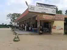
Ramannapet bustand
Geography
Ramanapeta is located at 17.2833°N 79.2859°E.[3] It has an average elevation of 322 meters (1073 ft).
References
- "District Census Handbook - Nalgonda" (PDF). Census of India. p. 13,260. Retrieved 8 February 2016.
- "District Level Mandal wise List of Villages in Andhra Pradesh" (PDF). Chief Commissioner of Land Administration. National Informatics Centre. p. 7. Archived from the original (PDF) on 14 December 2014. Retrieved 19 September 2015.
- Ramanapeta at Fallingrain.com
This article is issued from Wikipedia. The text is licensed under Creative Commons - Attribution - Sharealike. Additional terms may apply for the media files.
