Ranch to Market Road 1837
Ranch to Market Road 1837 (RM 1837) is a road maintained by the Texas Department of Transportation (TxDOT) connecting the Girl Scouts of the USA's Camp Mitre Peak to State highway 118 14.2 miles south of Fort Davis.[2] The road is part of the state's Farm and Ranch to Market Road System. RM 1837 is located entirely within Jeff Davis County.
| ||||
|---|---|---|---|---|

| ||||
| Route information | ||||
| Maintained by TxDOT | ||||
| Length | 3.383 mi[1] (5.444 km) | |||
| Existed | 1953–present | |||
| History | Formerly a route in Kaufman County | |||
| Major junctions | ||||
| West end | Camp Mitre Peak | |||
| East end | ||||
| Location | ||||
| Counties | Jeff Davis | |||
| Highway system | ||||
| ||||

Route description
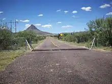
There are no cities or towns along RM 1837, and no intersections with any other public roads west of its terminus at SH 118. The road has narrow lanes and unpaved, grassy shoulders. The road relies on low-water crossings rather than bridges to cross streams leaving the roadway subject to flooding after heavy rainfall. The speed limit on RM 1837 is 70 miles per hour (113 km/h) daytime and 65 miles per hour (105 km/h) at night.
Much of the right-of-way is not fenced despite all of the ranch land along it being in private holdings. The road crosses over cattle guards between pastures, and loose livestock pose a hazard for motorists.
History
Kaufman County

On November 20, 1951, Farm to Market Road 1837 (FM 1837) was originally designated as a 4.8-mile (7.7 km) road in Kaufman County. The original route extended southeastward 4.8 miles from U.S. Route 80 1.0 mile (1.6 km) east of Terrell. That designation was canceled on January 29, 1953 when the original road was added as an extension to FM 429.[1]
Jeff Davis County
On March 26, 1953, the route number was assigned to the present route in Jeff Davis County, and was to be cancelled and relinquished back to county administration upon completion. Because the route was completed by September 20, 1954, the route was cancelled and relinquished back to county administration that day. On September 20, 1955, the state again assumed control over the road's maintenance, and the road was again designated as FM 1837. The road was given its current ranch to market designation on October 1, 1959.[1]
Major intersections
The entire route is in Jeff Davis County.
| Location | mi[1] | km | Destinations | Notes | |
|---|---|---|---|---|---|
| | 0.000 | 0.000 | Camp Mitre Peak entrance | ||
| | 3.383 | 5.444 | |||
| 1.000 mi = 1.609 km; 1.000 km = 0.621 mi | |||||
References
- Transportation Planning and Programming Division (n.d.). "Ranch to Market Road No. 1837". Highway Designation Files. Texas Department of Transportation. Retrieved 2009-12-07.
- Google (2009-12-06). "SH 118 between junction of RM 1837 and Fort Davis" (Map). Google Maps. Google. Retrieved 2009-12-06.
External links
![]() Geographic data related to Ranch to Market Road 1837 at OpenStreetMap
Geographic data related to Ranch to Market Road 1837 at OpenStreetMap