Rawls Springs, Mississippi
Rawls Springs is an unincorporated community and census-designated place (CDP) located in Forrest County, Mississippi, United States. As of the 2010 census it had a population of 1,254.[2] Rawls Springs is approximately 6.5 miles (10.5 km) northwest of Hattiesburg near U.S. Route 49 and a part of the Hattiesburg, Mississippi Metropolitan Statistical Area.
Rawls Springs, Mississippi | |
|---|---|
 Rawls Springs | |
| Coordinates: 31°22′51″N 89°22′17″W | |
| Country | United States |
| State | Mississippi |
| County | Forrest |
| Area | |
| • Total | 1.84 sq mi (4.76 km2) |
| • Land | 1.83 sq mi (4.73 km2) |
| • Water | 0.01 sq mi (0.03 km2) |
| Elevation | 174 ft (53 m) |
| Population (2010) | |
| • Total | 1,254 |
| • Density | 687/sq mi (265.2/km2) |
| Time zone | UTC-6 (Central (CST)) |
| • Summer (DST) | UTC-5 (CDT) |
| ZIP code | 39402 |
| Area code(s) | 601 |
| GNIS feature ID | 676496[1] |
Rawls Springs is located on the former Illinois Central Gulf Railroad.[3]
A post office operated under the name Rawles Springs from 1905 to 1927.[4]
Notable person
- Mercy Baby, blues musician[5]
References
- U.S. Geological Survey Geographic Names Information System: Rawls Springs, Mississippi
- "Geographic Identifiers: 2010 Census Summary File 1 (G001), Rawls Springs CDP, Mississippi". American FactFinder. U.S. Census Bureau. Archived from the original on February 13, 2020. Retrieved June 2, 2016.
- Howe, Tony. "Rawls Springs, Mississippi". Mississippi Rails. Retrieved 14 October 2020.
- "Forrest County". Jim Forte Postal History. Retrieved 14 October 2020.
- Bob L. Eagle; Eric S. LeBlanc (1 May 2013). Blues: A Regional Experience. ABC-CLIO. p. 118. ISBN 978-0-313-34424-4.
Municipalities and communities of Forrest County, Mississippi, United States | ||
|---|---|---|
| Cities | 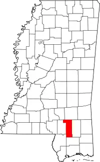 Map of Mississippi highlighting Forrest County | |
| CDPs | ||
| Other unincorporated communities | ||
| Ghost towns | ||
| Footnotes | ‡This populated place also has portions in an adjacent county or counties | |
| ||
This article is issued from Wikipedia. The text is licensed under Creative Commons - Attribution - Sharealike. Additional terms may apply for the media files.