Rdeči Kal, Trebnje
Rdeči Kal (pronounced [əɾˈdeːtʃi ˈkaːu̯]) is a settlement in the hills to the southeast of Dobrnič in the Municipality of Trebnje in eastern Slovenia. It lies below the northern slope of Sharp Peak (Slovene: Ostri vrh, 523 m). The area is part of the historical region of Lower Carniola. The municipality is now included in the Southeast Slovenia Statistical Region.[2]
Rdeči Kal | |
|---|---|
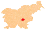
 Rdeči Kal Location in Slovenia | |
| Coordinates: 45°51′54.1″N 15°0′50.5″E | |
| Country | |
| Traditional region | Lower Carniola |
| Statistical region | Southeast Slovenia |
| Municipality | Trebnje |
| Area | |
| • Total | 6.31 km2 (2.44 sq mi) |
| Elevation | 296.2 m (971.8 ft) |
| Population (2002) | |
| • Total | 90 |
| [1] | |
External links
This article is issued from Wikipedia. The text is licensed under Creative Commons - Attribution - Sharealike. Additional terms may apply for the media files.