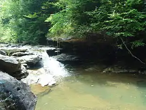
Red Bird River
The Red Bird River is a tributary of the South Fork Kentucky River, located in the Daniel Boone National Forest in extreme southeastern portion of the U.S. state of Kentucky.[1] It is 34.3 miles (55.2 km)[2] long and drains an area of 195.7 square miles (507 km2).[3]
The Red Bird River at the community of Big Creek has a mean annual discharge of approximately 274 cubic feet per second.[4]
Red Bird was the name of a Native American who was murdered near the river.[5]
Course
It rises as Red Bird Creek in northeastern Bell County, then becomes the Red Bird River at the confluence of the Phillips Fork just south of Queendale in Clay County. Continuing north, it forms the boundary between Clay and Leslie counties, eventually coming to a confluence with Goose Creek at Oneida to form the South Fork of the Kentucky River.
References
- U.S. Geological Survey Geographic Names Information System: Red Bird River
- U.S. Geological Survey. National Hydrography Dataset high-resolution flowline data. The National Map, accessed June 13, 2011
- U.S. Geological Survey. National Hydrography Dataset, area data covering Red Bird River watershed, 10-digit Hydrologic Unit Code 0510020302. The National Map, retrieved 2015-10-27
- https://waterdata.usgs.gov/ky/nwis/annual/?format=sites_selection_links&search_site_no=03281040&agency_cd=USGS&referred_module=sw
- Collins, Lewis (1877). History of Kentucky. p. 141.
External links
- University of Kentucky: Kentucky River Basin Report
- Daniel Boone National Forest: Red Bird Ranger District
- USGS GNIS Entry