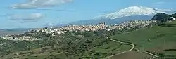
Regalbuto
Regalbuto (Latin: Ameselum; Sicilian: Regarbutu) is a comune in the province of Enna, Sicily, southern Italy.
Regalbuto | |
|---|---|
| Comune di Regalbuto | |
 | |
Location of Regalbuto 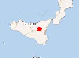
| |
 Regalbuto Location of Regalbuto in Italy 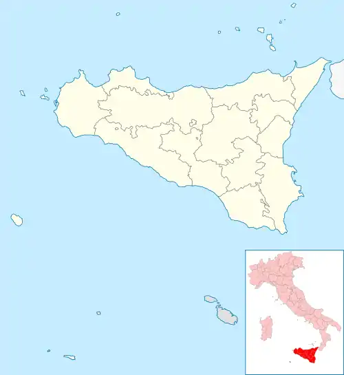 Regalbuto Regalbuto (Sicily) | |
| Coordinates: 37°38′58.53″N 14°38′22.55″E | |
| Country | Italy |
| Region | Sicily |
| Province | Enna (EN) |
| Government | |
| • Mayor | Francesco Bivona |
| Area | |
| • Total | 17,029 km2 (6,575 sq mi) |
| Elevation | 520 m (1,710 ft) |
| Population (30 November 2017)[2] | |
| • Total | 7,196[3] |
| Demonym(s) | Regalbutesi |
| Time zone | UTC+1 (CET) |
| • Summer (DST) | UTC+2 (CEST) |
| Postal code | 94017 |
| Dialing code | 0935 |
| Patron saint | Saint Vitus the martyr |
| Saint day | 11 August |
| Website | Official website |
There is an annual cattle fair held in the month of August.
History
Regalbuto may very well be the ancient town of Amaselos, which was named by the Greek and Sicilian historian Diodorus Siculus in his Bibliotheca historica (Historical Library) writings.
The name Regalbuto derives from the Arab term Rahal Abbud, "Abbud's farmhouse". Discoveries at the site include the old Saracen quarter.
Around AD 1200, the inhabitants of the nearby town of Centirupe, who rebelled against the Swabian dynasty whom Regalbuto had been faithful to, destroyed Regalbuto. Years later, King Manfred had the town rebuilt at its present site.
In AD 1860, a number of members of parliament met in Regalbuto with Garibaldi to discuss a truce during the Campaign of 1860.
The town was never subject to fiscal taxes, and a free magistracy elected by the king and the archbishops of Messina governed it. The town was severely damaged during World War II, and on August 3, 1943 the Pionier Battalion of Hermann Göring Panzer Division, supported by tanks and self-propelled guns was forced to cede the town, after four days of bitter fighting by the 1st Infantry Brigade of 1st Canadian Infantry Division. The current inhabited center was reconstructed only recently.
Main sights
- Chiesa Madre (Mother Church) dedicated to San Basilio, which was built on the site of a 16th-century building and preserving a luxurious 10 meter altar dedicated to San Vito. It has a Baroque façade with a pyramid shaped bell tower.
- The 15th-century Church of Santa Maria della Croce with a Baroque staircase
- Church of San Giovanni (18th-century), with a large bell loggia
- Town hall (Palazzo Municipale, 18th century)
- Remains of the 13th-century castle:
- Palazzo Citelli-Fascaro (17th century)
- Palazzo Falcone (17th century)
- Palazzo Campagnini, in Liberty Style
- Palazzo Carchiolo
In the city environs are sites of naturalistic interest like the Pozzillo Lake district, one of Europe's largest man-made lakes, fed by the Salso River. Mountains include the Monte Mascari (863 metres (2,831 ft)), north of the lake, and, also in the lake vicinity, the Monte Salici (1,442 metres (4,731 ft)).
Economy
The economy is based on agriculture, including cereals, agrumes and olives. Animal husbandry includes cattle, sheep and goats.
References
- "Superficie di Comuni Province e Regioni italiane al 9 ottobre 2011". Istat. Retrieved 16 March 2019.
- "Popolazione Residente al 1° Gennaio 2018". Istat. Retrieved 16 March 2019.
- All demographics and other statistics: Italian statistical institute Istat.
| Authority control |
|
|---|
