Rehlingen-Siersburg
Rehlingen-Siersburg is a municipality in the district of Saarlouis, in Saarland, Germany. It is situated on the river Saar, approx. 8 km northwest of Saarlouis, and 30 km northwest of Saarbrücken.
Rehlingen-Siersburg | |
|---|---|
 Coat of arms | |
Location of Rehlingen-Siersburg within Saarlouis district 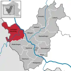 | |
 Rehlingen-Siersburg 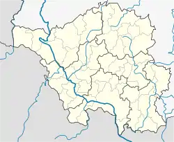 Rehlingen-Siersburg | |
| Coordinates: 49°22′7″N 6°40′43″E | |
| Country | Germany |
| State | Saarland |
| District | Saarlouis |
| Subdivisions | 10 |
| Government | |
| • Mayor | Ralf Collmann (no party) |
| Area | |
| • Total | 61.16 km2 (23.61 sq mi) |
| Elevation | 193 m (633 ft) |
| Population (2019-12-31)[1] | |
| • Total | 14,349 |
| • Density | 230/km2 (610/sq mi) |
| Time zone | UTC+01:00 (CET) |
| • Summer (DST) | UTC+02:00 (CEST) |
| Postal codes | 66780 |
| Dialling codes | 06835, 06869, 06833, 06861 |
| Vehicle registration | SLS |
| Website | www.rehlingen-siersburg.de |
Geography
Location
Rehlingen is located at the Saar, Siersburg is located at the Nied, the other districts are partly on the Gau (Saargau), partly in the valley of the Nied, a left-side tributary of the Saar. Rehlingen-Siersburg borders France to the west, Merzig-Wadern district to the north, Dillingen / Saar to the east, and Wallerfangen to the south.
Municipal districts
- Biringen
- Eimersdorf
- Fremersdorf
- Fürweiler
- Gerlfangen
- Hemmersdorf
- Niedaltdorf
- Oberesch
- Rehlingen Siersburg
Sights
- Castle Fremersdorf
- Castle Siersburg
- Niedaltdorf stalactite cave
- Lorraine houses and castles in different districts
- Niedtal
- Saargau
- Druids path
| Wikimedia Commons has media related to Rehlingen-Siersburg. |
Towns and municipalities in Saarlouis (district) | ||
|---|---|---|
References
- "Saarland.de – Amtliche Einwohnerzahlen Stand 31. Dezember 2019" (PDF). Statistisches Amt des Saarlandes (in German). July 2020.
| Authority control |
|---|
This article is issued from Wikipedia. The text is licensed under Creative Commons - Attribution - Sharealike. Additional terms may apply for the media files.
