Rejcov Grič
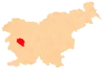
Rejcov Grič (pronounced [ˈɾeːi̯tsɔu̯ ˈɡɾiːtʃ]) is an isolated settlement in the hills west of Idrija in the traditional Inner Carniola region of Slovenia.[2] It includes the hamlets and isolated farms of Rejc, Rupa, and Lebanovše.
Rejcov Grič | |
|---|---|
 Rejcov Grič Location in Slovenia | |
| Coordinates: 46°0′5.43″N 13°59′1.78″E | |
| Country | |
| Traditional region | Inner Carniola |
| Statistical region | Gorizia |
| Municipality | Idrija |
| Area | |
| • Total | 1.1 km2 (0.4 sq mi) |
| Elevation | 854 m (2,802 ft) |
| Population (2014) | |
| • Total | 15 |
| [1] | |
Name
The name Rejcov Grič literally means 'Rejc's hill' and refers to Rejc Hill (Slovene: Rejčev Grič, 877 meters or 2,877 feet), which rises northwest of the hamlet of Rejc. The newly founded settlement was initially officially named Rejcov grič (with a small g) in Slovene.[4] However, this was declared an orthographic error a month later, and the official Slovene spelling was changed to Rejcov Grič (with a big G).[5]
Cultural heritage
A Second World War monument stands in the eastern part of the settlement, in the hamlet of Lebanovše. It was installed in 1969 and consists of a granite plaque mounted on a stone base topped by a stylized representation of Mount Triglav.[6]
References
- Statistical Office of the Republic of Slovenia
- Leksikon občin kraljestev in dežel zastopanih v državnem zboru, vol. 6: Kranjsko. Vienna: C. Kr. Dvorna in Državna Tiskarna. 1906. p. 124.
- Statistical Office of the Republic of Slovenia: Rejcov Grič.
- Odlok o spremembi območja naselja Čekovnik in ustanovitvi naselja Rejcov grič. Uradni list Republike Slovenije (17/2006) (9 February 2006).
- Odlok o spremembah Odloka o spremembi območja naselja Čekovnik in ustanovitvi naselja Rejcov grič. Uradni list Republike Slovenije (33/2006) (23 March 2006).
- Slovenian Ministry of Culture register of national heritage reference number ešd 19483

