Reubens, Idaho
Reubens is a city in Lewis County, Idaho, United States, on the Camas Prairie. The population was 71 at the 2010 census, and 72 in 2000.[5]
Reubens, Idaho | |
|---|---|
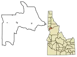 Location of Reubens in Lewis County, Idaho. | |
| Coordinates: 46°19′25″N 116°32′31″W | |
| Country | United States |
| State | Idaho |
| County | Lewis |
| Area | |
| • Total | 0.17 sq mi (0.44 km2) |
| • Land | 0.17 sq mi (0.44 km2) |
| • Water | 0.00 sq mi (0.00 km2) |
| Elevation | 3,527 ft (1,075 m) |
| Population | |
| • Total | 71 |
| • Estimate (2019)[3] | 64 |
| • Density | 378.70/sq mi (146.07/km2) |
| Time zone | UTC-8 (Pacific (PST)) |
| • Summer (DST) | UTC-7 (PDT) |
| ZIP code | 83548 |
| Area code(s) | 208 |
| FIPS code | 16-67150 |
| GNIS feature ID | 0398464 |
| Historical population | |||
|---|---|---|---|
| Census | Pop. | %± | |
| 1920 | 176 | — | |
| 1930 | 191 | 8.5% | |
| 1940 | 119 | −37.7% | |
| 1950 | 116 | −2.5% | |
| 1960 | 113 | −2.6% | |
| 1970 | 81 | −28.3% | |
| 1980 | 87 | 7.4% | |
| 1990 | 46 | −47.1% | |
| 2000 | 72 | 56.5% | |
| 2010 | 71 | −1.4% | |
| 2019 (est.) | 64 | [3] | −9.9% |
| U.S. Decennial Census[4] | |||
Geography
Reubens is located at 46°19′25″N 116°32′31″W,[6] at an elevation of 3,527 feet (1,075 m) above sea level.
According to the United States Census Bureau, the city has a total area of 0.29 square miles (0.75 km2), all of it land.[7]
Demographics
2010 census
As of the census[2] of 2010, there were 71 people, 29 households, and 20 families residing in the city. The population density was 244.8 inhabitants per square mile (94.5/km2). There were 32 housing units at an average density of 110.3 per square mile (42.6/km2). The racial makeup of the city was 97.2% White, 1.4% Native American, and 1.4% from two or more races.
There were 29 households, of which 41.4% had children under the age of 18 living with them, 58.6% were married couples living together, 10.3% had a female householder with no husband present, and 31.0% were non-families. 27.6% of all households were made up of individuals, and 3.4% had someone living alone who was 65 years of age or older. The average household size was 2.45 and the average family size was 2.95.
The median age in the city was 39.8 years. 28.2% of residents were under the age of 18; 4.2% were between the ages of 18 and 24; 26.9% were from 25 to 44; 33.7% were from 45 to 64; and 7% were 65 years of age or older. The gender makeup of the city was 46.5% male and 53.5% female.
2000 census
As of the census[8] of 2000, there were 72 people, 28 households, and 18 families residing in the city. The population density was 248.1 people per square mile (95.9/km2). There were 31 housing units at an average density of 106.8 per square mile (41.3/km2). The racial makeup of the city was 97.22% White, 1.39% from other races, and 1.39% from two or more races.
There were 28 households, out of which 39.3% had children under the age of 18 living with them, 57.1% were married couples living together, 3.6% had a female householder with no husband present, and 35.7% were non-families. 32.1% of all households were made up of individuals, and 7.1% had someone living alone who was 65 years of age or older. The average household size was 2.57 and the average family size was 3.33.
In the city, the population was spread out, with 33.3% under the age of 18, 29.2% from 25 to 44, 23.6% from 45 to 64, and 13.9% who were 65 years of age or older. The median age was 38 years. For every 100 females, there were 111.8 males. For every 100 females age 18 and over, there were 100.0 males.
The median income for a household in the city was $29,375, and the median income for a family was $35,417. Males had a median income of $33,750 versus $21,250 for females. The per capita income for the city was $11,078. There were 13.3% of families and 20.5% of the population living below the poverty line, including 21.2% of under eighteens and 27.3% of those over 64.
Government
The city's annual budget is approximately $23,000. The City Hall has no telephone, computer or other office equipment. Except for the City Council Meetings and elections, the city business is conducted from the home of the city clerk.
References
- "2019 U.S. Gazetteer Files". United States Census Bureau. Retrieved July 9, 2020.
- "U.S. Census website". United States Census Bureau. Retrieved 2012-12-18.
- "Population and Housing Unit Estimates". United States Census Bureau. May 24, 2020. Retrieved May 27, 2020.
- "Census of Population and Housing". Census.gov. Retrieved June 4, 2015.
- Spokesman-Review - 2010 census - Reubens, Idaho - accessed 2011-12-26
- "US Gazetteer files: 2010, 2000, and 1990". United States Census Bureau. 2011-02-12. Retrieved 2011-04-23.
- "US Gazetteer files 2010". United States Census Bureau. Archived from the original on 2012-07-02. Retrieved 2012-12-18.
- "U.S. Census website". United States Census Bureau. Retrieved 2008-01-31.
External links
- Chamber of Commerce - greater Craigmont area
Municipalities and communities of Lewis County, Idaho, United States | ||
|---|---|---|
| Cities | Map of Idaho highlighting Lewis County | |
| Unincorporated community | ||
| Indian reservation | ||
| Footnotes | ‡This populated place also has portions in an adjacent county or counties | |
| ||
| Authority control |
|
|---|
