Rheinsteig
The Rheinsteig is a hiking trail following a mainly elevated path along the east bank of the Rhine River in Germany. Its 320 kilometres (200 mi) route stretches from Bonn to Wiesbaden, running parallel to the Rheinhöhenweg Trail and Rheinburgenweg Trail.
| Rheinsteig | |
|---|---|
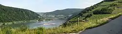 View of the river Rhine | |
| Length | 320 km (199 mi) |
| Location | Rhineland-Palatinate/Hesse/North Rhine-Westphalia, Germany |
| Trailheads | Bonn,[coord 1] Wiesbaden[coord 2] |
| Use | Hiking |
| Elevation | |
| Elevation change | 9,500 m (31,200 ft) |
| Highest point | Lykershausen, 351 m (1,152 ft) |
| Lowest point | Kennedy Bridge, Bonn, 60 m (200 ft) |
| Hiking details | |
| Trail difficulty | Easy |
| Season | All year |
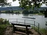
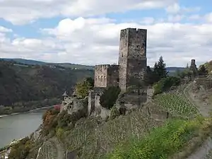
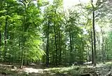
| Sights | Numerous castles along the Rhine Gorge and Siebengebirge. Vineyards of Rheingau. Woodland in Naturpark Rhein-Taunus. |
| Hazards | Cyclists |
| Website | www.rheinsteig.de |
Description
Rheinsteig trail marker
The Rheinsteig passes through woodlands and vineyards, and has challenging ascents and descents. It is signposted by signs with an 'R' on a blue background. The Rheinsteig allows either longer-distance hiking or a number of short tours.
Route and sights of interest
- Wiesbaden-Biebrich, Schloss Biebrich,[coord 3] Wiesbaden-Schierstein, Goethestein, Burg Frauenstein,[coord 4] Wiesbaden-Frauenstein
- Schlangenbad,[coord 5] Burg Scharfenstein, Kiedrich,
- Eberbach Abbey (Kloster Eberbach),[coord 6] Steinberg, Schloss Vollrads
- Johannisberg (Geisenheim), Schloss Johannisberg,
- Marienthal Monastery, Eibingen Abbey,
- Rüdesheim am Rhein, Niederwalddenkmal,[coord 7] Assmannshausen
- Lorch, Ruine Nollig, Burg Gutenfels[coord 8]
- Kaub, Dörscheid, Lorelei
- Sankt Goarshausen, Nochern, Burg Maus
- Kestert, Lykershausen, Burg Liebenstein, Burg Sterrenberg,[coord 9] Filsen
- Osterspai,[coord 10] Marksburg
- Braubach
- Lahnstein, Oberlahnstein, Niederlahnstein, Lahneck Castle[coord 11]
- Koblenz-Ehrenbreitstein, Ehrenbreitstein Fortress[coord 12]
- Vallendar
- Sayn (part of Bendorf)
- Rengsdorf
- Leutesdorf
- Rheinbrohl
- Leubsdorf, Linz am Rhein
- Unkel[coord 13]
- Bad Honnef, Drachenfels
- Königswinter
- Niederdollendorf
- Kennedy Bridge,[coord 14] Bonn
Literature and maps
Opened on September 8, 2005, hikers can find maps and books giving information about where to join and leave the track, should hikers want to do just a short section.
| Coordinate list |
|---|
|
Gallery
- Rheinsteig

 Arenfels castle
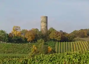
 Honigberg near Kiedrich
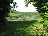 Eberbach Abbey
 The Rheinsteig in winter, Roßstein between Kaub and St. Goarshausen, view of Oberwesel
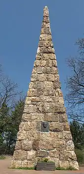 Goethestein, Wiesbaden-Frauenstein
References
External links
| Wikimedia Commons has media related to Rheinsteig. |
| Wikivoyage has a travel guide for Rheinsteig. |
This article is issued from Wikipedia. The text is licensed under Creative Commons - Attribution - Sharealike. Additional terms may apply for the media files.