Richburg, South Carolina
Richburg is a town in Chester County, South Carolina, United States. The population was 275 at the 2010 census,[6] down from 332 at the 2000 census.
Richburg, South Carolina | |
|---|---|
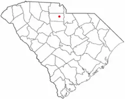 Location of Richburg, South Carolina | |
| Coordinates: 34°43′3″N 81°1′11″W | |
| Country | United States |
| State | South Carolina |
| County | Chester |
| Government | |
| • Mayor | James Harris[1] |
| Area | |
| • Total | 0.88 sq mi (2.27 km2) |
| • Land | 0.88 sq mi (2.27 km2) |
| • Water | 0.00 sq mi (0.00 km2) |
| Elevation | 584 ft (178 m) |
| Population (2010) | |
| • Total | 275 |
| • Estimate (2019)[3] | 260 |
| • Density | 296.80/sq mi (114.56/km2) |
| Time zone | UTC-5 (Eastern (EST)) |
| • Summer (DST) | UTC-4 (ES) |
| ZIP code | 29729 |
| Area code(s) | 803, 839 |
| FIPS code | 45-59920[4] |
| GNIS feature ID | 1250370[5] |
| Website | www |
History
The Elliott House and Landsford Plantation House are listed on the National Register of Historic Places.[7]
Geography
Richburg is located in east-central Chester County at 34°43′3″N 81°1′11″W (34.717374, -81.019635).[8] Interstate 77 passes just west of the town, with access from Exits 62 and 65. I-77 leads north 40 miles (64 km) to Charlotte and south 53 miles (85 km) to Columbia. South Carolina Highway 9 passes through the northeast side of the town, leading west 13 miles (21 km) to Chester, the county seat, and east 16 miles (26 km) to Lancaster.
According to the United States Census Bureau, Richburg has a total area of 0.89 square miles (2.3 km2), all of it land.[6]
Demographics
| Historical population | |||
|---|---|---|---|
| Census | Pop. | %± | |
| 1880 | 121 | — | |
| 1890 | 186 | 53.7% | |
| 1900 | 240 | 29.0% | |
| 1910 | 245 | 2.1% | |
| 1920 | 222 | −9.4% | |
| 1930 | 245 | 10.4% | |
| 1940 | 183 | −25.3% | |
| 1950 | 238 | 30.1% | |
| 1960 | 235 | −1.3% | |
| 1970 | 304 | 29.4% | |
| 1980 | 269 | −11.5% | |
| 1990 | 405 | 50.6% | |
| 2000 | 332 | −18.0% | |
| 2010 | 275 | −17.2% | |
| 2019 (est.) | 260 | [3] | −5.5% |
| U.S. Decennial Census[9] | |||
As of the census[4] of 2000, there were 332 people, 122 households, and 87 families residing in the town. The population density was 400.2 people per square mile (154.4/km2). There were 134 housing units at an average density of 161.5 per square mile (62.3/km2). The racial makeup of the town was 23.49% White, 74.70% African American, 1.20% Asian, and 0.60% from two or more races. Hispanic or Latino of any race were 1.20% of the population.
There were 122 households, out of which 31.1% had children under the age of 18 living with them, 38.5% were married couples living together, 27.0% had a female householder with no husband present, and 27.9% were non-families. 24.6% of all households were made up of individuals, and 15.6% had someone living alone who was 65 years of age or older. The average household size was 2.72 and the average family size was 3.26.
In the town, the population was spread out, with 24.7% under the age of 18, 7.8% from 18 to 24, 21.7% from 25 to 44, 29.5% from 45 to 64, and 16.3% who were 65 years of age or older. The median age was 40 years. For every 100 females, there were 77.5 males. For every 100 females age 18 and over, there were 71.2 males.
The median income for a household in the town was $31,875, and the median income for a family was $40,000. Males had a median income of $35,893 versus $18,295 for females. The per capita income for the town was $13,048. About 9.7% of families and 13.6% of the population were below the poverty line, including 22.5% of those under age 18 and 21.4% of those age 65 or over.
Education
Richburg has a public library, a branch of the Chester County Library System.[10]
Media
- WRBK, 90.3 FM, a noncommercial station that primarily features classic oldies
Notable residents
- Buck Baker, NASCAR driver
- Sheldon Brown, professional football player
- Marty Marion, baseball player (birthplace)
References
- Charles D. Perry (2008-10-06). "Some big shoes to fill". The Herald. Archived from the original on 2008-12-02. Retrieved 2008-10-21.
- "2019 U.S. Gazetteer Files". United States Census Bureau. Retrieved July 29, 2020.
- "Population and Housing Unit Estimates". United States Census Bureau. May 24, 2020. Retrieved May 27, 2020.
- "U.S. Census website". United States Census Bureau. Retrieved 2008-01-31.
- "US Board on Geographic Names". United States Geological Survey. 2007-10-25. Retrieved 2008-01-31.
- "Geographic Identifiers: 2010 Census Summary File 1 (G001): Richburg town, South Carolina". U.S. Census Bureau, American Factfinder. Archived from the original on February 13, 2020. Retrieved July 1, 2015.
- "National Register Information System". National Register of Historic Places. National Park Service. July 9, 2010.
- "US Gazetteer files: 2010, 2000, and 1990". United States Census Bureau. 2011-02-12. Retrieved 2011-04-23.
- "Census of Population and Housing". Census.gov. Retrieved June 4, 2015.
- "South Carolina libraries and archives". SCIWAY. Retrieved 7 June 2019.
External links
Municipalities and communities of Chester County, South Carolina, United States | ||
|---|---|---|
| City | 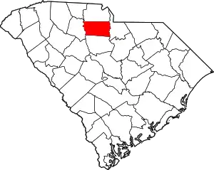 Map of South Carolina highlighting Chester County | |
| Towns | ||
| CDPs | ||
| Unincorporated communities | ||
| Ghost town | ||
| Footnotes | ‡This populated place also has portions in an adjacent county or counties | |
| ||