Riet River
The Riet River is a westward-flowing tributary of the Vaal River in central South Africa. In precolonial times the Riet was known as the Gama-!ab (or Gmaap), a !Kora name meaning 'muddy'. Its main tributary is the Modder River and after the confluence the Riet River flows westwards to meet the Vaal.[1]
| Riet Gmaap | |
|---|---|
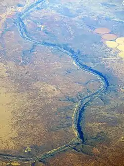 Aerial view of the river in 2018. | |
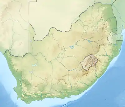 Location of the Riet River mouth | |
| Etymology | Native name Gama-!ab meaning 'muddy' in !Kora language |
| Native name | Gama-!ab |
| Location | |
| Country | South Africa |
| Region | Free State, Northern Cape |
| Physical characteristics | |
| Source | |
| • location | Near Smithfield |
| Mouth | Vaal River |
• location | Confluence |
• coordinates | 28°59′58″S 23°53′17″E |
• elevation | 1,001 m (3,284 ft) |
| Length | 300 km (190 mi) |
| Basin features | |
| Tributaries | |
| • right | Modder River |
The Riet flows about 300 km from the vicinity of the eastern Free State town of Smithfield and has a confluence with the Vaal River upstream from the Northern Cape town of Douglas.[2] It flows through the Kalkfontein Dam.
%252C_crop.jpg.webp)
The Riet River on a map of 1887. The lower Modder has since become the lower Riet.
References
- Upper Orange WMA 13
- Morris, D. 2002. Driekopseiland and 'the rain's magic power': landscape and history in a new interpretation of a Northern Cape rock engraving site. MA dissertation, Dept Anthropology and Sociology, University of the Western Cape
This article is issued from Wikipedia. The text is licensed under Creative Commons - Attribution - Sharealike. Additional terms may apply for the media files.
