Ringkøbing-Skjern Municipality
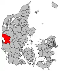
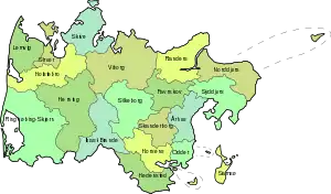
Ringkøbing-Skjern municipality is the largest municipality (Danish, kommune) in Denmark. It was formed on January 1, 2007 as part of the 2007 administrative reform from the former municipalities of Egvad, Holmsland, Ringkøbing, Skjern, and Videbæk. New figures concerning Regions and Municipalities of Denmark published by the Ministry of Economics, "Municipal Key Figures" (Danish: "De Kommunale Nøgletal" (www.noegletal.dk)), state that the new municipality from 2011 had an area of 1,494.56 square kilometres (577.05 sq mi), the largest municipality in Denmark by area. The total population was 57,148 (1 April 2014), according to Statistics Denmark (Danish:Danmarks Statistik) online statistics source: Statistikbanken.dk, "Befolkning og valg". Population density: 38 per square km. It is part of Region Midtjylland ("Region Central Jutland"), also known as the Central Denmark Region. The Mayor of the Municipality since 2018 is Hans Østergaard (Venstre).

The Church of Denmark has 46 parishes in the municipality.
Locations
| Ringkøbing | 9,900 |
| Skjern | 7,800 |
| Videbæk | 4,300 |
| Tarm | 4,000 |
| Hvide Sande | 2,900 |
| Spjald | 1,300 |
| Lem | 1,300 |
| Vorgod-Barde | 1,000 |
| Tim | 880 |
Politics
Municipal council
Ringkøbing-Skjern's municipal council consists of 29 members, elected every four years.
Below are the municipal councils elected since the Municipal Reform of 2007.
| Election | Party | Total seats |
Turnout | Elected mayor | |||||||||
|---|---|---|---|---|---|---|---|---|---|---|---|---|---|
| A | C | F | J | K | O | V | |||||||
| 2005 | 5 | 2 | 1 | 3 | 1 | 17 | 29 | 74.3% | Torben Nørregaard (V) | ||||
| 2009 | 5 | 1 | 3 | 2 | 2 | 16 | 70.3% | Iver Enevoldsen (V) | |||||
| 2013 | 6 | 3 | 1 | 3 | 2 | 14 | 76.0% | ||||||
| 2017 | 6 | 3 | 1 | 6 | 2 | 11 | 74.8% | Hans Østergaard (V) | |||||
| Data from Kmdvalg.dk 2005, 2009, 2013 and 2017 | |||||||||||||
See also
References
- Municipal statistics: NetBorger Kommunefakta, delivered from KMD aka Kommunedata (Municipal Data)
- Municipal mergers and neighbors: Eniro new municipalities map

