Riverside, Lincoln County, New Mexico
Riverside is an unincorporated community in Lincoln County, New Mexico, in the southwestern United States. It is located along the Rio Hondo that flows east out of the Sacramento Mountains, the Sierra Blanca and the Capitan Mountains of south-central New Mexico. It is on combined routes U.S. 380 and U.S. 70, between the town of Lincoln and Roswell.[2] The nearest community is Sunset about a mile upstream.[2]
Riverside, New Mexico | |
|---|---|
 Riverside  Riverside | |
| Coordinates: 33°19′58″N 105°03′37″W | |
| Country | United States |
| State | New Mexico |
| County | Lincoln |
| Elevation | 4,754 ft (1,449 m) |
| Time zone | UTC-7 (Mountain (MST)) |
| • Summer (DST) | UTC-6 (MDT) |
| ZIP codes | 88343 |
| GNIS feature ID | 898592 |
History
The settlement was established after World War I when W. O. Norman opened a filling station there, called "Big Hill Filling Station", and a car camp. In 1930 Norman sold his interest and the place was renamed "Riverside Camp", which was soon shortened to "Riverside".[3][4]
References
- "Riverside". Geographic Names Information System. United States Geological Survey., 13 November 1980
- Sunset Quadrangle, New Mexico – Lincoln County (Map) (provisional 1988 ed.). 1:24,000. 7.5 minutes series (topographic). United States Geological Survey. 1988.
- Julyan, Robert (1998). "Riverside (Lincoln County)". The Place Names of New Mexico (revised ed.). Albuquerque, New Mexico: University of New Mexico Press. p. 300. ISBN 0-8263-1689-1.
- "Summary of Hondo Valley Community Histories" (PDF). Archaeological and Cultural Education Consultants. Archived from the original on 29 June 2014.
Municipalities and communities of Lincoln County, New Mexico, United States | ||
|---|---|---|
| City | 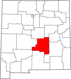 Map of New Mexico highlighting Lincoln County | |
| Town | ||
| Villages | ||
| CDP | ||
| Other unincorporated communities | ||
| Ghost town | ||
| ||
This article is issued from Wikipedia. The text is licensed under Creative Commons - Attribution - Sharealike. Additional terms may apply for the media files.