Romanoro
Romonoro is a small hamlet in the province of Modena in central Italy, administratively a frazione[4] of Frassinoro. It is about 700 metres (2,300 ft) above sea level.
Romanoro | |
|---|---|
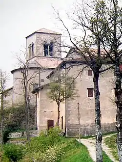 Romanoro church and its presbytery, dating back to the late 19th century. | |
 Romanoro Location of Romanoro in Italy | |
| Coordinates: 44°18′38″N 10°31′26″E | |
| Country | |
| Region | Emilia-Romagna |
| Province | Modena (MO) |
| Comune | Frassinoro |
| Area | |
| • Total | 14 km2 (5 sq mi) |
| Elevation | 700 m (2,300 ft) |
| Population (2001)[2] | |
| • Total | 54 |
| • Density | 3.9/km2 (10.0/sq mi) |
| Demonym(s) | Romanoresi |
| Time zone | UTC+1 (CET) |
| • Summer (DST) | UTC+2 (CEST) |
| Postal code | 41040 |
| Dialing code | 0536 |
| Patron saint | Scholastica, Benedict of Nursia[3] |
| Website | Official website |
Right below the town flows the Dolo mountain stream. A dam exists at the top of Fontanaluccia, that deviates part of the water about 16 km (9.9 mi) downward to the hydroelectric power plant located in the nearby Farneta.
History
Construction of a bridge over the Valoria landslide (44°19′22″N 10°32′11″E) had been planned since 2006. The bridge was completed in 2007.[5][6]
Images
 Romanoro - Cerreto
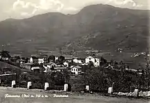 Romanoro - 1964 circa
See also
References
- Romanoro ed il Tartufo, Comune di Frassinoro. (The figure for elevation is stated to be an approximate. The figure for area is also an approximate, and probably does not correspond to the boundaries used by the source, dawinci.istat.it, in the 2001 census.)
- "Popolazione residente - Modena (dettaglio loc. abitate)". Istat. 2001. Retrieved 29 May 2018.
- Terre della Badia, Comune di Frassinoro.
- "Romanoro frazione's area" (in Italian).
- Bridge over the Valoria Landslide Archived 26 July 2011 at the Wayback Machine Province of Modena (italian)
- Bridge over the Valoria Landslide Local Newspaper article 29 September 2007 (italian)
| Wikimedia Commons has media related to Romanoro. |
This article is issued from Wikipedia. The text is licensed under Creative Commons - Attribution - Sharealike. Additional terms may apply for the media files.