Rose City, Michigan
Rose City is a city in Ogemaw County in the U.S. state of Michigan. The population was 653 at the 2010 census. Houghton Creek, a tributary of the Rifle River, runs through part of the city limits.
Rose City, Michigan | |
|---|---|
| City of Rose City | |
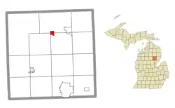 Location within Ogemaw County | |
 Rose City Location within the state of Michigan  Rose City Rose City (the United States) | |
| Coordinates: 44°25′16″N 84°06′55″W | |
| Country | United States |
| State | Michigan |
| County | Ogemaw |
| Settled | 1875 |
| Incorporated | 1910 |
| Government | |
| • Type | Mayor–council |
| • Mayor | Dave Reasner |
| • Clerk | Cindy Rosebrugh |
| Area | |
| • Total | 1.08 sq mi (2.81 km2) |
| • Land | 1.08 sq mi (2.79 km2) |
| • Water | 0.01 sq mi (0.02 km2) |
| Elevation | 958 ft (292 m) |
| Population | |
| • Total | 653 |
| • Estimate (2019)[3] | 632 |
| • Density | 586.82/sq mi (226.62/km2) |
| Time zone | UTC-5 (Eastern (EST)) |
| • Summer (DST) | UTC-4 (EDT) |
| ZIP code(s) | 48654 |
| Area code(s) | 989 |
| FIPS code | 26-69680[4] |
| GNIS feature ID | 636193[5] |
| Website | Official website |
The city is supported by some small businesses and manufacturing facilities (particularly plastics, machinery and auto parts production), but has survived over the years primarily as a result of tourism and the attraction of the many lakes and streams in the scenic surrounding area. The Rifle River State Recreation Area is less than three miles from the city limits.
History
Churchill was the original name of this lumbering town,[6] which was located 1⁄2 mile (0.8 km) from its present spot.[7] Hiram Hodge was the first resident of the community. He built a hotel, but later left. The Rose family, including Allan S. Rose, his father and two brothers, came from New York State in 1875. They built a general store with space for a post office.[7] A post office opened with the name Churchill on September 8, 1875.
On July 23, 1892, the settlement was moved 1⁄2 mile (0.8 km) east and the post office's name was changed to Rose City.[7][8]
Rose City was incorporated as a city in 1905. In 1910, the city was hit with a major fire that destroyed the business section with in an hour.[6] The Big Fire is memorialized by a Michigan Historical Marker, located on 410 N. Williams St. in Rose City[9]:
In the early morning hours of April 3, 1910, the booming lumber town of Rose City went up in flames as fire raged through the commercial district. Starting in D.W. Benjamin's grocery store on the south side of West Main Street, the fire quickly spread. Despite the efforts of a bucket brigade, the fire jumped across the street and swept down the north side. As most of the buildings were of frame construction, it took less than an hour for the entire business district to burn. The town lost over thirty buildings. Property losses attributed to the fire and looting totaled an estimated $175,000. Two concrete buildings on the Main Street, those that housed Bell's Store and Naylor's Store, were the only businesses to survive the fire.
Between 1950 and 2010, there have been a total 1,433 extreme weather events recorded within 50 miles of Rose City. There have been over 20 blizzards, 78 winter storms, 11 ice storms, 125 heavy snowfalls, 436 hail storms, 603 thunderstorms, 45 floods, and 4 wildfires.[10]
Geography
According to the United States Census Bureau, the city has a total area of 1.09 square miles (2.82 km2), of which 1.08 square miles (2.80 km2) is land and 0.01 square miles (0.03 km2) is water.[11]
Demographics
| Historical population | |||
|---|---|---|---|
| Census | Pop. | %± | |
| 1910 | 542 | — | |
| 1920 | 331 | −38.9% | |
| 1930 | 338 | 2.1% | |
| 1940 | 355 | 5.0% | |
| 1950 | 446 | 25.6% | |
| 1960 | 435 | −2.5% | |
| 1970 | 530 | 21.8% | |
| 1980 | 661 | 24.7% | |
| 1990 | 686 | 3.8% | |
| 2000 | 721 | 5.1% | |
| 2010 | 653 | −9.4% | |
| 2019 (est.) | 632 | [3] | −3.2% |
| U.S. Decennial Census[12] | |||
2010 census
At the 2010 census there were 653 people in 238 households, including 154 families, in the city. The population density was 604.6 inhabitants per square mile (233.4/km2). There were 288 housing units at an average density of 266.7 per square mile (103.0/km2). The racial makeup of the city was 96.9% White, 0.2% African American, 1.2% Native American, 0.3% Asian, 0.5% from other races, and 0.9% from two or more races. Hispanic or Latino of any race were 1.7%.[2]
Of the 238 households 35.7% had children under the age of 18 living with them, 36.1% were married couples living together, 21.4% had a female householder with no husband present, 7.1% had a male householder with no wife present, and 35.3% were non-families. 30.7% of households were one person and 14.3% were one person aged 65 or older. The average household size was 2.36 and the average family size was 2.87.
The median age was 44.6 years. 23.3% of residents were under the age of 18; 7.4% were between the ages of 18 and 24; 19.6% were from 25 to 44; 25% were from 45 to 64; and 24.8% were 65 or older. The gender makeup of the city was 48.4% male and 51.6% female.
2000 census
At the 2000 census there were 721 people in 241 households, including 155 families, in the city. The population density was 665.7 per square mile (257.8/km2). There were 283 housing units at an average density of 261.3 per square mile (101.2/km2). The racial makeup of the city was 96.26% White, 0.14% African American, 0.83% Native American, 0.97% from other races, and 1.80% from two or more races. Hispanic or Latino of any race were 1.39%.[4]
Of the 241 households 35.3% had children under the age of 18 living with them, 40.7% were married couples living together, 21.2% had a female householder with no husband present, and 35.3% were non-families. 30.7% of households were one person and 13.3% were one person aged 65 or older. The average household size was 2.51 and the average family size was 3.16.
The age distribution was 26.4% under the age of 18, 6.8% from 18 to 24, 23.3% from 25 to 44, 17.2% from 45 to 64, and 26.4% 65 or older. The median age was 39 years. For every 100 females, there were 82.1 males. For every 100 females age 18 and over, there were 75.2 males.
The median household income was $25,192 and the median family income was $31,042. Males had a median income of $24,861 versus $18,417 for females. The per capita income for the city was $10,684. About 18.3% of families and 24.7% of the population were below the poverty line, including 33.5% of those under age 18 and 3.1% of those age 65 or over.
Government
Rose City is governed by a mayor and a six-member city council.[13]
References
- "2019 U.S. Gazetteer Files". United States Census Bureau. Retrieved July 25, 2020.
- "U.S. Census website". United States Census Bureau. Retrieved 2012-11-25.
- "Population and Housing Unit Estimates". United States Census Bureau. May 24, 2020. Retrieved May 27, 2020.
- "U.S. Census website". United States Census Bureau. Retrieved 2008-01-31.
- U.S. Geological Survey Geographic Names Information System: Rose City, Michigan
- "The 18 tiniest cities in Michigan". Flint Journal. Mlive Media Group. December 4, 2016. p. 14. Retrieved December 5, 2016.
- Romig, Walter (October 1, 1986) [1973]. Michigan Place Names: The History of the Founding and the Naming of More Than Five Thousand Past and Present Michigan Communities (Paperback). Great Lakes Books Series. Detroit, Michigan: Wayne State University Press. p. 485. ISBN 081431838X. ISBN 978-0814318386.
- U.S. Geological Survey Geographic Names Information System: Rose City Post Office
- "Rose City / The Big Fire". The Michigan Historical Marker Web Site. Retrieved 7 February 2021.
- "Rose City, MI Natural Disasters and Weather Extremes". USA.com. World Media Group, LLC. Retrieved 7 February 2021.
- "US Gazetteer files 2010". United States Census Bureau. Archived from the original on 2012-01-25. Retrieved 2012-11-25.
- "Census of Population and Housing". Census.gov. Retrieved June 4, 2015.
- City Government - Rose City, Michigan at InfoMI.com
External links
Municipalities and communities of Ogemaw County, Michigan, United States | ||
|---|---|---|
| Cities | 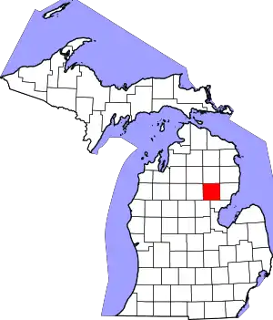 Map of Michigan highlighting Ogemaw County.svg | |
| Village | ||
| Civil townships | ||
| CDPs | ||
| ||