Rouvray-Saint-Denis
Rouvray-Saint-Denis is a commune in the Eure-et-Loir department in northern France.
Rouvray-Saint-Denis | |
|---|---|
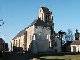 The church of Saint Denis | |
Location of Rouvray-Saint-Denis 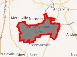
| |
 Rouvray-Saint-Denis  Rouvray-Saint-Denis | |
| Coordinates: 48°16′44″N 1°56′43″E | |
| Country | France |
| Region | Centre-Val de Loire |
| Department | Eure-et-Loir |
| Arrondissement | Chartres |
| Canton | Les Villages Vovéens |
| Government | |
| • Mayor (2020–2026) | Pascal Reau[1] |
| Area 1 | 19.35 km2 (7.47 sq mi) |
| Population (2017-01-01)[2] | 434 |
| • Density | 22/km2 (58/sq mi) |
| Time zone | UTC+01:00 (CET) |
| • Summer (DST) | UTC+02:00 (CEST) |
| INSEE/Postal code | 28319 /28310 |
| Elevation | 129–147 m (423–482 ft) (avg. 138 m or 453 ft) |
| 1 French Land Register data, which excludes lakes, ponds, glaciers > 1 km2 (0.386 sq mi or 247 acres) and river estuaries. | |
History
It has long been thought that it was the site of the Battle of the Herrings in 1429, when Sir John Fastolf beat off an attack on an English convoy taking supplies to the siege of Orléans; but in his biography of Fastolf, The Real Falstaff, Stephen Cooper argues that the battle is more likely to have taken place at Rouvray-Sainte-Croix.
Population
| Year | Pop. | ±% |
|---|---|---|
| 1962 | 385 | — |
| 1968 | 358 | −7.0% |
| 1975 | 308 | −14.0% |
| 1982 | 309 | +0.3% |
| 1990 | 326 | +5.5% |
| 1999 | 359 | +10.1% |
| 2008 | 435 | +21.2% |
References
- "Répertoire national des élus: les maires". data.gouv.fr, Plateforme ouverte des données publiques françaises (in French). 2 December 2020. Retrieved 7 December 2020.
- "Populations légales 2017". INSEE. Retrieved 6 January 2020.
| Wikimedia Commons has media related to Rouvray-Saint-Denis. |
| Authority control |
|---|
This article is issued from Wikipedia. The text is licensed under Creative Commons - Attribution - Sharealike. Additional terms may apply for the media files.