Ruamahanga River
The Ruamahanga River runs through the southeastern North Island of New Zealand.
| Ruamahanga River | |
|---|---|
.jpg.webp) | |
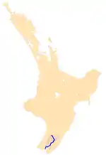 The Ruamahanga River system | |
| Location | |
| Country | New Zealand |
| Physical characteristics | |
| Source | |
| • location | Mount Dundas, Tararua Ranges |
| • elevation | 1,504 m (4,934 ft) |
| Mouth | |
• location | Palliser Bay, Cook Strait |
• elevation | 0 m (0 ft) |
| Length | 124 km (77 mi) |
| Basin size | 3,470 km2 (1,340 sq mi) |
| Basin features | |
| Tributaries | |
| • left | Tauweru River |
| • right | Waipoua River, Waingawa River, Waiohine River, Lake Wairarapa outlet |
The river's headwaters are in the Tararua Ranges northwest of Masterton. From there it runs firstly south and then southwest for 130 kilometres (81 mi) before emptying into the Cook Strait. The towns of Masterton and Martinborough are close to the banks of the river. It is joined by many other rivers, including the Tauweru River near Gladstone.[1]
In its lower reaches, the river meanders across a large floodplain, culminating in the wetlands around the edges of Lake Wairarapa. The river once flowed into the lake, but has now been diverted. The river drains at Palliser Bay 10 kilometres (6 mi) further south.
The river has now become generally polluted from sewage and farming that prevents people from swimming in the river or its tributaries.[2]
References
- Grant-Taylor, Thomas (1966). "RUAMAHANGA RIVER". Te Ara - 1966 Encyclopaedia of New Zealand. Retrieved 12 September 2018.
- Harris, Caleb (6 January 2016). "Some of Wairarapa's best swimming holes are now too dried up or polluted to swim in". The Dominion Post. Retrieved 28 June 2018.
