Saint Martin (island)
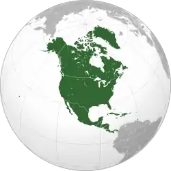
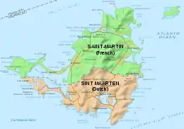
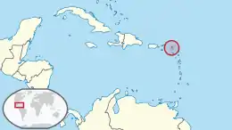
Saint Martin (French: Saint-Martin; Dutch: Sint Maarten) is an island in the northeast Caribbean Sea, approximately 300 km (190 mi) east of Puerto Rico. The 87-square-kilometre (34 sq mi) island is divided roughly 60:40 between the French Republic (53 km2, 20 sq mi)[1] and the Kingdom of the Netherlands (34 km2, 13 sq mi),[2] but the two parts are roughly equal in population. The division dates to 1648. The southern Dutch part comprises Sint Maarten and is one of four constituent countries that form the Kingdom of the Netherlands. The northern French part comprises the Collectivity of Saint Martin and is an overseas collectivity of the French Republic. As part of France, the French part of the island is also part of the European Union.[3] The island is also known for having an airport runway extremely close to the beach.
| Native name: Nickname: The Friendly Island | |
|---|---|
 | |
 | |
| Geography | |
| Location | Caribbean Sea |
| Coordinates | 18°04′N 63°03′W |
| Archipelago | Leeward Islands, Lesser Antilles, Antilles, West Indies |
| Area | 87 km2 (34 sq mi) |
| Highest elevation | 414 m (1358 ft) |
| Highest point | Pic Paradis |
| Administration | |
French Republic (France) | |
| Overseas collectivity | Saint Martin |
| Capital and largest settlement | Marigot (pop. 5,700) |
| Area covered | 53 km2 (20 sq mi; 60.9%) |
| Constituent country | Sint Maarten |
| Capital | Philipsburg |
| Largest settlement | Lower Prince's Quarter (pop. 8,123) |
| Area covered | 37 km2 (14 sq mi; 42.5%) |
| Demographics | |
| Demonym | St. Martinois (French); St. Maartener (Dutch) |
| Population | 77,741 (1 January 2009) |
| Pop. density | 892/km2 (2310/sq mi) |
| Ethnic groups | Afro-Caribbean, European, Chinese, East Indian, and mixed |
On 1 January 2009, the population of the whole island was 77,741 inhabitants, with 40,917 living on the Dutch side[4] and 36,824 on the French side.[5]
Collectively, the two territories are known as "Saint-Martin / Sint Maarten", or sometimes "SXM", the IATA identifier for Princess Juliana International Airport, the island's main airport. St. Martin (the French portion) received the ISO 3166-1 code MF in October 2007.[6] In 2010, the Dutch part had its status changed to that of a country within the Kingdom of the Netherlands and was given the code SX.[7]
Geography
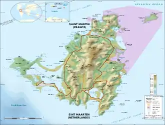
Saint Martin has a land area of 87 km2 (34 sq mi), 53 km2 (20 sq mi) which is under the sovereignty of the French Republic,[1] and 34 km2 (13 sq mi) under the sovereignty of the Kingdom of the Netherlands.[8] This is the only land border shared by the French Republic and the Kingdom of the Netherlands. There is no border between these countries in continental Europe.
The main cities are Philipsburg on the Dutch side and Marigot on the French side. The Dutch side is more heavily populated. The largest settlement on the entire island is Lower Prince's Quarter, which is on the Dutch side.
The highest hilltop is the Pic Paradis (424 metres (1,391 ft)) in the center of a hill chain on the French side. Both sides are hilly with large mountain peaks. This forms a valley where many houses are located. There are no rivers on the island, but there are many dry gullies. Hiking trails give access to the dry forest that covers tops and slopes.
The island is located south of Anguilla and is separated from that British overseas territory by the Anguilla Channel. Saint Martin is northwest of Saint Barthélemy and is separated from that French overseas collectivity by the Saint-Barthélemy Channel.
History
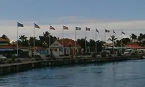
It is commonly believed that Christopher Columbus named the island in honor of Saint Martin of Tours when he encountered it on his second voyage of discovery. However, he actually applied the name to the island now called Nevis when he anchored offshore on November 11, 1493, the feast day of Saint Martin. The confusion of numerous poorly charted small islands in the Leeward Islands meant that this name was accidentally transferred to the island now known as Saint-Martin/Sint Maarten.[9][10]
At Columbus' time, St. Martin was populated, if at all, by Carib amerindians. The former Arawaks had been chased by the Caribs coming from the north coast of South America a short time before the arrival of the Spaniards who followed in Columbus' wake. The Arawaks were agricultural people who fashioned pottery and whose social organization was headed by hereditary chieftains who derived their power from personal deities called zemis. The Caribs' territory was not completely conquered until the mid-17th century when most of them perished in the struggle between the French, English (later British), Dutch, Danes and Spanish for control of the West Indies islands around the Caribbean Sea.
The Dutch first began to use the island's ponds for salt in the 1620s. Then still at war with the Dutch, the Spaniards captured St. Martin in 1633. One year later, they built a fort (now Fort Amsterdam, near Philipsburg) and another artillery battery at Pointe Blanche to assert their claim and control access to Great Bay salt pond. A massive influx of African slaves took place in the 18th century with the development of sugarcane plantations by the French and Dutch. Slavery was abolished in the first half of the 19th century. On some of their territories the British imported Chinese and South Asians to take the place of slaves. Thus, St. Martin and the other islands are populated by a mixture of Amerindian, European, African, Indian, and Asian peoples.
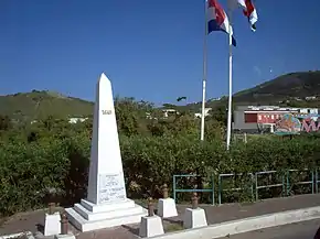
On 23 March 1648, the Kingdom of France and the Dutch Republic agreed to divide the island between their two territories, with the signing of the Treaty of Concordia. Folklore surrounds the history of the once ever-changing border division between St. Martin and Sint Maarten, and a popular story among locals narrates that "to divide the island into two sections, [in 1648] the inhabitants were told to choose two walkers, one chosen by the French-dominated community and the other one by the Dutch-dominated community, who were put back to back in one extreme of the island, making them walk in opposite directions while stuck to the littoral line, and not allowing them to run. The point where they eventually met was set as the other extreme of the island, and the subsequently created line was chosen as the frontier, dividing Saint-Martin from Sint Maarten. Seemingly, the French walker had walked more than his Dutch counterpart (they earned their respective lands 54 km² and 32 km²). The French locals' explanation for this discrepancy is that, as the first man chose wine as his stimulant prior to the race, while the latter chose Jenever (Dutch Gin), the difference between such beverages' lightness was said to be the cause of the territorial differences. The Dutch locals instead accuse the French walker of running."[11][12]
Climate
Under the Köppen climate classification, the island has a tropical savanna climate (Aw)[13] with a dry season from January to April and a rainy season from August to December.[14] The precipitation patterns are due to the movement of the Azores high during the year.[14] With the wind direction predominantly from the east or the northeast, northeasterly trades, temperatures remain stable throughout the year and temperatures rarely exceed 34 °C (93 °F) or fall below 20 °C (68 °F).[14] Temperatures remain steady throughout the year with an average mean temperature of 27.2 °C (81.0 °F). The average sea temperature is 27.2 °C (81.0 °F) ranging from a low of 25.9 °C (78.6 °F) in February to a high of 28.4 °C (83.1 °F) in October.[15] The total average yearly rainfall is 1,047 mm (41.2 in), with 142 days of measurable rainfall.[15] Thunderstorms can occasionally occur, with 18 days with thunder per year.[15] Precipitation totals are quite variable from year to year, depending on the number of passing tropical cyclones.
| Climate data for Saint Martin (Princess Juliana Airport) 1971–2000 | |||||||||||||
|---|---|---|---|---|---|---|---|---|---|---|---|---|---|
| Month | Jan | Feb | Mar | Apr | May | Jun | Jul | Aug | Sep | Oct | Nov | Dec | Year |
| Record high °C (°F) | 32.7 (90.9) |
31.6 (88.9) |
32.6 (90.7) |
33.6 (92.5) |
33.5 (92.3) |
33.9 (93.0) |
34.2 (93.6) |
35.1 (95.2) |
34.8 (94.6) |
34.3 (93.7) |
33.9 (93.0) |
32.1 (89.8) |
35.1 (95.2) |
| Average high °C (°F) | 28.6 (83.5) |
28.7 (83.7) |
29.2 (84.6) |
29.8 (85.6) |
30.4 (86.7) |
31.3 (88.3) |
31.6 (88.9) |
31.7 (89.1) |
31.6 (88.9) |
31.2 (88.2) |
30.2 (86.4) |
29.2 (84.6) |
30.3 (86.5) |
| Daily mean °C (°F) | 25.5 (77.9) |
25.4 (77.7) |
25.7 (78.3) |
26.5 (79.7) |
27.4 (81.3) |
28.2 (82.8) |
28.3 (82.9) |
28.6 (83.5) |
28.5 (83.3) |
28.2 (82.8) |
27.3 (81.1) |
26.1 (79.0) |
27.2 (81.0) |
| Average low °C (°F) | 23.2 (73.8) |
23.1 (73.6) |
23.5 (74.3) |
24.1 (75.4) |
25.1 (77.2) |
25.2 (77.4) |
26.1 (79.0) |
26.2 (79.2) |
26.0 (78.8) |
25.7 (78.3) |
24.9 (76.8) |
23.9 (75.0) |
24.8 (76.6) |
| Record low °C (°F) | 18.6 (65.5) |
19.2 (66.6) |
19.5 (67.1) |
19.3 (66.7) |
20.2 (68.4) |
22.3 (72.1) |
22.1 (71.8) |
21.4 (70.5) |
22.0 (71.6) |
22.1 (71.8) |
21.2 (70.2) |
20.0 (68.0) |
18.6 (65.5) |
| Average rainfall mm (inches) | 66.0 (2.60) |
50.7 (2.00) |
45.2 (1.78) |
64.0 (2.52) |
93.3 (3.67) |
61.8 (2.43) |
71.6 (2.82) |
98.8 (3.89) |
139.6 (5.50) |
113.0 (4.45) |
149.3 (5.88) |
93.8 (3.69) |
1,047.1 (41.22) |
| Average rainy days (≥ 1.0 mm) | 11.9 | 9.3 | 9.0 | 11.8 | 10.3 | 8.4 | 12.2 | 13.9 | 13.5 | 13.8 | 14.8 | 13.3 | 142.0 |
| Average relative humidity (%) | 74.7 | 74.1 | 73.6 | 75.0 | 75.9 | 75.1 | 74.8 | 75.4 | 76.3 | 76.8 | 77.4 | 76.6 | 75.5 |
| Mean monthly sunshine hours | 257.2 | 235.2 | 271.6 | 265.4 | 251.0 | 245.1 | 257.2 | 288.1 | 232.4 | 244.6 | 235.0 | 246.7 | 3,009.4 |
| Percent possible sunshine | 73.5 | 72.7 | 72.2 | 70.6 | 62.4 | 62.0 | 63.2 | 67.7 | 62.8 | 67.0 | 68.3 | 71.4 | 67.8 |
| Source: Meteorological Department Curaçao[15] | |||||||||||||
Hurricane Irma (2017)
_05.jpg.webp)
On 6 September 2017 the island was hit by Hurricane Irma (Category 5 at landfall), which caused widespread and significant damage, estimated at $3 billion, to buildings and infrastructure.[16] A total of 11 deaths had been reported as of 9 July 2018.[17][18][19] France's Minister of the Interior, Gérard Collomb, said on 8 September 2017 that most of the schools were destroyed on the French half of the island. In addition to damage caused by high winds, there were reports of serious flood damage to businesses in the village of Marigot. Looting was also a serious problem. Both France and the Netherlands sent aid as well as additional police and emergency personnel to the island.[17][20] The Washington Post reported that 95% of the structures on the French side and 75% of the structures on the Dutch side were damaged or destroyed.[21][22]
Some days after the storm had abated, a survey by the Dutch Red Cross estimated that nearly a third of the buildings in Sint Maarten had been destroyed and that over 90 percent of structures on the island had been damaged.[23] Princess Juliana Airport was extensively damaged but reopened on a partial basis in two days to allow incoming relief flights and for flights that would take evacuees to other islands.[24]
Economy
The INSEE estimated in 2005 the GDP per capita of Saint Martin for 1999 to be €14,500 (about USD15,400).[25][26]
The main industry of the island is tourism. In 2000, the island had about one million visitors annually. About 85% of the workforce was engaged in the tourist industry.[27]
Demographics
On 1 January 2009 the population of the entire island of Saint Martin was 77,741 inhabitants, 40,917 of whom lived on the Dutch side of the island,[4] and 36,824 on the French side.[5] A local English-based creole language is spoken on both sides of the island.[28]
Culture
St. Martin's Dutch side is known for its festive nightlife, beaches, jewelry, drinks made with native rum-based guavaberry liquors, and casinos.[29] The island's French side is known for its nude beaches, clothes, shopping (including outdoor markets), and French and Indian Caribbean cuisine. English is the most commonly spoken language along with a local dialect. The official languages are French for Saint-Martin, and both Dutch and English for Sint Maarten. Other common languages include various French-based creoles (spoken by immigrants from other French Caribbean islands), Spanish (spoken by immigrants from the Dominican Republic and various South American countries), and Papiamento (spoken by immigrants from Aruba, Bonaire and Curaçao).
Among the leading cultural artists of the island are Youth Waves, music band; Isidore "Mighty Dow" York, kaisonian, panman; Roland Richardson, Impressionist painter; Ruby Bute, painter; Nicole de Weever, dancer and Broadway star; Lasana M. Sekou, poet, author, independence advocate; Clara Reyes, choreographer; and Tanny and The Boys, string band music group.
Public buses are the primary mode of transportation for visitors staying on the island.[30] Traffic on the island has become a major problem. Long traffic jams between Marigot, Philipsburg and the airport are common.
In recent years sargassum weed has arrived on the south ("Dutch") shoreline, but the northern French coast is generally free of the weed.[31]
Because the island is located along the intertropical convergence zone, it is occasionally threatened by Atlantic hurricane activity in the late summer and early fall.
Neighbouring islands include Saint Barthélemy (French), Anguilla (British), Saba (Dutch), Sint Eustatius "Statia" (Dutch), Saint Kitts and Nevis (independent, formerly British). With the exception of Nevis, all of these islands are easily visible on a clear day from St. Martin.
News publications on St. Martin include The Daily Herald,[32] Soualiga News Day,[33] Soualiga News,[34] St. Maarten News,[35] SMN News,[36] SXM Island Time,[37] and SXM Talks.[38]
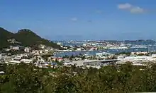 Simpson Bay, Sint Maarten, Dutch side
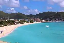 Philipsburg and the Great Bay
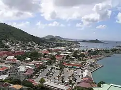 Marigot, Saint Martin, French side
 Phillipsburg
Currency
The official currency of Saint Martin is the Euro, while Sint Maarten uses the Netherlands Antillean guilder, pegged at 1.79 per US dollar. As a consequence of the dissolution of the Netherlands Antilles, the Netherlands Antillean guilder will cease to be legal tender and be replaced by the Caribbean guilder in the coming years. Almost every store on the island also accepts the United States dollar, although sometimes a more expensive exchange rate is used.
Transport
Border checks
Neither side of the island is part of the Schengen Area; full border checks are performed when traveling in and out of the island. Passport controls are also exercised when taking the ferry from Marigot or Princess Juliana International Airport to Anguilla. There are rarely checks at the border between the two sides of the island.
In 1994, the Kingdom of the Netherlands and France signed the Franco-Dutch treaty on Saint Martin border controls, which allows for joint Franco-Dutch border controls on so-called "risk flights" arriving from off-island and only admitting foreigners having permission to travel on both sides of the island. After some delay, the treaty was ratified in November 2006 in the Netherlands and subsequently entered into force on 1 August 2007. Its provisions are not yet implemented as the working group specified in the treaty is not yet installed. The treaty requires a working group that has never been set up, to harmonize external checks at the two main airports. The Dutch side has expressed concern that new and tighter French visa requirements would harm their tourism income.[39]
Airports
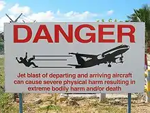
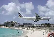
The island is served by many major airlines that daily bring in large jet aircraft, including Boeing 747s and Airbus A340s carrying tourists from across the world. The short main runway at Princess Juliana International Airport and its position between a large hill and a beach cause some spectacular approaches. Aviation photographers flock to the airport to capture pictures of large jets just a few metres above sunbathers on Maho Beach.[40]
There is a small airport on the French side of the island at Grand Case, L'Espérance Airport for small aircraft serving neighboring Caribbean islands. It frequently suffers thick fog during the hurricane season due to its location.
See also
References
- "Saint-Martin : Terre d'accueil et de contrastes, Synthese" (PDF) (in French). INSEE. 16 December 2016. Retrieved 11 December 2020.
- Central Bureau of Statistics Netherlands Antilles. "Area, population density and capital". Archived from the original on 7 February 2009. Retrieved 27 January 2009.
- "EUR-Lex - 12016ME/TXT - EN - EUR-Lex". Eur-lex.europa.eu. Retrieved 2019-08-24.
- Department of Statistics (STAT) of St. Maarten. "Population, St. Maarten, January 1 st" (PDF). Archived from the original (PDF) on 31 May 2013. Retrieved 20 August 2012.
- INSEE, Government of France. "Les populations légales 2009 entrent en vigueur le 1er janvier 2012" (in French). Retrieved 20 August 2010.
- ISO 3166-1 Newsletter.Assignment of code elements for Saint-Barthélemy and Saint-Martin and update of France and other French Territories.
- ISO 3166-1 Newsletter. Code elements for Bonaire, Saint Eustatius, and Saba, Curaçao, and Sint Maarten (Dutch part), update of other territories and minor corrections.
- "Geography St Martin island - locate st martin island in the caribbean - St Martin west indies sxm - tourism board st martin". www.stmartinisland.org.
- Hubbard, Vincent K. (2002). A History of St Kitts. MacMillan Caribbean. p. 13. ISBN 0333747607.
- Morison, Samuel Eliot (1974). The European Discovery of America, The Southern Voyages. Oxford University Press. pp. 108-109.
- Frank Jacobs (24 April 2012). "One Island, Two Countries". The New York Times.
- Pérez, Abón Satur (Chief Editor) (1980). Nueva Geografía Universal, Tomo IX, América. (New Universal Geography, Volume IX, America). Promexa. p. 19. ISBN 978-84-7113-130-0.
- "Sain Martin". mindat.org.
- "Climate Summaries". Meteorological Department Curaçao. Archived from the original on 17 February 2013. Retrieved 21 February 2013.
- "Summary of Climatological Data, Period 1971–2000" (PDF). Meteorological Department Curaçao. Archived from the original (PDF) on 2 July 2013. Retrieved 22 September 2016.
- Meade, Natalie (2 March 2018). "St. Maarten is still striving to recover from its worst hurricane in a century". The New Yorker. Retrieved 26 April 2019.
- Davies, Caroline (8 September 2017). "Caribbean islanders fear another battering after Irma wreaks havoc". The Guardian.
- Robles, Frances; Semple, Kirk; Yee, Vivian (7 September 2017). "Caribbean Devastated as Irma Heads Toward Florida". The New York Times.
- "Revisited - Video: One year after Hurricane Irma, St Martin struggles to recover". France 24. 2018-09-07. Retrieved 2019-06-06.
- News, ABC. "ABC News". ABC News. Archived from the original on 13 September 2017.
- "Dutch officials: Irma damaged or destroyed 70 percent of St. Maarten homes, leaving island vulnerable to Jose’s approach", Washington Post, 9 September 2017. Accessed 9 September 2017.
- "Hurricane Irma destroys ‘95%’ of French part of St. Martin—official", Agence France-Presse, 7 September 2017. Accessed 9 September 2017.
- "Third of buildings on Dutch St. Martin destroyed".
- "St. Martin's famous airport badly damaged by Hurricane Irma". ABC News. 7 September 2017.
- Estimation du PIB de Saint-Barthélemy et de Saint-Martin, INSEE.
- World Development Indicators, World Bank. Accessed on 30 July 2012.
- "CIA Factbook". Cia.gov. Retrieved 10 February 2014.
- Holm (1989), Pidgins and Creoles, vol. 2.
- "Casinos". about-saintmartin.com. 17 June 2013. Retrieved 10 February 2014.
- "Bus transit Saint-Martin". stmartinisland.org. 22 June 2015. Retrieved 6 November 2016.
- "St. Martin FAQ's". Grand Case Beach Club. 1 August 2015. Retrieved 1 August 2015.
- "The Daily Herald". www.thedailyherald.sx. Retrieved 2020-09-16.
- "Sint Maarten Online Newsday Source". www.soualiganewsday.com. Retrieved 2020-09-16.
- "SoualigaPost.com | All the news St. Martin & St. Maarten". www.soualigapost.com. Retrieved 2020-09-16.
- "StMaartenNews.com - News Views Reviews & Interviews - Always on point!". StMaartenNews.com - News Views Reviews & Interviews. Retrieved 2020-09-16.
- "St. Martin News Network - St. Martin News Network - Latest News in and around St. Maarten/St. Martin". www.smn-news.com. Retrieved 2020-09-16.
- "Home 5". SXM IslandTime. Retrieved 2020-09-16.
- "SXM Talks | Sint Maarten News And Discussion". Retrieved 2020-09-16.
- "Immigration Formalities". About-saintmartin.com. Retrieved 10 February 2014.
- "Aviation Photos: Philipsburg / St. Maarten – Princess Juliana (SXM / TNCM)". airliners.net.
Sources
- Baldacchino, Godfrey; Dana, Leo Paul (2012). "The Impact of Public Policy on Entrepreneurship: A Critical Investigation of the Protestant Ethic on a Divided Island Jurisdiction". Journal of Small Business & Entrepreneurship. 19 (4): 419–430. doi:10.1080/08276331.2006.10593381. ISSN 0827-6331. S2CID 143824108.
- Dana, Leo Paul (1990). "Saint Martin/Sint Maarten: A Case Study of the Effects of Politics and Culture on Economic Development". Journal of Small Business Management. XXVIII (4): 91–98.
- Dana, Leo Paul (2010). Entrepreneurship & Religion. Cheltenham: Edward Elgar. ISBN 978-1-84720-572-8.
- Houston, Lynn Marie (2005). Food Culture in the Caribbean. Greenwood. pp. 113–. ISBN 978-0-313-32764-3.
Further reading
- Arrindell, Rhoda, Language, Culture, and Identity in St. Martin. St. Martin: House of Nehesi Publishers, 2014.
- St. Martin Massive! A Snapshot of Popular Artists, St. Martin: House of Nehesi Publishers, 2000.
- Hyman, Yvette, From Yvette's Kitchen To Your Table: A Treasury of St. Martin's Traditional & Contemporary Cuisine. St. Martin: House of Nehesi Publishers, 2014 (Fourth printing).
- Lake Jr., Joseph H., Friendly Anger – The rise of the labor movement in St. Martin. St. Martin: House of Nehesi Publishers, 2004.
- Sekou, Lasana M. (ed.), National Symbols of St. Martin – A Primer. St. Martin: House of Nehesi Publishers, 1997 (Third printing).
External links
| Wikimedia Commons has media related to Saint Martin. |
| Wikisource has the text of the 1911 Encyclopædia Britannica article St Martin. |
- General information
- Saint Martin. The World Factbook. Central Intelligence Agency.
- Saint Martin (island) at Curlie
 Wikimedia Atlas of Saint Martin
- News and media
- The Daily Herald daily newspaper from St. Maarten
- LE FAXinfo daily newspaper from Saint Martin (in French)
- Travel
- Dutch St. Maarten official Tourist Bureau
- French Saint Martin official Tourist Office
- Official tourist website for LGBT visitors
- French Saint Martin Hotel Association
- Princess Juliana International Airport, Sint Maarten official website
 Saint Martin (island) travel guide from Wikivoyage
- Others
- Eric Dubois-Millot, Birds of Sint Maarten, Action Nature
