Salem, Illinois
Salem is a city in and the county seat of Marion County, Illinois, United States.[3] The population was 7,485 at the 2010 census.
Salem | |
|---|---|
.jpg.webp) Downtown Salem, July 2019 | |
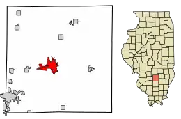 Location of Salem in Marion County, Illinois. | |
.svg.png.webp) Location of Illinois in the United States | |
| Coordinates: 38°38′N 88°57′W | |
| Country | United States |
| State | Illinois |
| County | Marion |
| Government | |
| • Mayor | Sue Morgan |
| Area | |
| • Total | 7.11 sq mi (18.41 km2) |
| • Land | 6.96 sq mi (18.01 km2) |
| • Water | 0.15 sq mi (0.40 km2) |
| Population (2010) | |
| • Total | 7,485 |
| • Estimate (2019)[2] | 6,971 |
| • Density | 1,002.30/sq mi (387.00/km2) |
| Time zone | UTC-6 (CST) |
| • Summer (DST) | UTC-5 (CDT) |
| ZIP Code(s) | 62881 |
| Area code(s) | 618 |
| FIPS code | 17-67236 |
| Wikimedia Commons | Salem, Illinois |
| Website | City of Salem, Illinois |

Geography
Salem is located at 38°38′N 88°57′W (38.6282, -88.9482).[4]
According to the 2010 census, Salem has a total area of 7.097 square miles (18.38 km2), of which 6.94 square miles (17.97 km2) (or 97.79%) is land and 0.157 square miles (0.41 km2) (or 2.21%) is water.[5]
History
Salem was formerly a sundown town. "For decades" Salem "had signs on each main road going into town, telling the blacks, that they were not allowed in town after sundown."[6]
Demographics
| Historical population | |||
|---|---|---|---|
| Census | Pop. | %± | |
| 1870 | 1,182 | — | |
| 1880 | 1,327 | 12.3% | |
| 1890 | 1,493 | 12.5% | |
| 1900 | 1,642 | 10.0% | |
| 1910 | 2,669 | 62.5% | |
| 1920 | 3,457 | 29.5% | |
| 1930 | 4,420 | 27.9% | |
| 1940 | 7,319 | 65.6% | |
| 1950 | 6,159 | −15.8% | |
| 1960 | 6,165 | 0.1% | |
| 1970 | 6,187 | 0.4% | |
| 1980 | 7,813 | 26.3% | |
| 1990 | 7,470 | −4.4% | |
| 2000 | 7,909 | 5.9% | |
| 2010 | 7,485 | −5.4% | |
| 2019 (est.) | 6,971 | [2] | −6.9% |
| U.S. Decennial Census[7] | |||
At the 2000 census there were 7,909 people in 3,249 households, including 2,082 families, in the city. The population density was 1,296.5 people per square mile (500.6/km2). There were 3,473 housing units at an average density of 569.3 per square mile (219.8/km2). The racial makeup of the city was 97.13% White, 0.72% African American, 0.30% Native American, 1.15% Asian, 0.04% Pacific Islander, 0.14% from other races, and 0.52% from two or more races. Hispanic or Latino of any race were 0.72%.[8]
Of the 3,249 households 28.6% had children under the age of 18 living with them, 48.8% were married couples living together, 11.0% had a female householder with no husband present, and 35.9% were non-families. 32.3% of households were one person and 17.2% were one person aged 65 or older. The average household size was 2.32 and the average family size was 2.91.
The age distribution was 23.5% under the age of 18, 8.7% from 18 to 24, 26.1% from 25 to 44, 22.1% from 45 to 64, and 19.6% 65 or older. The median age was 39 years. For every 100 females, there were 87.6 males. For every 100 females age 18 and over, there were 83.9 males.
The median household income was $34,339 and the median family income was $42,070. Males had a median income of $31,811 versus $21,931 for females. The per capita income for the city was $16,954. About 6.1% of families and 9.2% of the population were below the poverty line, including 13.2% of those under age 18 and 9.2% of those age 65 or over.
Education
Public schools:
- Salem Community High School
- Salem Elementary School
- Selmaville Elementary School
Notable people
- William Jennings Bryan, 41st US Secretary of State; US congressman representing Nebraska's 1st district, 3-time U.S. presidential candidate; born in Salem[9]
- Charles W. Bryan, 20th and 23rd governor of Nebraska; younger brother of William Jennings Bryan; born in Salem[10]
- Jim Finks, pro football player and executive; attended high school in Salem
- Jim Bredar, basketball player for 1950-51 Illinois team that reached NCAA basketball tournament's Final Four; born in Salem
- Merle Harmon, sports broadcaster; born in Salem
- Bill Laswell, bassist, producer and record label owner
- Jess Marlow, television journalist; born in Salem
- Rockette Morton, musician and bassist with Captain Beefheart and The Magic Band.
- John T. Scopes, science teacher who defended teaching of Evolution against William Jennings Bryan in Dayton, Tennessee
- Morrie Steevens, pitcher for Chicago Cubs and Philadelphia Phillies; born in Salem
- Erastus D. Telford, Illinois state senator and lawyer
Arts and culture
Salem is said to be home to Miracle Whip salad dressing and three homes on the National Register of Historic Places: the Charles and Naomi Bachmann House, the Badollet House, and the William Jennings Bryan Boyhood Home. Recently Grace United Methodist Church was placed on the National Register of Historic Places.
References
- "2019 U.S. Gazetteer Files". United States Census Bureau. Retrieved July 14, 2020.
- "Population and Housing Unit Estimates". United States Census Bureau. May 24, 2020. Retrieved May 27, 2020.
- "Find a County". National Association of Counties. Archived from the original on 2011-05-31. Retrieved 2011-06-07.
- "US Gazetteer files: 2010, 2000, and 1990". United States Census Bureau. 2011-02-12. Retrieved 2011-04-23.
- "G001 - Geographic Identifiers - 2010 Census Summary File 1". United States Census Bureau. Archived from the original on 2020-02-13. Retrieved 2015-12-27.
- Loewen, James W. (2005). Sundown Towns : a hidden dimension of American racism. The New Press. pp. 12–13. ISBN 156584887X.
- "Census of Population and Housing". Census.gov. Retrieved June 4, 2015.
- "U.S. Census website". United States Census Bureau. Retrieved 2008-01-31.
- "Nebraska State Historical Society". Nebraska State Historical Society. Archived from the original on 25 September 2017. Retrieved 25 April 2018.
- "Charles W. Bryan". National Governors Association. Archived from the original on 2 December 2012. Retrieved 24 September 2012.
External links
| Wikimedia Commons has media related to Salem, Illinois. |
| Wikisource has the text of a 1905 New International Encyclopedia article about "Salem, Illinois". |
Municipalities and communities of Marion County, Illinois, United States | ||
|---|---|---|
| Cities | Map of Illinois highlighting Marion County | |
| Villages | ||
| Townships | ||
| Unincorporated communities | ||
| Footnotes | ‡This populated place also has portions in an adjacent county or counties | |
| ||
| Authority control |
|---|