Salem, Saline County, Arkansas
Salem is a census-designated place (CDP) in Saline County, Arkansas, United States. The population was 2,607 at the 2010 census.[3] It is part of the Little Rock–North Little Rock–Conway Metropolitan Statistical Area.
Salem, Arkansas | |
|---|---|
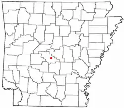 Location of Salem, Saline County, Arkansas | |
| Coordinates: 34°37′46″N 92°33′42″W | |
| Country | United States |
| State | Arkansas |
| County | Saline |
| Area | |
| • Total | 3.23 sq mi (8.38 km2) |
| • Land | 3.19 sq mi (8.25 km2) |
| • Water | 0.05 sq mi (0.13 km2) |
| Elevation | 469 ft (143 m) |
| Population (2010) | |
| • Total | 1,635 |
| • Estimate (2016)[2] | N/A |
| Time zone | UTC-6 (Central (CST)) |
| • Summer (DST) | UTC-5 (CDT) |
| FIPS code | 05-62210 |
| GNIS feature ID | 0054484 |
Geography
Salem is located at 34°37′46″N 92°33′42″W (34.629565, -92.561668).[4]
According to the United States Census Bureau, the CDP has a total area of 3.2 square miles (8.4 km2), of which 3.2 square miles (8.2 km2) is land and 0.05 square mile (0.1 km2) (1.52%) is water.
Demographics
| Historical population | |||
|---|---|---|---|
| Census | Pop. | %± | |
| U.S. Decennial Census[5] | |||
As of the census[6] of 2000, there were 2,789 people, 1,069 households, and 857 families residing in the CDP. The population density was 815.3 people per square mile (314.9/km2). There were 1,096 housing units at an average density of 320.4 per square mile (123.7/km2). The racial makeup of the CDP was 98.03% White, 0.32% Black or African American, 0.47% Native American, 0.18% Asian, 0.36% from other races, and 0.65% from two or more races. 1.08% of the population were Hispanic or Latino of any race.
There were 1,069 households, out of which 34.8% had children under the age of 18 living with them, 68.8% were married couples living together, 8.0% had a female householder with no husband present, and 19.8% were non-families. 17.4% of all households were made up of individuals, and 5.5% had someone living alone who was 65 years of age or older. The average household size was 2.61 and the average family size was 2.94.
In the CDP the population was spread out, with 24.7% under the age of 18, 8.0% from 18 to 24, 29.2% from 25 to 44, 27.5% from 45 to 64, and 10.5% who were 65 years of age or older. The median age was 39 years. For every 100 females there were 99.9 males. For every 100 females age 18 and over, there were 97.7 males.
The median income for a household in the CDP was $44,681, and the median income for a family was $52,216. Males had a median income of $33,207 versus $26,337 for females. The per capita income for the CDP was $21,301. About 3.9% of families and 3.1% of the population were below the poverty line, including 6.9% of those under age 18 and none of those age 65 or over.
Education
Public education for early childhood, elementary and secondary school students is provided by
- Benton School District, which leads to graduation from Benton High School.
- Bryant Public Schools, which leads to graduation from Bryant High School.
Notable person
- Lanny Fite, Republican member of the Arkansas House of Representatives from Saline County
References
- "2016 U.S. Gazetteer Files". United States Census Bureau. Retrieved Jul 18, 2017.
- "Population and Housing Unit Estimates". Retrieved June 9, 2017.
- "U.S. Census website". U.S. Census Bureau. Retrieved 6 May 2011.
- "US Gazetteer files: 2010, 2000, and 1990". United States Census Bureau. 2011-02-12. Retrieved 2011-04-23.
- "Census of Population and Housing". Census.gov. Retrieved June 4, 2016.
- "U.S. Census website". United States Census Bureau. Retrieved 2008-01-31.
Municipalities and communities of Saline County, Arkansas, United States | ||
|---|---|---|
| Cities | 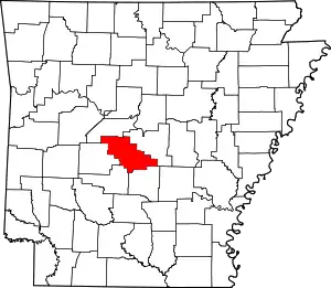 Map of Arkansas highlighting Saline County | |
| Towns | ||
| CDPs | ||
| Unincorporated communities | ||
| Footnotes | ‡This populated place also has portions in an adjacent county or counties | |
| ||