Sam Ngao District
Sam Ngao (Thai: สามเงา, pronounced [sǎːm ŋāw]) with Tha Song Yang District is the northernmost district (amphoe) of Tak Province, western Thailand.
Sam Ngao
สามเงา | |
|---|---|
 | |
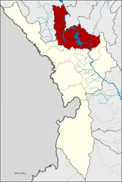 District location in Tak Province | |
| Coordinates: 17°14′36″N 99°1′21″E | |
| Country | Thailand |
| Province | Tak |
| Seat | Sam Ngao |
| Area | |
| • Total | 2,771.927 km2 (1,070.247 sq mi) |
| Population (2007) | |
| • Total | 32,483 |
| • Density | 11.7/km2 (30/sq mi) |
| Time zone | UTC+7 (ICT) |
| Postal code | 63130 |
| Geocode | 6303 |
History
The minor district (king amphoe) was established in 1930 as a subordinate of Ban Tak District. Originally named Tha Pui (ท่าปุย), it was renamed "Sam Ngao" in 1939.[1] It was upgraded to a full district in 1958.[2]
Geography
Neighboring districts are (south from clockwise): Ban Tak, Mae Ramat of Tak Province, Omkoi, Doi Tao of Chiang Mai Province, Thung Hua Chang of Lamphun Province, Mae Phrik and Thoen of Lampang Province.
The southwest end of the Phi Pan Nam Range reaches the eastern end of the district. The important water resources of the district are the Ping and Wang Rivers. The Bhumibol Dam is an artificial lake of the Ping River for flood control and for generating electricity.
Administration
The district is divided into six sub-districts (tambons), which are further subdivided into 43 villages (mubans). Sam Ngao is a sub-district municipality (thesaban tambon) which covers parts of the tambon Sam Ngao. There are a further six tambon administrative organizations (TAO).
| No. | Name | Thai | Pop. |
|---|---|---|---|
| 1. | Sam Ngao | สามเงา | 9,241 |
| 2. | Wang Man | วังหมัน | 4,522 |
| 3. | Yokkrabat | ยกกระบัตร | 8,200 |
| 4. | Yan Ri | ย่านรี | 3,294 |
| 5. | Ban Na | บ้านนา | 2,161 |
| 6. | Wang Chan | วังจันทร์ | 5,065 |
References
- พระราชกฤษฎีกาเปลี่ยนนามอำเภอ กิ่งอำเภอ และตำบลบางแห่ง พุทธศักราช ๒๔๘๒ (PDF). Royal Gazette (in Thai). 56 (0 ก): 354–364. April 17, 1939.
- พระราชกฤษฎีกาจัดตั้งอำเภอกระสัง ... (PDF). Royal Gazette (in Thai). 75 (55 ก): 321–327. July 22, 1958.