San Agustin, Isabela
San Agustin, officially the Municipality of San Agustin (Ilocano: Ili ti San Agustin; Tagalog: Bayan ng San Agustin), is a 3rd class municipality in the province of Isabela, Philippines. According to the 2015 census, it has a population of 22,880 people. [3]
San Agustin | |
|---|---|
| Municipality of San Agustin | |
 Seal | |
| Nickname(s): Crossbred Capital of the Philippines | |
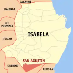 Map of Isabela with San Agustin highlighted | |
OpenStreetMap 
| |
.svg.png.webp) San Agustin Location within the Philippines | |
| Coordinates: 16°31′N 121°45′E | |
| Country | |
| Region | Cagayan Valley (Region II) |
| Province | Isabela |
| District | 4th District |
| Barangays | 23 (see Barangays) |
| Government | |
| • Type | Sangguniang Bayan |
| • Mayor | Cesar A. Mondala |
| • Vice Mayor | Larry Mark Lloyd T. Guerrero |
| • Representative | Alyssa Sheena P. Tan |
| • Electorate | 15,161 voters (2019) |
| Area | |
| • Total | 278.40 km2 (107.49 sq mi) |
| Elevation | 125 m (410 ft) |
| Population | |
| • Total | 22,880 |
| • Density | 82/km2 (210/sq mi) |
| • Households | 5,377 |
| Economy | |
| • Income class | 3rd municipal income class |
| • Poverty incidence | 13.62% (2015)[4] |
| • Revenue | ₱91,980,026.07 (2016) |
| Time zone | UTC+8 (PST) |
| ZIP code | 3314 |
| PSGC | |
| IDD : area code | +63 (0)78 |
| Climate type | tropical rainforest climate |
| Native languages | Ilocano Ilongot Tagalog |
| Website | www |
History
Founded by Agustin Daguro Agpaoa in 1949, by virtue of Executive Order No. 259 dated September 28, 1949 issued by President Elpidio Quirino. The mayor named the new LGU after his first name but on official records, it was named after the patron of the new town. There are seven towns in Isabela named after its founders but used prefix "San" (Saint) to remove the idea of being self-serving.
In the old days, the present site of San Agustin, Isabela was a hinterland inhabited by headhunting Ilongots and some scattered bands of Aetas locally known as "Pogot". It was then a part of the municipality of Echague. From this historic town sailed forth a band of intrepid pioneers led by Juan Gumpal, Antonio Pintang, and Vicente Taguiam. They penetrated the wilderness and explored the rich valleys along both sides of the Cagayan River. They put up scattered settlements which were often plagued by malaria, and the marauding Ilongots and Pogots but the brave pioneers stayed put and in the end they were able to befriend Ilongots and Aetas and at the same time they were able to lick malaria. Not long after the scattered settlements grew into sitios and one of them was Lakay-lakay (named after the creek) on the western side of the Cagayan River. The place is now "Masaya Centro", the seat of the municipal government of San Agustin.
When Jones was organized into an independent municipality in 1921, 30 barrios were separated from the municipality of Echague and one of them was Masaya. Because all the barrios of Jones prospered beyond the inhabitants' expectations and since there were no good roads connecting the barrios at that time, the people of Masaya and adjoining barrios petitioned the President of the Philippines to organize the barrios into a regular town.[5]
In 1959, the barrio of Uldogan was renamed Laoag.[6]
It is the home of the "Nuang Festival" the annual celebration in honor of the sturdy carabao and in recognition of the highly successful Carabao Upgrading Program of the local government, through the Office of the Municipal Agriculturist and its cooperating agencies and stakeholders. The program was commenced in 1993 by then Mayor Jesus M. Silorio. This was continued under the successive administrations of Mayor Virgilio A. Padilla and Mayor Operaflor A. Manuel. Under the latter's leadership, the Nuang Festival was started.
Mayor Cesar Agonoy Mondala, won the 2016 Elections with the support of 1 & 1/2 barangay Captain out of 23 Barangay.
Barangays
San Agustin is politically subdivided into 23barangays. [2]
- Bautista
- Calaocan
- Dabubu Grande
- Dabubu Pequeño
- Dappig
- Laoag
- Mapalad
- Masaya Centro (Poblacion)
- Masaya Norte
- Masaya Sur
- Nemmatan
- Palacian
- Panang
- Quimalabasa Norte
- Quimalabasa Sur
- Rang-ay
- Salay
- San Antonio
- Santo Niño
- Santos
- Sinaoangan Norte
- Sinaoangan Sur
- Virgoneza
Demographics
| Year | Pop. | ±% p.a. |
|---|---|---|
| 1960 | 10,136 | — |
| 1970 | 13,294 | +2.75% |
| 1975 | 14,862 | +2.26% |
| 1980 | 14,880 | +0.02% |
| 1990 | 16,577 | +1.09% |
| 1995 | 17,861 | +1.41% |
| 2000 | 19,927 | +2.37% |
| 2007 | 20,681 | +0.51% |
| 2010 | 21,797 | +1.93% |
| 2015 | 22,880 | +0.93% |
| Source: Philippine Statistics Authority [3] [7] [8][9] | ||
In the 2015 census, the population of San Agustin, Isabela, was 22,880 people, [3] with a density of 82 inhabitants per square kilometre or 210 inhabitants per square mile.
Climate
| Climate data for San Agustin, Isabela | |||||||||||||
|---|---|---|---|---|---|---|---|---|---|---|---|---|---|
| Month | Jan | Feb | Mar | Apr | May | Jun | Jul | Aug | Sep | Oct | Nov | Dec | Year |
| Average high °C (°F) | 29 (84) |
30 (86) |
32 (90) |
35 (95) |
35 (95) |
35 (95) |
34 (93) |
33 (91) |
32 (90) |
31 (88) |
30 (86) |
28 (82) |
32 (90) |
| Average low °C (°F) | 19 (66) |
20 (68) |
21 (70) |
23 (73) |
23 (73) |
24 (75) |
23 (73) |
23 (73) |
23 (73) |
22 (72) |
21 (70) |
20 (68) |
22 (71) |
| Average precipitation mm (inches) | 31.2 (1.23) |
23 (0.9) |
27.7 (1.09) |
28.1 (1.11) |
113.5 (4.47) |
141.4 (5.57) |
176.4 (6.94) |
236.6 (9.31) |
224.9 (8.85) |
247.7 (9.75) |
222.9 (8.78) |
178 (7.0) |
1,651.4 (65) |
| Average rainy days | 10 | 6 | 5 | 5 | 13 | 12 | 15 | 15 | 15 | 17 | 16 | 15 | 144 |
| Source: World Weather Online[10] | |||||||||||||
References
- Municipality of San Agustin | (DILG)
- "Province: Isabela". PSGC Interactive. Quezon City, Philippines: Philippine Statistics Authority. Retrieved 12 November 2016.
- Census of Population (2015). "Region II (Cagayan Valley)". Total Population by Province, City, Municipality and Barangay. PSA. Retrieved 20 June 2016.
- "PSA releases the 2015 Municipal and City Level Poverty Estimates". Quezon City, Philippines. Retrieved 1 January 2020.
- Miano, Troy Alexander (September 28, 2017). "NUANG AND THE FESTIVAL OF SAN AGUSTIN". Facebook.
- "R.A. No. 2096, An Act Changing the Name of the Barrio of Uldogan in the Municipality of San Agustin, Province of Isabela, to Laoag". LawPH.com. Retrieved 2011-04-13.
- Census of Population and Housing (2010). "Region II (Cagayan Valley)". Total Population by Province, City, Municipality and Barangay. NSO. Retrieved 29 June 2016.
- Censuses of Population (1903–2007). "Region II (Cagayan Valley)". Table 1. Population Enumerated in Various Censuses by Province/Highly Urbanized City: 1903 to 2007. NSO.
- "Province of Isabela". Municipality Population Data. Local Water Utilities Administration Research Division. Retrieved 17 December 2016.
- "San Agustin, Isabela: Average Temperatures and Rainfall". World Weather Online. Retrieved 3 November 2015.
External links
- San Agustin Profile at PhilAtlas.com
- Municipal Profile at the National Competitiveness Council of the Philippines
- san Agustin at the Isabela Government Website
- Local Governance Performance Management System
- Philippine Standard Geographic Code
- Philippine Census Information
- Municipality of San Agustin
Places adjacent to San Agustin, Isabela | ||||||||||
|---|---|---|---|---|---|---|---|---|---|---|
| ||||||||||
Ilagan (capital) | |
| Municipalities |
|
| Component Cities | |
| Independent Component City |
|
| Barangays | |