San Fernando, Trinidad and Tobago
San Fernando, officially the City of San Fernando, is the most populous city and second most populous municipality in Trinidad and Tobago, after Chaguanas. Sando, as it is also known, occupies 19 km² and is located in the southwestern part of the island of Trinidad. It is bounded to the north by the Guaracara River, the south by the Oropouche River, the east by the Sir Solomon Hochoy Highway, and the west by the Gulf of Paria. The former borough was elevated to the status of a city corporation on 18 November 1988. The motto of San Fernando is: "Sanitas Fortis" - In a Healthy Environment We Will Find Strength. Many local Trinidadians refer to the city with the shortened name "Sando." San Fernando is called Trinidad and Tobago's "industrial capital" because of its proximity to the Pointe-à-Pierre oil refinery and many other petrochemical, LNG, iron and steel and aluminium smelters in places such as Point Lisas in Couva, Point Fortin, and La Brea.
San Fernando | |
|---|---|
| City of San Fernando | |
.jpg.webp) Independence Avenue in Downtown San Fernando | |
| Nickname(s): Sando The Industrial Capital of Trinidad and Tobago[1] | |
| Motto(s): Sanitas Fortis In a Healthy Environment We Will Find Strength. | |
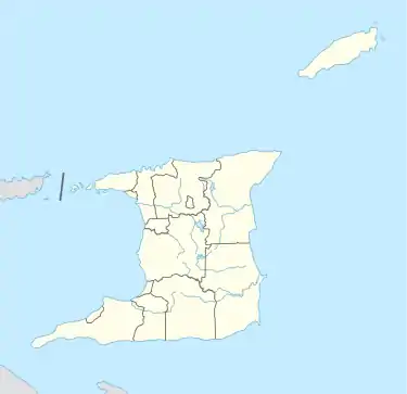 San Fernando Location on the island of Trinidad 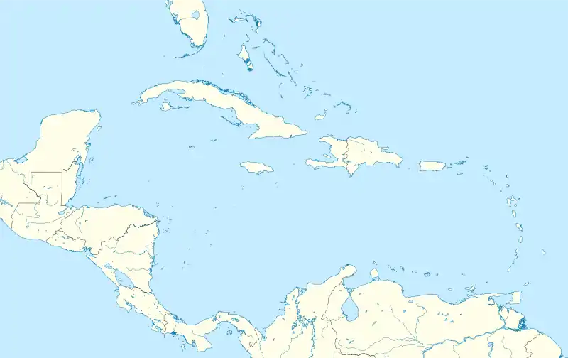 San Fernando San Fernando (Caribbean) 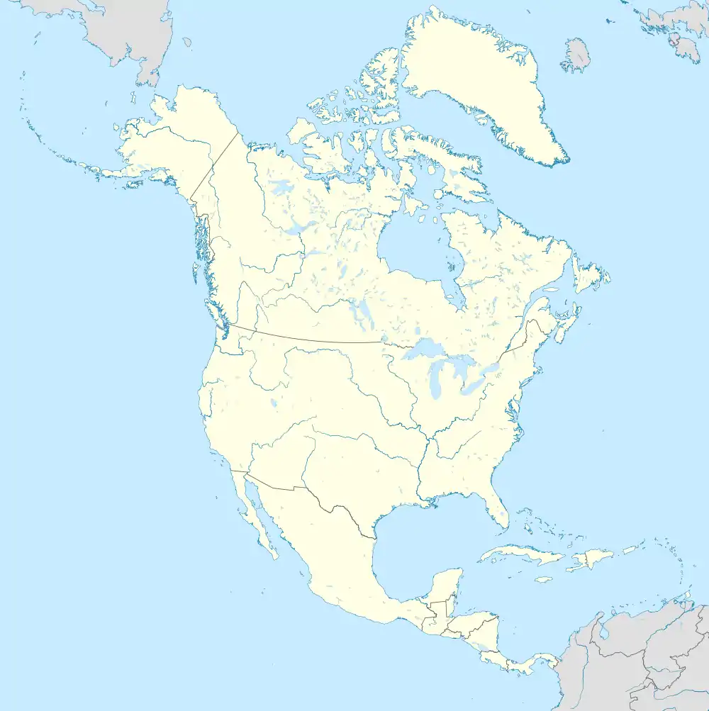 San Fernando San Fernando (North America) | |
| Coordinates: 10°17′N 61°28′W | |
| Country | |
| Jurisdiction | City of San Fernando |
| Settled | 1595 |
| Borough | 1853 |
| City | November 18th, 1988 |
| Named for | Saint Ferdinand III of Castile |
| Government | |
| • Body | San Fernando City Corporation |
| • Mayor | Junia Regrello, PNM |
| • Deputy Mayor | Ferri Hosein, PNM |
| City Corporation seats | 9 electoral districts |
| House seats | 2/41 |
| Area | |
| • City | 19 km2 (7 sq mi) |
| Elevation | 1 m (3 ft) |
| Population (2011) | |
| • City | 48,838 |
| • Rank | 2nd |
| • Density | 2,570/km2 (6,700/sq mi) |
| • Urban | 82,997 |
| Demonym(s) | San Fernandian |
| Time zone | UTC-4 (AST) |
| Postal Code | 60xxxx, 61xxxx, 65xxxx[3] |
| Area code(s) | (868) |
| ISO 3166 code | TT-SFO |
| Telephone Exchanges | 652, 653, 657, 658, 697, 831 |
| HDI The HDI for Trinidad and Tobago is 0.814, which gives the country a rank of 19th out of 177 countries with data (2007/2008) – high | |
Geography
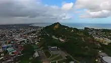
San Fernando is a coastal city. It is bounded by the Guaracara River to the north, the Sir Solomon Hochoy Highway to the east, the Southern Main Road to the southeast, and the Oropouche River to the south. The city proper is located on the flanks of two hills - San Fernando Hill (formerly known as Naparima Hill) and Alexander Hill. Several mansions on the pinnacle of Alexander Hill house belong to some of the more prominent San Fernandian families. The Cipero, Vistabella, Marabella and Godineau Rivers all enter the sea within the city limits.
Climate
San Fernando has a tropical monsoon climate with a wet season lasting from May to January and a dry season lasting from February to April.[4]
| Climate data for San Fernando, Trinidad and Tobago | |||||||||||||
|---|---|---|---|---|---|---|---|---|---|---|---|---|---|
| Month | Jan | Feb | Mar | Apr | May | Jun | Jul | Aug | Sep | Oct | Nov | Dec | Year |
| Average high °C (°F) | 29.3 (84.7) |
29.7 (85.5) |
30.3 (86.5) |
31.2 (88.2) |
31.0 (87.8) |
30.2 (86.4) |
30.1 (86.2) |
30.6 (87.1) |
31.1 (88.0) |
30.9 (87.6) |
30.6 (87.1) |
29.8 (85.6) |
30.4 (86.7) |
| Daily mean °C (°F) | 25.0 (77.0) |
25.0 (77.0) |
25.6 (78.1) |
26.5 (79.7) |
26.9 (80.4) |
26.3 (79.3) |
26.2 (79.2) |
26.4 (79.5) |
26.7 (80.1) |
26.6 (79.9) |
26.3 (79.3) |
25.5 (77.9) |
26.1 (79.0) |
| Average low °C (°F) | 20.7 (69.3) |
20.4 (68.7) |
20.9 (69.6) |
21.8 (71.2) |
22.8 (73.0) |
22.5 (72.5) |
22.4 (72.3) |
22.3 (72.1) |
22.4 (72.3) |
22.4 (72.3) |
22.0 (71.6) |
21.2 (70.2) |
21.8 (71.3) |
| Average precipitation mm (inches) | 77 (3.0) |
42 (1.7) |
43 (1.7) |
56 (2.2) |
84 (3.3) |
193 (7.6) |
214 (8.4) |
235 (9.3) |
182 (7.2) |
157 (6.2) |
184 (7.2) |
132 (5.2) |
1,599 (63) |
| Source: Climate-data.org[5] | |||||||||||||
Demographics
| Year | Pop. | ±% |
|---|---|---|
| 1980 | 33,395 | — |
| 1990 | 26,483 | −20.7% |
| 2000 | 48,784 | +84.2% |
| 2011 | 48,838 | +0.1% |
Ancestry
| Racial composition | 2011[6] |
|---|---|
| African (Afro-Trinidadian/Tobagonian) | 35.7% |
| South Asian (Indo-Trinidadian) | 30.3% |
| Multiracial | 17.3% |
| Dougla (South Asian and Black) | 8.2% |
| European (White Trinidadian) | 0.5% |
| East Asian (Chinese) | 0.6% |
| Native American (Amerindian) | 0.08% |
| Arab (Syrian/Lebanese) | 0.9% |
| Other | 0.02% |
| Not stated | 6.7% |
Prominent San Fernandians
- Stephen Ames, PGA Tour golfer
- Eugene Chen (Chen Youren) (1878–1944) Foreign Minister of China.
- Hasely Crawford, Olympic gold medalist (1976)
- Annie Dookhan, convicted felon and former chemist
- Hedy Fry, PC, MP (born 6 August 1941) is a Trinidadian-born Canadian politician and physician.
- Noor Hassanali, President of Trinidad and Tobago (1987–97)
- Rikki Jai, chutney and chutney soca artist
- Christina F. Lewis (1919-1974) Pan-African community worker, trade unionist and women's rights activist
- Patrick Manning, Prime Minister of Trinidad and Tobago (1991–95, 2002–2010)
- Sir Trevor McDonald, news reporter
- Mishael Morgan, TV actress
- Basdeo Panday, Prime Minister of Trinidad and Tobago (1995–2002)
- Manny Ramjohn, long-distance runner; first person to win a gold medal for Trinidad and Tobago at a major athletics event.
- Jean Ramjohn-Richards, First Lady of Trinidad and Tobago (2003–2013)
- George Maxwell Richards, President of Trinidad and Tobago (2003–2013)
- Adrian Cola Rienzi (Krishna Deonarine Tiwari)
- Samuel Selvon, writer (1923-1994)
- Jlloyd Samuel, footballer
- Sullivan Walker, film and television actor[7]
References
- "Touring Trinidad: the 'deep south'", Discover Trinidad & Tobago.
- "Elevation of San Fernando,Trinidad and Tobago Elevation Map, Topo, Contour". floodmap.net. Retrieved 5 April 2016.
- "List of Postal Districts". TTPOST. 29 July 2018. Retrieved 29 July 2018.
- "Trinidad and Tobago (Climate Data > Historical)". The World Bank Group. Retrieved April 27, 2019.
- "San Fernando climate". Climate-data.org. Retrieved February 29, 2020.
- Central Statistical Office. "NON-INSTITUTIONAL POPULATION BY SEX, AGE GROUP, ETHNIC GROUP AND MUNICIPALITY" (PDF).
- Felmine, Kevon (2012-03-03). "San Fernando farewell to actor Sullivan Walker". Trinidad Guardian. Retrieved 3 March 2012.
External links
![]() San Fernando travel guide from Wikivoyage
San Fernando travel guide from Wikivoyage
| Wikimedia Commons has media related to San Fernando, Trinidad and Tobago. |
| Regions | |
|---|---|
| Municipalities | |
| Other bodies | |
| Counties (historic) | |
| Authority control |
|---|