San Fernando de Apure
San Fernando de Apure (Spanish pronunciation: [saɱ feɾˈnando ðe aˈpuɾe]) is a city in Apure State in Venezuela. The population of the municipality area is 165,135 (2011 census). The 18th century exports included heron feathers (for pens) and animal hides.
San Fernando de Apure | |
|---|---|
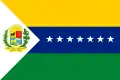 Flag | |
| Nickname(s): "Ciudad de la Esperanza" (English:"City of Hope") | |
| Motto(s): "none " | |
.svg.png.webp) San Fernando de Apure | |
| Coordinates: 7.894°N 67.473°W | |
| Country | |
| State | Apure |
| Counties | San Fernando |
| Government | |
| • Mayor | John Guerra (2008–2012) |
| Area | |
| • Total | 5,982 km2 (2,310 sq mi) |
| Elevation | 47 m (154 ft) |
| Population (2011 census) | |
| • Total | 165,135 |
| • Density | 28/km2 (71/sq mi) |
| Climate | Aw |
| Website | Alcaldía de San Fernando |
The “Maria Nieves” bridge across the Apure River at San Fernando commenced construction in 1959 under the direction of President Rómulo Betancourt, and was opened February 1, 1961. It cost 8.5 million bolivars. Notable is the Casa de Bolivar, a National Historical Monument, at the intersection of Comercio St. and Independencia St. It is the 18th Century Armory, and was the dwelling of General Miguel Gerrero. Now it contains a public library as well as the cultural offices of the municipality. It was restored in 1983.
History
It was founded February 28, 1788 on the banks of the Rio Apure, Apure River, by Fernando de Miyares González, the Governor and Captain General of Barinas Province, New Granada, with the assistance of Don Juan Antonio Rodríguez and the Capuchine monk Fray Buenaventura de Benaocaz. On December 1, 1793 it was elevated to the status of a town (Villa). The Eighteenth Century exports included heron feathers (for pens) and animal hides.
In 1831 a private school for young men was opened by Master Juan Castellano; in 1844 classes for younger children were added; in 1875 the Federal High School (el Colegio Federal de Segunda Categoría) was opened; and at the end of the 19th century the Federal School Leon XIII was opened.
The bridge across the Rio Apure at San Fernando commenced construction in 1959 under the direction of President Rómulo Betancourt, and was opened February 1, 1961. It cost 8.5 million bolivars.
Geography and climate
San Fernando de Apure is a very warm locality due to its location in the center of the Venezuelan plains. The daily annual average is 27.8 °C. The humidity can reach more than 79%, due to its location next to the 300 meter wide Apure River. The relief of San Fernando is totally a plain. Natural land elevations do not exist, and the visibility of the horizon can reach up to 10 km. Some high barriers can be artificially by engineer installations for the prevention of floods. The city is established on humid grounds, and for this reason civil constructions superior to 5 levels are not permitted. In this sense, San Fernando projects a flat skyline.[1]
San Fernando de Apure is a near-exact antipode to the city of Batu, Indonesia.[2]
| Month | Jan | Feb | Mar | Apr | May | Jun | Jul | Aug | Sep | Oct | Nov | Dec | Year |
|---|---|---|---|---|---|---|---|---|---|---|---|---|---|
| Record high °C (°F) | 37.7 (99.9) |
39.1 (102.4) |
40.0 (104.0) |
39.7 (103.5) |
38.1 (100.6) |
37.1 (98.8) |
34.3 (93.7) |
34.3 (93.7) |
35.4 (95.7) |
35.9 (96.6) |
37.2 (99.0) |
36.3 (97.3) |
40.0 (104.0) |
| Average high °C (°F) | 33.1 (91.6) |
34.2 (93.6) |
35.2 (95.4) |
34.8 (94.6) |
32.5 (90.5) |
30.6 (87.1) |
30.0 (86.0) |
30.3 (86.5) |
31.2 (88.2) |
32.1 (89.8) |
32.4 (90.3) |
32.6 (90.7) |
32.4 (90.3) |
| Daily mean °C (°F) | 27.5 (81.5) |
28.5 (83.3) |
29.5 (85.1) |
29.6 (85.3) |
28.1 (82.6) |
26.8 (80.2) |
26.4 (79.5) |
26.8 (80.2) |
27.4 (81.3) |
28.0 (82.4) |
27.9 (82.2) |
27.5 (81.5) |
27.8 (82.0) |
| Average low °C (°F) | 21.9 (71.4) |
22.7 (72.9) |
23.8 (74.8) |
24.3 (75.7) |
23.7 (74.7) |
23.0 (73.4) |
22.8 (73.0) |
23.2 (73.8) |
23.6 (74.5) |
23.8 (74.8) |
23.3 (73.9) |
22.3 (72.1) |
23.2 (73.8) |
| Record low °C (°F) | 18.0 (64.4) |
15.9 (60.6) |
19.0 (66.2) |
20.5 (68.9) |
19.9 (67.8) |
17.9 (64.2) |
18.1 (64.6) |
18.3 (64.9) |
18.9 (66.0) |
19.0 (66.2) |
19.3 (66.7) |
18.2 (64.8) |
15.9 (60.6) |
| Average rainfall mm (inches) | 1.1 (0.04) |
3.5 (0.14) |
6.2 (0.24) |
71.9 (2.83) |
167.3 (6.59) |
242.9 (9.56) |
276.1 (10.87) |
255.3 (10.05) |
172.4 (6.79) |
98.5 (3.88) |
44.2 (1.74) |
9.9 (0.39) |
1,349.3 (53.12) |
| Average rainy days (≥ 1.0 mm) | 1 | 1 | 1 | 5 | 13 | 20 | 24 | 21 | 16 | 11 | 6 | 2 | 121 |
| Average relative humidity (%) | 71.5 | 68.0 | 65.0 | 66.0 | 74.5 | 80.0 | 81.5 | 82.0 | 81.0 | 79.5 | 78.0 | 75.5 | 75.2 |
| Mean monthly sunshine hours | 294.5 | 274.4 | 285.2 | 216.0 | 189.1 | 162.0 | 176.7 | 186.0 | 204.0 | 241.8 | 261.0 | 288.3 | 2,779 |
| Source 1: Instituto Nacional de Meteorología e Hidrología (INAMEH)[3][4] | |||||||||||||
| Source 2: World Meteorological Organization (rainfall data),[5] NOAA (extremes and sun)[6] | |||||||||||||
Satellite towns of San Fernando
|
|
|
Parishes
- El Recreo
- Peñalver
- San Fernando
- San Rafael de Atamaica
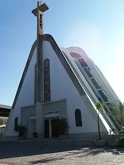
Gallery Images
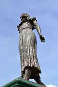 La Marisela Monument in San Fernando
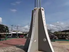 La Bandera Monument
Demographics
The city is conformed by three urban nucleus: San Fernando de Apure, who covers all the metropolitan area in both shores of the Apure River, the satellite town of Biruaca to the west, which conforms another political jurisdiction, and to the east El Recreo parish. In agreement with the 2001 Venezuelan census, the urban area of San Fernando was conformed by 175.056 inhabitants, having Biruaca an intercensal rate of the 69,4% relative growth, and San Fernando the 36,1%. San Fernando lifestyle varies according to zone, wealth and age. Many young people of the metropolitan area characterize themselves to assume an urban style with fort influence of nonown cultures of the locality, reflecting in first term North America lifestyle, and soon expressions of the north region of Venezuela (mainly, Caracas lifestyle). The adult population of the city is charged of a mixed style, that goes from traditional llanero customs, to the nonown. In certain groups of the greater adult population a traditional lifestyle is present, with typical characteristics of the region. Towards in the peripheral zones of the city, can be appreciated very rustic customs and traditions, with little impact of nonown cultures.[7]
Colleges and universities
Universities in San Fernando include Simón Rodríguez University and Ezequiel Zamora Experimental National University of the Western Plains.
Other universities:
See also
| Wikimedia Commons has media related to San Fernando de Apure. |
| Spanish Wikipedia has a version of San Fernando de Apure |
References
- Geography and climate
- url=https://www.findlatitudeandlongitude.com/antipode-map/#.Wga27BOCzUo | name= Antipodes Map (AKA Tunnel Map)
- "Estadísticos Básicos Temperaturas y Humedades Relativas Máximas y Mínimas Medias" (PDF). INAMEH (in Spanish). Archived from the original (pdf) on 15 June 2013. Retrieved 16 October 2012.
- "Estadísticos Básicos Temperaturas y Humedades Relativas Medias" (PDF). INAMEH (in Spanish). Archived from the original (pdf) on 2013-06-15. Retrieved October 2012. Check date values in:
|accessdate=(help) - "World Weather Information Service - San Fernando". World Meteorological Organization. Retrieved 16 October 2012.
- "San Fernando de Apure Climate Normals 1961–1990". National Oceanic and Atmospheric Administration. Retrieved 12 August 2015.
- Demographics
External links
- Historia del Municipio San Fernando de Apure in Spanish.
- San Fernando de Apure Venezuela Tuya in Spanish.
Capital, state | ||||||
Bold indicates national capital. | ||||||