San Miguel Chicaj
San Miguel Chicaj (Spanish pronunciation: [san miˈɣel tʃiˈkax]) is a town and municipality in the Baja Verapaz department of Guatemala. San Miguel Chicaj has an area of 280 Km², which makes one of the largest municipality of Baja Verapaz Department. It has a population of 33,131 (2018 census), mostly of achí background.[3]
San Miguel Chicaj | |
|---|---|
Municipality | |
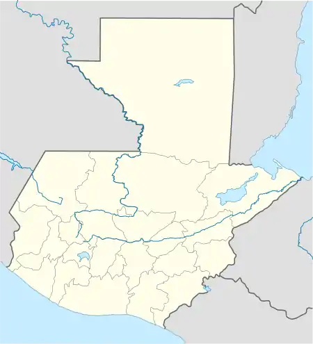 San Miguel Chicaj Location in Guatemala | |
| Coordinates: 15°05′36″N 90°23′46″W | |
| Country | |
| Department | |
| Government | |
| • Mayor | Edgar Adán Ixtecoc[1] (LIDER) |
| Area | |
| • Municipality | 280 km2 (110 sq mi) |
| Population (2018 census)[2] | |
| • Municipality | 33,121 |
| • Density | 120/km2 (310/sq mi) |
| • Urban | 7,609 |
| Climate | Aw |
History
According to an old local legend, the name "San Miguel Chicaj" came from the time that Saint Michael Archangel descended from Heaven and landed on the region.
On the Municipality of Salamá minutes, San Miguel Chicaj was founded on 23 October 1803 and raised to fourth category municipality in 1877, by the government of general Justo Rufino Barrios.[4]
Commercial activities
San Miguel Chijal is a farming community; its main produces are corn, beans and sugar cane, while its people also works with chickens and livestock, producing eggs, meat and several dairy products.
Climate
San Miguel Chicaj has a tropical savanna climate (Köppen: Aw).
| Climate data for San Miguel Chicaj | |||||||||||||
|---|---|---|---|---|---|---|---|---|---|---|---|---|---|
| Month | Jan | Feb | Mar | Apr | May | Jun | Jul | Aug | Sep | Oct | Nov | Dec | Year |
| Average high °C (°F) | 27.1 (80.8) |
28.5 (83.3) |
30.1 (86.2) |
30.8 (87.4) |
30.0 (86.0) |
28.6 (83.5) |
28.2 (82.8) |
28.6 (83.5) |
28.3 (82.9) |
27.9 (82.2) |
27.4 (81.3) |
27.3 (81.1) |
28.6 (83.4) |
| Daily mean °C (°F) | 20.4 (68.7) |
21.4 (70.5) |
23.0 (73.4) |
24.1 (75.4) |
23.9 (75.0) |
23.6 (74.5) |
23.1 (73.6) |
23.1 (73.6) |
22.9 (73.2) |
22.5 (72.5) |
21.3 (70.3) |
20.6 (69.1) |
22.5 (72.5) |
| Average low °C (°F) | 13.7 (56.7) |
14.3 (57.7) |
15.9 (60.6) |
17.4 (63.3) |
17.9 (64.2) |
18.6 (65.5) |
18.0 (64.4) |
17.7 (63.9) |
17.6 (63.7) |
17.1 (62.8) |
15.3 (59.5) |
14.0 (57.2) |
16.5 (61.6) |
| Average precipitation mm (inches) | 11 (0.4) |
11 (0.4) |
13 (0.5) |
27 (1.1) |
87 (3.4) |
196 (7.7) |
138 (5.4) |
85 (3.3) |
153 (6.0) |
96 (3.8) |
35 (1.4) |
12 (0.5) |
864 (33.9) |
| Source: Climate-Data.org[5] | |||||||||||||
Geographic location
Places adjacent to San Miguel Chicaj | ||||||||||
|---|---|---|---|---|---|---|---|---|---|---|
| ||||||||||
See also
Notes and references
References
- "Byron Tejeda gana elección a alcalde de Salamá" (in Spanish). Guatemala. 8 September 2015. Retrieved 8 September 2015.CS1 maint: ref=harv (link)
- Citypopulation.de Population of departments and municipalities in Guatemala
- Font 2004.
- Blog de San Miguel Chicaj 2010.
- "Climate: San Miguel Chicaj". Climate-Data.org. Retrieved 20 August 2015.
- SEGEPLAN n.d.
Bibliography
- Blog de San Miguel Chicaj (2010). "San Miguel Chicaj". Blog de San Miguelo Chicaj (in Spanish). Guatemala. Archived from the original on 29 May 2014. Retrieved 1 July 2015.CS1 maint: ref=harv (link)
- Escalante Herrera, Marco Antonio (n.d.). "San Miguel Chicaj" (in Spanish). Archived from the original on 11 September 2014. Retrieved 1 July 2015.CS1 maint: ref=harv (link)
- Font, Mariana (2004). "Baja Verapaz". El rincón del vago (in Spanish). Archived from the original on 27 September 2004. Retrieved 1 July 2015.CS1 maint: ref=harv (link)
- SEGEPLAN (n.d.). "Municipios de Baja Verapaz, Guatemala". Secretaría General de Planificación y Programación de la Presidencia de la República (in Spanish). Guatemala. Archived from the original on 29 June 2015. Retrieved 29 June 2015.CS1 maint: ref=harv (link)
| Capital | 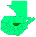 | |
|---|---|---|
| Municipalities | ||
