Sandy Township, Clearfield County, Pennsylvania
Sandy Township is a township in Clearfield County, Pennsylvania, United States. The population was 10,625 at the 2010 census.[3]
Sandy Township, Pennsylvania | |
|---|---|
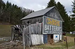 Barn south of Clearfield, a variant on Mail Pouch tobacco barns | |
Map of Clearfield County, Pennsylvania highlighting Sandy Township | |
Map of Clearfield County, Pennsylvania | |
| Country | United States |
| State | Pennsylvania |
| County | Clearfield |
| Settled | 1812 |
| Incorporated | 1878 |
| Area | |
| • Total | 52.99 sq mi (137.25 km2) |
| • Land | 51.96 sq mi (134.58 km2) |
| • Water | 1.03 sq mi (2.68 km2) |
| Population (2010) | |
| • Total | 10,625 |
| • Estimate (2018)[2] | 10,465 |
| • Density | 205.08/sq mi (79.18/km2) |
| Time zone | UTC-5 (Eastern (EST)) |
| • Summer (DST) | UTC-4 (EDT) |
| Area code(s) | 814 |
| FIPS code | 42-033-67792 |
Geography
According to the United States Census Bureau, the township has a total area of 52.8 square miles (136.7 km2), of which, 51.8 square miles (134.1 km2) of it is land and 1.0 square miles (2.6 km2) of it (1.88%) is water.
Communities
- Adrian Furnace
- Clear Run
- Gelnett
- Iselin Heights
- Oklahoma
- Narrows Creek
- Sabula
- Sandy
- Treasure Lake
- West Liberty
The township surrounds DuBois, which is the postal address of township residents. Combined, they have a population of nearly 20,000. Several attempts have been made by city and township officials to incorporate the two entities as one, but these attempts have traditionally been met with resistance from residents.
Demographics
| Historical population | |||
|---|---|---|---|
| Census | Pop. | %± | |
| 2000 | 11,556 | — | |
| 2010 | 10,625 | −8.1% | |
| 2018 (est.) | 10,465 | [2] | −1.5% |
| U.S. Decennial Census[4] | |||
As of the census[5] of 2000, there were 11,556 people, 4,387 households, and 3,299 families residing in the township. The population density was 223.2 people per square mile (86.2/km2). There were 5,028 housing units at an average density of 97.1/sq mi (37.5/km2). The racial makeup of the township was 98.58% White, 0.20% African American, 0.06% Native American, 0.61% Asian, 0.03% Pacific Islander, 0.07% from other races, and 0.46% from two or more races. Hispanic or Latino of any race were 0.45% of the population.
There were 4,387 households, out of which 31.2% had children under the age of 18 living with them, 65.3% were married couples living together, 6.8% had a female householder with no husband present, and 24.8% were non-families. 21.8% of all households were made up of individuals, and 9.2% had someone living alone who was 65 years of age or older. The average household size was 2.50 and the average family size was 2.91.
In the township the population was spread out, with 22.8% under the age of 18, 5.5% from 18 to 24, 27.2% from 25 to 44, 25.1% from 45 to 64, and 19.5% who were 65 years of age or older. The median age was 42 years. For every 100 females there were 93.4 males. For every 100 females age 18 and over, there were 89.9 males.
The median income for a household in the township was $42,450, and the median income for a family was $49,013. Males had a median income of $38,185 versus $24,042 for females. The per capita income for the township was $20,420. About 5.0% of families and 7.2% of the population were below the poverty line, including 9.3% of those under age 18 and 6.4% of those age 65 or over.
School districts
References
- "2016 U.S. Gazetteer Files". United States Census Bureau. Retrieved Aug 13, 2017.
- Bureau, U. S. Census. "U.S. Census website". United States Census Bureau. US Census Bureau. Retrieved 30 November 2019.
- https://www.census.gov/2010census/
- "Census of Population and Housing". Census.gov. Retrieved June 4, 2016.
- "U.S. Census website". United States Census Bureau. Retrieved 2008-01-31.
Municipalities and communities of Clearfield County, Pennsylvania, United States | ||
|---|---|---|
| City | ||
| Boroughs | ||
| Townships | ||
| CDPs | ||
| Unincorporated communities |
| |
| Footnotes | ‡This populated place also has portions in an adjacent county or counties | |
| ||