Sapotaweyak Cree Nation
The Sapotaweyak Cree Nation is a First Nations band government whose reserves are located in Central Manitoba north-east of Swan River. The community is mainly Cree, but has a mixture of Plains Cree, Swampy Cree and Saulteaux languages, a unique dialect shared with Wuskwi Sipihk First Nation to the southwest. They have a number of dispersed reserves, most of which are along the shores of Lake Winnipegosis. The main centre of the community is Shoal River Indian Reserve 65A, located adjacent to Pelican Rapids (known as the "Métis Side" to the locals). About half the community's population resides on the reserve while the other half live off reserve.[1][2]
Indian Reserves
Indian Reserves assigned to the band are:[3]
- Channel Island Sapotaweyak Cree Nation Indian Reserve, 1359 ha.
- Overflowing River Sapotaweyak Cree Nation Indian Reserve, 469 ha.
- Pelican Rapids Access Road Phase 1 Indian Reserve, 8409.30 ha.
- PTH 10 Sapotaweyak Cree Nation Indian Reserve, 58 ha.
- Sapotaweyak Cree Nation Indian Reserve, 28204.80 ha.
- Sapotaweyak Cree Nation - Spruce Island Indian Reserve 1848 ha.
- Shoal River Indian Reserve No. 65A, 83 km south of The Pas 392.20 ha.
- Shoal River Indian Reserve No. 65B, at Steep Rock Point, Dawson's Bay, Lake Winnipegosis 955.10 ha.
- Shoal River Indian Reserve No. 65F, at Dawson Bay, Lake Winnipegosis 44.10 ha.
The following reserve is shared with 32 other bands, all signatories to Treaty 4.
- Treaty Four Reserve Grounds Indian Reserve No. 77, adjacent to and west of Fort Qu'Appelle, Saskatchewan 37.90 ha.
External links
References
Division No. 19, Manitoba (North East Manitoba) | ||
|---|---|---|
| First Nations | 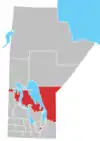 | |
| Indian reserves |
| |
| Unorganized areas | ||
| Unincorporated communities | ||