Sardis, Ohio
Sardis is a census-designated place (CDP) in southeastern Lee Township, Monroe County, Ohio, United States. It is unincorporated, but has a post office with the ZIP code of 43946.[2] As of the 2010 census, it had a population of 559.[3]
Sardis, Ohio | |
|---|---|
 Methodist church, Monroe and Fifth | |
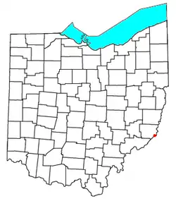 Location of Sardis, Ohio | |
| Coordinates: 39°37′32″N 80°54′44″W | |
| Country | United States |
| State | Ohio |
| County | Monroe |
| Area | |
| • Total | 1.2 sq mi (3.2 km2) |
| • Land | 1.2 sq mi (3.2 km2) |
| • Water | 0.0 sq mi (0.0 km2) |
| Elevation | 668 ft (204 m) |
| Population (2010) | |
| • Total | 559 |
| • Density | 450/sq mi (170/km2) |
| Time zone | UTC-5 (Eastern (EST)) |
| • Summer (DST) | UTC-4 (EDT) |
| ZIP code | 43946 |
Sardis is at the intersection of Ohio State Routes 7 and 255, lying between Duffy and Fly.
Among the early settlers in this area was Major Earl Sproat, one of the 48 members of the Ohio Company. The Ohio Company founded Marietta, the first permanent settlement in the Northwest Territory in 1788. The village of Sardis was laid out by James Patton in 1843.
Students from Sardis attend River Elementary and River High School in nearby Hannibal, and are served by the Switzerland of Ohio Local School District. This school is shared with other nearby riverfront communities including: Antioch, Duffy, Fly, Hannibal, Laings, Powhatan Point (of neighboring Belmont County), and Clarington.
Geography
Sardis is located at 39°37′22″N 80°54′44″W. According to the United States Census Bureau, the CDP has a total area of 1.2 square miles (3.2 km2), all of it land.[4]
References
- "US Board on Geographic Names". United States Geological Survey. 2007-10-25. Retrieved 2008-01-31.
- Zip Code Lookup
- "Profile of General Population and Housing Characteristics: 2010 Demographic Profile Data (DP-1): Sardis CDP, Ohio". United States Census Bureau. Retrieved June 4, 2012.
- "Geographic Identifiers: 2010 Demographic Profile Data (G001): Sardis CDP, Ohio". United States Census Bureau. Retrieved June 4, 2012.
Municipalities and communities of Monroe County, Ohio, United States | ||
|---|---|---|
| Villages | 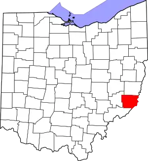 Map of Ohio highlighting Monroe County | |
| Townships | ||
| CDPs | ||
| Unincorporated communities | ||
| Ghost town | ||
| Footnotes | ‡This populated place also has portions in an adjacent county or counties | |
| ||