Scariff Island
Scariff Island (Irish: An Scairbh, meaning "Rugged",[2][3]) is an island of the Atlantic Ocean belonging to County Kerry, Ireland.
| Native name: An Scairbh | |
|---|---|
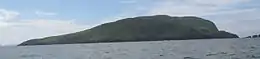 Scariff Island north side from a yacht | |
 Scariff Island | |
| Geography | |
| Location | Atlantic Ocean |
| Coordinates | 51.7307°N 10.2502°W |
| Area | 1.48 km2 (0.57 sq mi) |
| Highest elevation | 252 m (827 ft) |
| Administration | |
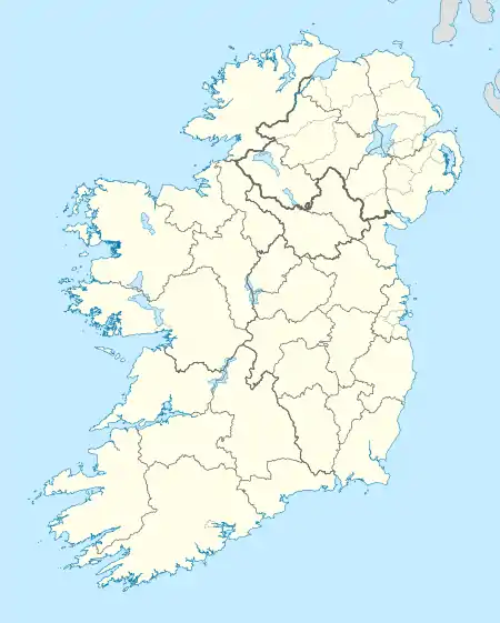
| Province | Munster |
| County | Kerry |
| Demographics | |
| Population | 0 (2011) |
| Pop. density | 0/km2 (0/sq mi) |
| Scariff Island | |
|---|---|
| Highest point | |
| Elevation | 252 m (827 ft) [1] |
| Prominence | 252 m (827 ft) [1] |
| Listing | Marilyn |
Geography
The island is 366 acres; its highest hill is at 252 m.[1] It's located in the Atlantic Ocean at around 1 km from Deenish Island[2] and 7 km from Hogs Head, on the mainland.[4]
History
In 1837 only one family lived on Scariff; their main work was to care the cattle which grazed on the island. On the summit of the hill there were remains of an ancient hermitage and, on the east side, ruins of a church.[5] 1911 census does not report any inhabitant for Scariff Island.[2]
See also
References
- "Dunkerron Mountains Area - Scarriff Island Hill". MountainViews. Ordnance Survey Ireland. Retrieved May 19, 2015.
- "Scariff and Deenish". St. Cronan's School. Retrieved May 19, 2015.
- "An Scairbh". Placenames Database of Ireland. Dublin City University. Retrieved May 19, 2015.
- "Traveling Luck for Hogs Head, Kerry, Ireland". travelingluck.com. Retrieved May 19, 2015.
- Samuel Lewis (1837). A topographical dictionary of Ireland. libraryireland.com. S. Lewis & Co. Retrieved May 19, 2015.
External links
![]() Media related to Scariff Island at Wikimedia Commons
Media related to Scariff Island at Wikimedia Commons
- Scariff and Deenish, page on irishislands.info
- The island page on iscoverireland.ie
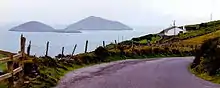
Scariff (right) and Deenish islands from the mainland
This article is issued from Wikipedia. The text is licensed under Creative Commons - Attribution - Sharealike. Additional terms may apply for the media files.