Schalkau
Schalkau is a town in the district of Sonneberg, in Thuringia, Germany. It is situated 13 km west of Sonneberg, and 15 km north of Coburg. The former municipality Bachfeld was merged into Schalkau in December 2019.
Schalkau | |
|---|---|
 Coat of arms | |
Location of Schalkau within Sonneberg district 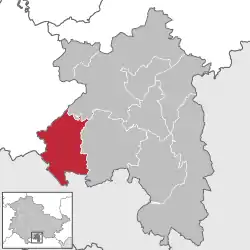 | |
 Schalkau 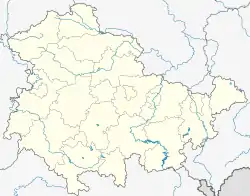 Schalkau | |
| Coordinates: 50°23′40″N 11°0′31″E | |
| Country | Germany |
| State | Thuringia |
| District | Sonneberg |
| Government | |
| • Mayor | Ute Hopf (Ind.) |
| Area | |
| • Total | 44.03 km2 (17.00 sq mi) |
| Elevation | 400 m (1,300 ft) |
| Population (2019-12-31)[1] | |
| • Total | 3,318 |
| • Density | 75/km2 (200/sq mi) |
| Time zone | UTC+01:00 (CET) |
| • Summer (DST) | UTC+02:00 (CEST) |
| Postal codes | 96528 |
| Dialling codes | 036766 |
| Vehicle registration | SON, NH |
| Website | www.schalkau.de |
Transportation
Schalkau has two train stations, Schalkau and Schalkau Mitte, on the Hinterland Railway (Hinterlandbahn) from Sonneberg Hauptbahnhof to Eisfeld.[2] There is also a regular bus service to Sonneberg.
Education
There is one secondary school, educating pupils 11-16 (ordinarily) which falls into the 'Realschule' category. The school is named after the famous German writer, Goethe. There is a post office and a few other facilities.
[[File:Schalkau-Ev-Kirche.jpg|thumb|130px|St. Johannis Lutheran church
Town division
The town has 10 districts:
|
|
Inhabitants
Number of inhabitants (as of 31 December):
|
|
|
- Source since 1994: Thuringia statistical office Erfurt
Personalities
- Jan Eichhorn (born 1981), luger
- Maximilian Mörlin (1516-1584), Protestant theologian and reformer
- David Möller (born 1982), luger
- Fritz Mueller (1907-2001), aerospace engineer
References
- "Bevölkerung der Gemeinden, erfüllenden Gemeinden und Verwaltungsgemeinschaften in Thüringen Gebietsstand: 31.12.2019". Thüringer Landesamt für Statistik (in German). August 2020.
- Eisenbahnatlas Deutschland (German railway atlas) 2007/2008 edition. Schweers + Wall. 2007. ISBN 978-3-89494-136-9.
Towns and municipalities in Sonneberg (district) | ||
|---|---|---|
| Authority control |
|---|