Schweigen-Rechtenbach
Schweigen-Rechtenbach is a municipality in Südliche Weinstraße district, in Rhineland-Palatinate, western Germany.
Schweigen-Rechtenbach | |
|---|---|
 Coat of arms | |
Location of Schweigen-Rechtenbach within Südliche Weinstraße district 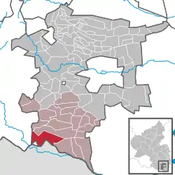 | |
 Schweigen-Rechtenbach  Schweigen-Rechtenbach | |
| Coordinates: 49°03′11″N 7°57′22″E | |
| Country | Germany |
| State | Rhineland-Palatinate |
| District | Südliche Weinstraße |
| Municipal assoc. | Bad Bergzabern |
| Subdivisions | 2 |
| Government | |
| • Mayor | Helmut Geißer |
| Area | |
| • Total | 16.04 km2 (6.19 sq mi) |
| Elevation | 217 m (712 ft) |
| Population (2019-12-31)[1] | |
| • Total | 1,362 |
| • Density | 85/km2 (220/sq mi) |
| Time zone | UTC+01:00 (CET) |
| • Summer (DST) | UTC+02:00 (CEST) |
| Postal codes | 76889 |
| Dialling codes | 06342 |
| Vehicle registration | SÜW |
| Website | www.schweigen-rechtenbach.de |
Geography
Schweigen-Rechtenbach is located at the southern end, marked by the imposing Deutsches Weintor, of the German Wine Route. The principal route no longer passes through the "Weintor", but has been diverted round it. Continuing in a southerly direction from the municipality the principal route continues to Wissembourg, first crossing the current frontier between Germany and France.
History
Schweigen-Rechtenbach was created, as part of a larger programme of local government boundary reforms in the area, on 7 June 1969 through the fusion of Schweigen and Rechtenbach, both of which had previously been administratively independent.[2]
References
- "Bevölkerungsstand 2019, Kreise, Gemeinden, Verbandsgemeinden". Statistisches Landesamt Rheinland-Pfalz (in German). 2020.
- Statistisches Landesamt Rheinland-Pfalz – Amtliches Gemeindeverzeichnis 2006 Archived 2015-09-24 at the Wayback Machine, Seite 196 (PDF; 2,6 MB)
| Authority control |
|---|
This article is issued from Wikipedia. The text is licensed under Creative Commons - Attribution - Sharealike. Additional terms may apply for the media files.